Search Map It! Okinawa

Tuesday, December 27, 2011

"The Goddess Sunset at Nago City"

The Goddess Sunset at Nago City


View Map It! Okinawa in a larger map
The Goddess Sunset at Nago City

     GPS
     LatitudeLongitude
     N 26 34.983E 127 59.333


The Goddess Sunset at Nago City


It's normal tradition among friends and love ones to see the very First Sunrise of the New Year. But what about the very Last Sunset of the closing year? There are many places on Okinawa to view the beautiful Okinawa sunset, but Nago City host one of the most beautiful sunset viewing locations on the island. This brings us back to the same location of the statue known as The Goddess of Mercy – Hence the title, The Goddess Sunset*. The location is picture perfect in many ways; the right angle and elevation, the calm reflecting waters below, and the sitting Bodhisattva that evenly splits the Nago Bay. Regardless if it's New Year's Eve or not, at anytime of the year the sunset here leaves you with a sense of amazement and peace. This is Map It! Okinawa's 2011 Sunset of the Year. 

What to bring: A peace of mind...and your camera. For Directions & Parking: See post on Kannon-sama, Goddess of Mercy.

Other places of interest nearby: Ato no Utaki (Kyoda), Big Okinawan House, Scenic View Mount Tanodake,Giant Shisas (Kyoda), Green Bridge/Lower Creek Park, Haneji Dam Family Picnic Area, Mikaya Dam, Nago Museum,Nangusuku Castle Ruins, Route 18/Haneji Dam Route, Todoroki Waterfall (Sukata), Water From Hands (Kyoda)Kannon-sama, Goddess of Mercy.

*The name was created by the author of this post to describe the event and location. It is not an official title. 

Sunday, December 25, 2011

"Kannon-sama, The Goddess of Mercy – Nago City"

Kannon-sama, Goddess of Mercy sitting in front of Cherry Blossom Trees - Nago City


View Map It! Okinawa in a larger map
Kannon-sama, Goddess of Mercy

     GPS
     LatitudeLongitude
     N 26 34.983E 127 59.333


Kannon-sama, The Goddess of Mercy – Nago City


The statue you see above is a Bodhisattva referred to in Japanese as Kannon or Kannon-sama, also known as the 'Goddess of Mercy'. She is referred to by many different names in different languages and has taken both male and female forms depending on the folklore and legend. There are many such statues of this Bodhisattva that exist of much, much greater size and magnitude in other East Asian countries, to include Mainland Japan. This one, in Nago City, is a modest size of about 15-16 feet in height. Nevertheless, the scenery itself is a trifecta of sorts. First, the Bodhisattva is surrounded by Nago's greenery of trees and mountains. And then there is the Cherry Blossoms behind the statue strategically laid out on a hill top making this an ideal spot for your photographic moment during blooming season. And finally, the statue overlooks a very calm and beautiful view of the Nago Bay.

The Poem. Next to the statue lies a stone inscription of a poem in Japanese, written by a person with the  family name Yokoyama. (The Kanji of the first name could not be accurately determined). Translated, it reads: 

     “Those who won and those who lost are now gone, and the Okinawa ocean is now calm.

Behind the stone inscription it says: “Those who chant the poem will be touched by the truth. By understanding the poem it will awaken the good in your heart. And by understanding the poem you will be inspired by its beauty.

The interpretation of the poem, of course, is left open for discussion. But being that this is the 'Goddess of Mercy', the message is certain to be one of peace.

Getting there. The location is south of the Orion Beer Factory on a hilltop. There are several ways to get there. You can either take Highway 58 and approach it from the west or approach it from the east on Highway 18. Please see map above for recommended entry (blue route). Depending on which highway you use, the turn-off will either be the very last turn-off to the right before you go up the Nago Green Bridge or the very first turn-off to the left as you are coming down the Nago Green Bridge.

Parking. If this is your first time attending this location, I recommend parking at the base of the hill and walking up, especially during Cherry Blossom season. At some point the road is only wide enough for one vehicle and 3-point turns are difficult. It is not too difficult of a walk from the bottom. Possible parking spots have been plotted above. The Pink Thumbtack icon marks another entrance way to the statue location from Highway 18, but it is easy to miss. It can also be used to exit onto Highway 18 as you leave the statue area.

Caution. If you notice on the map there is another route branching off that goes further south roughly paralleling Highway 18. Be advise that tremendous road damage existed on this route when last visited in early December 2011. Warning signs have been place. Do not go past these signs. The roads were severely damaged due to an eroding hillside.

Other places of interest nearby: Ato no Utaki (Kyoda), Big Okinawan House, Scenic View Mount Tanodake,Giant Shisas (Kyoda), Green Bridge/Lower Creek Park, Haneji Dam Family Picnic Area, Mikaya Dam, Nago Museum,Nangusuku Castle Ruins, Route 18/Haneji Dam Route, Todoroki Waterfall (Sukata), Water From Hands (Kyoda).

Wednesday, December 21, 2011

"Sunset! Zakimi-jo"

Sunset at Zakimi-jo


View Map It! Okinawa in a larger map
Sunset! Zakimi-jo

    GPS
     LatitudeLongitude
     N 26 24.481E 127 44.520


Sunset at Zakimi-jo Castle


When the engineers built telecommunication towers and power lines near Zakimi-jo Castle, they probably didn't have the view of the sunset in mind. It didn't stop this couple, however, from capturing a commanding view of the Okinawa sunset. Like most castles and fortresses on Okinawa, Zakimi-jo sits upon at high elevation, good enough to get a good view of both the ocean horizon and the sun as it descends down in a blaze of fire.

If you don't mind a few man-made obstacles in the way and wish to spend some sentimental time watching one of the small joys of nature, then this is an ideal spot. And if you are lucky enough, maybe you too will have an unsuspecting photographer capturing your Kodak moment. This is Sunset at Zakimi-jo.

Getting there. Zakimi-jo is in Yomitan Village. If you take Highway 58 (north or south), get on Highway 12. Look for road signs that point to Zakimi-jo Castle.

Other places of interest nearby: Yomitan's Tucked Away Nature Trail.

Sunday, December 18, 2011

"Manko Waterbird & Wetland Center"

Grey Heron at the Manko Wetlands (About 300m from the Center)


View Map It! Okinawa in a larger map
Manko Waterbird and Wetland Center

     GPS
     LatitudeLongitude
     N 26 11.638E 127 40.915


Manko Waterbird & Wetland Center


This is the Manko Waterbird and Wetland Center of Tomigusuku City just outside the borders of Naha. It's not too far from the very visible Toyomi Ohashi Bridge often seen to the east as you are driving down Highway 58. Because of its significance as a stopover point during the winter season for various migratory birds, the Manko Wetlands became a registered wetland area under the Ramsar Convention in May 1999 (Ramsar site no. 996). Inside the center you will see various picturesbird displays, and information on the various birds often seen in the Manko Wetlands. On the second deck, there are birding scopes so you can get a glimpse of some of the wildlife that take refuge there. Just outside the center there is a man-made boardwalk that takes you to an outdoor observation post.

For the most part the center is a very English friendly place. They have a well done English pamphlet that talks about the various wildlife seen there and the history behind the Manko Wetlands. Make sure you grab one of these pamphlets. The pamphlets are located at the sign-in booth as soon as you walk in. If they don't have one, then be sure to ask for one. Also inside the pamphlet is a field map of other observation areas surrounding wetlands. And please don't forget to sign in. There is no entrance fee to go inside, but your name and where you come are important to keeping the place open.

In the photo album you will see some of the various birds just taken in one hour's time: Osprey, Grey Heron, Japanese White-eye, Common Redshank, and the Little Egret. The captions in the photo album will have the scientific name. To see other wildlife in action at the Manko Wetlands visit Mike's Ryukyu Gallery.

Getting there. Getting there is not difficult, however the turn-off can often be missed cause one of the street signs is blocked by a group of trees. Please look at the map and study the landmark and the blue designated vehicle route. Entrance to the wetland center is the very first left as soon as you commence on the road designated by the blue route. It is a 'J' hook turn to the left.

Open: 9am-5pm daily except Mondays, the next day after a holiday, and during Dec 29-Jan 3
Phone Number: 098-840-5121
Website: http://www.geocities.jp/manko_mizudori/ (Japanese Only)
Entrance Fee : Free

They ask you to call in advance for groups of 15 or more.

Other birding areas on Okinawa: Birding Observation Point (Awase).

Other places of interest nearby: Fukushuen Chinese Garden, Monument to Hibari Misora, Pineapple House Store, Sumiyoshi Shrine.

Wednesday, December 14, 2011

"Kin Town's Cherry Blossom Way"

Cherry Blossoms in Kin Town


View Map It! Okinawa in a larger map
Kin Town's Cherry Blossom Way

     GPS
     LatitudeLongitude
     N 26 27.729E 127 55.934


Kin Town's Cherry Blossom Way


Normally not recognized for its Cherry Blossoms, Kin Town does have its own little tucked away corridor of Cherry Blossom trees. It sits beneath the Kin Town Bridge often unnoticed by the daily traffickers that skirt north and south along Highway 329. What you see above are the trees in their non-blooming season, but during full bloom this can be quite the photographic spectacle given the small ground it covers compared to some of the more popular locations like Mount Yaedake. Currently, in the background you will see the construction of the new Kin Dam. Though not an ideal scene yet for a panoramic photograph, but with a little imagination, good use of angles, and some cropping you will still be able to capture the photographic and natural beauty of these small wonders of nature. In a few years time, the completed Kin Dam will be a wonderful addition to the blend of Cherry Trees in the foreground. 

What to bring. Definitely a camera. If you are into photography, recommend you bring a step ladder or better in order to get a better vantage point. A little higher elevation can make a tremendous difference in your angle perspective and thus automatically crop out unnecessary obstacles that might be in a the way (i.e. overgrown vegetation).

Cherry Blossom Season: January-February time frame, pending climate conditions. 

Getting there. The location is just north of Camp Hansen. It is the first turn-off to the left heading north once you pass the Highway 104 and 329 intersection. The turnoff is immediately before the Kin Town Bridge.  

(Note: Photos of the full bloom will be added to the album once blooming season starts.)

Other places of interest nearby: Birth Place of Toyoma Kyuzo, Gold Hall, Kin Kannonji Temple, Kin Watch Tower, Kin's Castle Rock , Kinjo's Used Goods, Kin's Hidden Nature Trail, Kin Town's History Chronicles, Okawa, The Natural Spring, Oshiro Kozo Statue, Richamocha Cafe, Toyoma Kyuzo Statue.

Sunday, December 11, 2011

"A Tribute to Hibari Misora - Gajyanbira Park, Naha City"

A monument in tribute to Hibari Misora at Gajyanbira Park. Naha Port in the back.

View Map It! Okinawa in a larger map
A Tribute to Hibari Misora at Gajyanbira Park, Naha

     GPS
     LatitudeLongitude
     N 26 12.280E 127 39.972


A Tribute to Hibari Misora - Gajyanbira Park, Naha City


The aftermath of World War II left many in agony from all sides and left many to question the future of world peace. Okinawa had suffered the many horrors of war first hand on its own soil. And at a uncertain time in an uncertain future, uplift was desperately needed. One voice would emerge to bring sunlight to the darkest corner of the earth, She is perhaps Japan's most famous singer and she is given tribute here at Gajyanbira Park in Naha City. She is Hibari Misora. 

Born in 1937, she began her singing career at the age of 9 in 1946 just after the war. It was through her captivating voice that gave inspiration and hope to the many Japanese and Okinawans during their most darkest days. She had sang over 1500 songs in her career. But there was one song she sang that gave tribute to the people of Okinawa in their struggle to find solace and inner peace in the aftermath of the 'Great Okinawan War'. The song is titled "Hanakaze no Minato" and is loosely translated as "The Port of Flowers in the Wind". As token of their appreciation Okinawans dedicated this monument in her name and placed portions of the lyrics of this song on a large stone, and if you stand at the right place you will hear this song being played. Just look for a set of yellow footsteps, just a short distance from this stone and let the electronic 'magic' do the rest. The location too couldn't be more fitting. It sits above on a ridge overlooking Naha Port. On a clear day with great blue skies the scenery is exquisite.  

Sadly, Hibari Misora's life and a career was short lived. She had died at the young age of 52 in 1989. Though gone, she is not forgotten and rests in the hearts of many Japanese and Okinawans to this day. To learn more about her life and career please visit the Official Website both in Japanese and in English at Misorahibari.com. To hear portions of the song, "Hanakaze no Minato", please visit this YouTube Site*. 

Other places of interest nearby: Sumiyoshi Shrine of Naha City, Pineapple House in Naha City, Manko Waterbird & Wetland Center, Fukushuen Chinese Garden.

*Reader's note: It is not certain if the voice of this particular YouTube clip belongs to Hibari Misora.

Thursday, December 8, 2011

"Sumiyoshi Shrine in Yamashita, Naha City"

Sumiyoshi Shrine of Yamashita, Naha City


View Map It! Okinawa in a larger map
Sumiyoshi Shrine of Yamashita, Naha City

     GPS
     LatitudeLongitude
     N 26 12.237E 127 40.029


Sumiyoshi Shrine in Yamashita, Naha City


This is the Sumiyoshi Shrine of Yamashita in Naha City. It's a small beautiful shrine decorated in bright orange that rests on a ridge-side near the Naha Port. Poor legibility and difficulties with some of the advance Kanji on the shrine's stone marker made it difficult for an accurate explanation of its origin. Further research is required and will update the post accordingly. There are a couple of shrines named Sumiyoshi in mainland Japan, and thus there could be a possible connection. What is known is that the shrine gives homage to 8 important figures. Some were to gods and some were of people. As you can tell from the picture above, there are 8 stone placards marking the names of a god or person. Some of the gods were those that represented the Dragon, Fire, and Land. Some of the other placards had suffixes that gave reference to a person, but the Kanji names could not be easily deciphered. This is a small simple shrine, but it does blend in with the natural beauty with the ridge-side greenery and because it is less visited, you may find a more sense of tranquility and peace than you would at some of your more high profile shrines on Okinawa.

Caution. Once you are at the main shrine area you will see an extra set of steps leading upwards into the hillside. This eventually takes you to a trail that leads you to the very top of the ridge. However, in order to get to the top you have to climb a muddy and slippery slope. There is (was?) a makeshift rope to help you climb. However, I highly recommend you don't climb it. The slope is very slippery, the rope is severely worn, and there are some rocks you can hurt your knee on. THERE IS ANOTHER WAY TO GET THERE BY CAR. At the top is Gajyanbira Park. Scroll to the left on the map above and you will see a vehicle route to get to it. At the edge of Gajyanbira Park, you will find a monument giving tribute to perhaps one of Japan's most famous singers. Her name is Hibari Misora

Getting there. It is not too difficult to get the shrine, however, if you are not alert you will miss the turn-off completely. The only practical way to get there is by going on the southbound lane of the 331. As you just hit the Onoyama Park/Dome you will notice that the 331 splits into two. The right lane takes you on the 331 By-Pass on-ramp and the left most lane is the main 331 that skirts the Yamashita District. DO NOT GO ON THE ON-RAMP. STAY IN THE LEFT MOST LANE. Continue straight. You will pass one major intersection (Highway 7). As soon as you pass this you will see an ENEOS gas station to your left. Turn left as soon as you pass this gas station. The left turn is immediately after the gas station. See the blue designated route. Park near the lower park. You will a set of bright orange stair rails. That will lead you to the shrine.

Other places of interest nearby: Tribute Monument to Hibari Misora, Pineapple House of Naha City, Manko Waterbird & Wetland Center, Fukushuen Chinese Garden.

Sunday, December 4, 2011

"Iji Shrine and The Cherry Blossom Hill"

Iji Shrine and the Cherry Blossom hill behind it.


View Map It! Okinawa in a larger map
Iji Shrine & The Cherry Blossom Hill

     GPS
     LatitudeLongitude
     N 26 45.479E 128 11.542


Iji Shrine and The Cherry Blossom Hill


Mark your calendar! Cherry Blossom season is just around the corner and with the season so short, it's a good idea to plan ahead to where you want to go and see these beautiful flowers. What's obviously missing in the picture above are the blooming Cherry Blossoms. That's because this photo was taken around October with the anticipation of coming back during the January/February blooming season (photos of the full bloom will be added to the photo album later). The picture is of Iji Shrine located in Kunagami Village, just north of the Okuma Recreational Facility. Behind the shrine is a large hill populated with Cherry Blossom trees. Though this is not Nago or Mount Yaedake, the backdrop of Cherry Blossoms still make for a beautiful scene. The god enshrined here is called 'Uji Kama-sama', with 'kama-sama' given reference to a god. There is a large stone with a poetic inscription by a poet named Toguchi Seisho. The poem compares the beauty of the Cherry Blossom to that of the people of Iji. 

Getting there. The location is not too far north of the Okuma Recreational Facility. Look at the map for the landmark. It is far enough to the south to give you an early warning. Once you pass the the landmark you make a right (if going north) on the second turn. This will take you into the Iji village. From there you will have to navigate your way north/northeast. Roads are tight in this neighborhood.

Parking. There is a small parking lot, but during Cherry Blossom season finding a close-by parking spot may be difficult and you may have to park further out. In fact, this may be a good idea. The roads are tight and exiting the place might be more difficult the closer you park near the shrine. And by walking, you will get to see the town as a whole and hopefully meet some of the locals along the way. A "Konichi wa" (good afternoon in Japanese) with a smile goes a long way in Okinawa. Even if you park near the 58, the walking distance shouldn't be too challenging. You also may be tempted to take a side route into the mountains as your escape. During the last visit, there was a unexpected dead-end though it does not show on the map. The roads going up are somewhat steep and most times large enough for one vehicle. Highly discourage any such spontaneous vehicle excursions here in Iji during the Cherry Blossom season. Good advice is to leave the same way you came out.

Other places of interest nearby: River Stream in Ura, Small Cave Spring in Kunigami, Yanbaru Wildlife Conservation Center.

Wednesday, November 30, 2011

"The Shiinagusuku Ruins"

Shiinagusuku Ruins


View Map It! Okinawa in a larger map
Shiinagusuku Ruins

     GPS
     LatitudeLongitude
     N 26 39.595E 127 58.396


The Shiinagusuku Ruins


This is the Shiinagusuku Ruins. The history and research about this place is mired in mystery. It is not even quite clear which town or precinct it belongs to. It borders Nakajin Village, Nago City, and the town of Motobu. Nothing was mentioned in any of their official websites about this site. The only information that we obtained was its name, due to a small road sign in roman characters leading us to the ruins. The suffix 'gusuku' is Okinawan dialect for castle or fortress, and by its appearance and location it does give indication that it was once used as such. Once you are there, you do get the ambiance that it is an 'old' ruin site – preserved and untainted by modern construction. Mostly what you will see are large stones that seemed to be naturally part of the landscape, and then some makeshift stone walls further back (though it is not certain when those walls were erected). Now, it is mostly covered by Elephant Ear plants and trees interspersed throughout the area. One intriguing question does come to mind – what was its relationship which Nakajin Castle not too far away? Did it just serve as an outpost or lookout of the northern east side of the Motobu Peninsula? It's not quite clear.

There were signs that possible renovations may be done in the future. Engineer tape and reflective markers were placed at strategic points on location. However, at this time, the origins and the history of the Shiinagusuku Ruins shall remain a mystery.

Caution. I highly recommend you bring a good size guide stick, larger than a normal size umbrella. Though there are some well laid out paths, there are some areas you may be tempted to go. However, I highly recommend you just stay on the beaten paths. You can safely pretty much see all you need to see from there. Because of all the gaps between stones and sometimes dense ground vegetation along the unbeaten areas, you will need to probe these areas if you do decide to go. There are just too many places for snakes to hide. There are also plenty of spider webs in the area, so keep your eyes on top as well.

What to bring. Bring plenty of mosquito repellant. Recommend pants, good shoes, hat and long sleeve shirt (pending on weather), water, and your camera.

Getting There. Getting there is not difficult. If you look at the map you will see the turn off is off Highway 505. However, there is only one small road sign that points in that direction. Study the map carefully so as not to pass it. Once you turn you will see other signs (in Japanese only) pointing you the way. At some point you will reach an end point. You will see a construction area to the left and a tented farm center-right. The path is along this tented farm. The following pictures are the sequence you will see from parking to entering the ruin site: Picture 1, Picture 2, Picture 3, Picture 4, Picture 5, Picture 6

Sunday, November 27, 2011

"The Futenma Shrine and Cave"

The Main Hall of the Futenma Shrine


View Map It! Okinawa in a larger map
Futenma Shrine and Cave


     GPS
     LatitudeLongitude
     N 26 17.572E 127 46.624


The Futenma Shrine and Cave


The Futenma Shrine is considered one of the major Shinto Shrines here on Okinawa. Many people come here to pray for various reasons, mainly for good fortune. It is accessible to all, but perhaps to get the most and best experience from visiting this shrine, is to bring a Japanese or Okinawan friend along with you. Having someone familiar with the customs can guide you through some of the traditional practices when attending such a sacred place. This might also be their first time attending this particular shrine as well. If you do go without any knowledge of the customs, just show proper etiquette as you would at any sacred place.

There are few simple things that you can do however. When you first enter go through the Torii Gate, give a slight bow as you enter. The Torii Gate symbolizes an entrance to a holy ground. Next you want to go to the 'purification fountain'. They have a pictorial demonstration board posted next to the fountain. Please go to this link of the “Awase Shrine” and go to the section called 'Steps to Purification'. The process is same.

When you go to the main hall, you will see an offertory box. It is not required, but if you wish to make an offering (10 or 100 yen is okay) you can do so. Once you drop your offering you bow twice then clap twice (quietly), then bow once again. Some people just bow and clap twice. Different sources may vary. You can also read the section called “How to Pay Reverence at a Shinto Shrine” here.

The Story. The office at the shrine does have an English write up of two legends pertaining to this shrine. Ask for one when you go there. The first legend is about a female deity or 'kami' named Megami. The legend goes as follows (paraphrased): there where two sisters that lived in area called Syuri. There were rumors that the eldest sister was a very beautiful women, but because of her devotion to spirituality, she had no desire to be seen in public. Her younger sister's husband wanting to see what she looked like took a peek. Realizing that she had been seen, “the older sister rushed out of the house in agony and into the cave, never to be seen again”. Since then, she had become a deity of the cave (quote was taken from that English write-up).

The second legend is about a male diety or 'kami' called Kumano. Legend has it that there was once a humble couple that lived in poverty many, many years ago in Nakagusku-son, not too far away from modern day Futenma. Because of their dire circumstances, the couple agreed that the wife work as a royal maid at Shuri Castle. Every evening after work, the wife would leave Shuri Castle and make the long journey to the Futenma Shrine to pay her respect. Then one day, the Kumano Kami, disguised as an old mountain man, visited the poor woman near the Futenma Shrine and gave her an item that was wrapped . He told her to hold it for him. Time went on and he had not reappeared for some time, so she prayed. One night he appeared to her in a dream and revealed who he was. He then told her that the special item was hers to keep as a reward for her perseverance. She then opened up the item and it discovered it was gold. Since then, the couple became prosperous and wealthy. Henceforth, people have become more devoted to the shrine.

Photographs. If you wish to take photographs of the main hall, please do so quietly from the outside looking in as to not create any disturbance inside. People go in to meditate and to pray. Sometimes there will be a prayer session going on. Avoid taking any photographs while inside the main hall sitting area, unless given special permission.

The Cave. You have to be granted permission to enter the cave. This is not difficult, however, you do have to ask. They will escort you in. This is a controlled environment and there is limited space in the cave so you may have to wait. If you can, please have a Japanese friend come with you to help explain some of the things you will see. I think you will get more out of this experience if you do so. If there is a special ceremony inside the cave then it may be closed off to the public at that time. Pictures are allowed inside the cave but please do so without creating any major disturbances. Please maintain a low voice and a sense of quietness at all times as you enjoy the peace. You are on sacred grounds.

Getting there. Getting there is not difficult. The shrine is just south of Camp Foster and Camp Buckner. However, the turn-off will sneak up on you. You can only enter when you are driving in the north lane of Highway 330. There is a middle divider blocking you if you are driving south. When you do turn off, it may not be apparent where you are supposed to pull in. There is a driveway to the right of the Torii Gate as you are looking at it. Drive through there and it will take you to the parking lot. Parking is free.

Saturday, November 26, 2011

"Yomitan's Tucked Away Nature Trail"

The beginning of a trail in Yomitan


View Map It! Okinawa in a larger map
Yomitan's Tucked Away Nature Trail

     GPS
     LatitudeLongitude
     N 26 24.270E 127 44.770


Yomitan's Tucked Away Nature Trail


For those who are not familiar with Yomitan Village you are most likely to drive pass a small nature trail and not even be aware of it. This is because the beginning of the trail is tucked quite cleverly near a slope just off Highway 12 as you are heading towards Zakimi-jo Castle from Highway 58. The mostly, paved small trail is about 1.5 km long. However, it still delivers an opportunity to view nature, especially birds who feed along the creek side. Though it seems largely forgotten because of overgrown vegetation in some areas, it can still serve as a nice morning or afternoon walk with the family dog or with a friend. At about a 150 meters into the trail you will see a well to the left and at the very end of the trail you will see a set of steps that leads you to a small cave cut-out structure used as a prayer site. There is also a small tomb built on the cliff side next to the prayer site. You cannot go any further pass this point. The creek that skirts along the trail runs into the Nagaham Dam, however, the dam will not be visible at the turning point. 

If you do decide to walk your dogs in this area please keep them on a leash. There is a farm next to the trail with chickens and small farm animals that roam the area freely.

Also marked on the map and south of the trail is a small well believed to be named 'Tanangaa' Well. The carved name etched in stone next to the well was slightly eroded.

Getting there. Getting there is not hard. It's a straight shot on Highway 12 leaving Highway 58. Look for the Kijimuna (Okinawa jungle boy) statue as a landmark. Park across the street in the open dirt lot (Green Thumbtack above.)

Other places of interest nearby: Zakami-jo Castle.

Tuesday, November 22, 2011

"Ubugaa"

Ubugaa, Awase's Sacred Well sits behind this Utaki


View Map It! Okinawa in a larger map
Ubugaa

     GPS
     LatitudeLongitude
     N 26 19.143E 127 50.168


Ubugaa


Though small in stature, this sacred site has significant meaning to the people of Awase and their history. This is Ubugaa, Awase's sacred well. The picture you see above is the utaki or place of worship for the well. The well actually sits behind this small structure. Like its counterpart, the 'God of Fire', that sits only a few meters away, Ubugaa too has an interesting story about its origin. The sign (translated in English) reads,
Ubugaa was built during the first part of 1768 when the village was formed.  It is a well built from natural springs for the villagers to use as drinking water. It was not only used for drinking but also used as a baby's first bath after they were born. People also drink this water on New Years day and has been esteemed for years. During birth, people also took this water to wipe the baby's forehead. The water was also  used to wash the body of dead. It was the children's duties to fetch the water from this well when used for a new born baby and New Years. They are taught not to switch hands when carrying the water back home.
31August, 2002 - Awase Restoration Committee
One obvious question is, why is switching the water in the other hand considered a 'no-no'? It was something that couldn't be answered with the given resources. Further research is required. This could be a local tradition or something part of a wider custom. As January 1st comes closer and closer (or later, depending on what day the Lunar New Year falls on),  you may see activity heighten as people prepare for the upcoming New Year . It is also not uncommon for people to come here and pray during other parts of the year as well.

Language note: The word "gaa" is of Hogen dialect. It understood as a 'well' or 'spring' when it is appended to another group of words as a suffix. It this case this well is called "Ubu-gaa". The Nakandakari Hijya Spring in Nanjo-Shi is also referred to as "Ufugaa".

Other places of interest nearby: The Awase Shrine, The Meinu Utaki, The Awase War Memorial, Kanumou Well, God of Fire Utaki.

Sunday, November 20, 2011

"Awase's God of Fire Utaki"

Awase's God of Fire Utaki


View Map It! Okinawa in a larger map
Awase's God of Fire


     GPS
     LatitudeLongitude
     N 26 19.151E 127 50.163


Awase's God of Fire Utaki


In many places around Okinawa you will see some sacred places of worship or 'utakis' that give homage to the fire spirit or 'god of fire'. This one is located in Awase of Okinawa City. It is collocated next to another place of worship called 'Ubugaa'. It is also about 150 meters near the 'Meinu Utaki' (not visible on map*). Information gathered about this site was derived from a stone inscription next to the utaki. It reads,
Place of Worship:  The God of Fire
The god of fire has been worshiped in ancient times (Okinawa) in people's kitchen.  To this day, it is known as the protector of homes and is very well respected.  From a family guardian, god of villages, and more importantly, Guardian of the Ryukyu Government during the Sho Dynasty, it became the highest level female guardian. On 24 December based on the lunar calendar it is said that she rose to heaven. January 4 on the lunar calendar the following year, is a festival welcoming the god of fire.  
Prior to 1945, Awase's God of Fire was placed facing the south side of the road, found on the northern part of 'Ubugaa.' (a water well collocated in the same area). It is symbolized by three stones (Umichimon) and an incense holder. In 1945, Awase was seized by U.S. soldiers. The original structure was burned down and damaged during the war. In 1951, part of Awase was re-opened to the Okinawan people and the prayer site was temporarily reestablished. The current location was rebuilt by the Awase Land Re-adjustment Committee. 
31August, 2002 - Awase Restoration Committee
The god of fire is also referred to as 'Hinukan' in Japanese, but it can also be referred to as 'Umichimon' as written above in the translation and gives reference to "three honorable things" (source: Encyclopedia of Shinto).

Other places of interest nearby: The Awase Shrine, The Meinu Utaki, The Awase War Memorial, Kanumou Well, Ubugaa.

*Reader's Note: Icons of nearby areas will not be visible on the above map. This is because Google Maps starts a new complete Map Page when a certain number of Icons been marked. Don't worry the other icons are still there. To see the other places of interest on the map, click the 'View Map It! Okinawa in a large Map' link above and scroll down at the bottom where you see the Previous and Next Links. I have provided feedback to Google that they should show everything on the map.

Thursday, November 17, 2011

"In the Beginning, ...there was Kudaka-Jima"

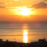
A Lone Road on Kudaka Jima


View Map It! Okinawa in a larger map
Kudaka-Jima

     GPS
     LatitudeLongitude
     N 26 09.816E 127 53.749


Kudaka-Jima


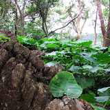
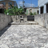
This is Kudaka Island, home of the first Okinawans as told by Okinawa folklore and tradition. But for all practical purposes, Kudaka Island looks no different than any other region in Okinawa. They have their farms, coral reefs, old style homes, dense vegetation, and structures of modern technology. However, there is one very noticeably difference about Kudaka-Jima once you set on foot. It is very eerily quiet.

Okinawan legends may vary, but one version originating around the beginning of the 16th Century tells us that two gods, Amamikyu and Shinerikyu, a female and male deity respectively, first descended on Kudaka Island many years ago. Still a virgin, Amamikyu had given birth to three children which became Okinawa's first inhabitants. The first child was a son and became the first king. The second was a daughter and became the first priestess or 'noro' and the third child was the second son and became the first farmer. Another account written around the 1650's tells us that Amamikyu and Shinerikyu descended from heaven and created the land and its inhabitants. Many years later, a grandson was born, named Tentenshi, and he divided mankind into five classes of people. He would bear five children and made the first son, the 'First Ruler', the second son, the 'First Noble (Anzu)', the third son, the 'First Farmer', the oldest daughter, the 'First High Priestess (Kikoe-ogimi)', and the second daughter, the 'First Village Priestess (Noro)'.

As you can see, the 'Noros' were well rooted in Okinawa folklore and history. The 'Noros' were at one time a powerful organization of women in the Ryukyu Kingdom. Their influence was immense. Highly regarded for advice, Ryukyu Kings would often seek them out for consultation. It was here at Kudaka-Jima, where a ceremony called the 'Izaiho' was held every 12 years to appoint a new Noro. The last one was conducted in 1978. In 1990 it was canceled due to declining population of women on Kudaka. It is not certain if such a historic ceremony will be revived again.

Enjoy the peace that comes with Kudaka. You may see many travelers there, particularly from mainland Japan. It is a great place to meditate and to soak in the spirituality of Okinawa. Included in the photo album are numerous pictures of things you will see on Kudaka. Enjoy and have a safe journey.

TRAVELER'S NOTE: PLEASE READ.
Since there are soo many prayer sites on Kudaka, you may accidentally wander into a prayer session or ceremony. Please refrain from taking pictures unless given permission to do so and please maintain a proper distance. It might be wise to temporarily leave the area and come back later.

Souvenirs. Please refrain from taking any natural souvenirs (rocks, sand, etc.) from Kudaka Island. I know the temptation will be great. The gods will be watching. Strange things have happen to those who have tried...according to the O-Files ; )

Taking Pictures. Taking pictures is permissible all over the island except at Fubo Utaki. Please also avoid taking pictures of ceremonies unless given permission to do so. You may not even be allowed in the immediate premises during such event.

Fubo Utaki (Forbidden to the General Public). Eventually on the western side you will run into a sign that points you the entry way to Fubo Utaki, which is the most sacred place in all of Okinawa. Fubo Utaki and what really happens there is mired in mystery and will probably remain that way for a very long time. The entry point is marked by a sign written only in Japanese. THE GENERAL PUBLIC ARE NOT ALLOWED PASSED THIS POINT. It is a small sign that has an arrow pointing to the ground. You can miss it. Look for these landmark signs (picture 1 & picture 2) of where you are not allowed to enter.

Getting Around Kudaka. I highly recommend renting a bike. The cost is inexpensive ranging from 300 Yen to 1000 Yen depending on how many hours you go for a ride. Kudaka Island is about 4km from tip to tip. You can walk to, but it will just take you a little longer and if there is a hot sun, you will be tired. See the Travel Prep page for more info on what to bring.

Recommended Route. When you first get to Kudaka, I recommend you first start exploring the southern part of Kudaka which is the residential area of the island. You will see many prayer sites or 'utakis' in this area. Then make your way back to the port and start viewing the western side as you move your way up to the north. The west side of Kudaka has more interesting things to see such as wells/springs, landscape, and other prayer sites. Most of the wells are literally next to the rocky cliff. Halfway on the island the western and eastern routes converge to one central route that takes you to the northern most point on Kudaka. On your way back you can take the route on the eastern side. The eastern side is full of jagged coral reef and some beach areas. As you explore the western side, you may have to step off your bike and skirt part of the western edge on foot. If you strictly stay on the dirt road you may miss some of the wells and prayer sites. Most wells will be down close to sea level. There are about 4-5 of them on the western side. All have stairways that lead down to them. Please use caution. Some of the stairways are extremely damaged. There was one that was soo damaged due to harsh erosion that we decided not to go down on it. It literally seemed like it was on its last leg.

Source. JapanTimes: Animistic Run Deep in Okinawa, Okinawa Diaspora, The Great Loochoo: A Study of Okinawa Village Life, Pilgrimages and Spiritual Quest in Japan, International Association of History of Religions:World Congress Proceedings Tokyo 2005 (PDF).

To learn how to travel to Kudaka, please refer to post: Azama Port: Gateway to Kudaka.