Search Map It! Okinawa

Showing posts with label Utaki. Show all posts

Monday, October 14, 2013

Onna Gusuku and the Hamasaki Utaki

A view of Onna Gusuku from Highway 58


View Map It! Okinawa in a larger map
Onna Gusuku and the Hamasaki Utaki

     GPS
     LatitudeLongitude
     N 26 29.926E 127 51.492


Onna Gusuku and the Hamasaki Utaki

Along Highway 58, near the entrance to Cape Manzamo, sits a very large hill. Little information is known about this particular area, but it is the location of an old fortress called Onna Gusuku(i). You will find little of anything that resembles a man-made stronghold here. That is because the fortification relied mainly on the natural terrain as its walls and defenses. Artifacts, such as pottery and Chinese ceramics, have been found at this location.(1)(2)

Hamasaki Utaki. Onna Gusuku is considered a sacred site and is also known as the Hamasaki Utaki(ii). In 1713, it was recorded in the historical volumes, Ryukyu Koku Yurai Ki (Origins of the Ryukyu's), as a sacred site within the Ryukyu Kingdom.(2) The Origins of the Ryukyu's, are one of few historical documents remaining today that outline the history of the Old Ryukyu Kingdom.

Caution/Recommendation. Because Onna Gusuku is considered a sacred area, it is highly recommended that any geocaching activity (physical stashing of man-made objects) be avoided in the immediate area.

References.
1. Onna Historical Guide, March 2000
2. Historical Sign produced by the Onna Village Office on site (translated in English)

Notes.
i. The term gusuku is of the Okinawan language and could be interpreted as a castle or a fortress. Size is not a determining factor in the usage of the word; a fortress could be small or large.
ii. The term utaki is of the Okinawan language meaning a sacred area or site. It is sometimes loosely used to describe man-made structures built on sacred grounds that are the focal points of prayers and ceremonies, but those types of structures are more accurately referred to in the Okinawan language as an uganjyu (ウガンジュ). An utaki is usually associated with an area of land; it could be a waterfall location, a hill, a grove, a large rock or any such area deemed as sacred by the Okinawan people.

Directions. Onna Gusuku is a few hundreds meters (first traffic light) north of the Cape Manzamo turn-off on Highway 58. You will see a very large hill to the right (driving north) near this the traffic light T-intersection. There is also a two-story building adjacent to the hill. Look for a historic sign marker just in front of the hill. To get to the entrance you have to continue to drive around the back and you will see an entrance sign for the Hamasaki Utaki.

Tuesday, October 30, 2012

"Kagami-iwa, The Mirror Rock"

Kagami-iwa, the Mirror Rock


View Map It! Okinawa in a larger map
The Mirror Rock and Shirumichu-reijo

     GPS
     LatitudeLongitude
     N 26 18.769E 127 57.574


Kagami-iwa, The Mirror Rock - Hamahiga Island


Not too far from the Shirumichu Cave is a place that just leaves you in awe. The large slanted rock you see above is called 'Kagami-iwa' meaning 'The Mirror Rock'. It has a striking resemblance to one of the most sacred sites here on Okinawa, Seifa Utaki. It is here that the land owner, Mr Nohina, believes are the images of two of the most sacred figures in Ryukyuan Mythology: Shirumichu and Amamichu, male and female deities said to be the originators of the Ryukyu Islands. This should be of no surprise considering Hamahiga is purported to be one of the dwelling places of the first ancestors. At first, the images are difficult to make out, but if you look carefully – and with a little imagination, you can see two figures embedded on the side of the wall. To get a visual orientation, click the following links in sequence: Picture 1 (both images), Picture 2 (both images and Mr. Nohina), Picture 3 (Shirumichu), Picture 4 (Amamichu). According to Mr. Nohina, the optimal time to see the apparitions is generally between May and September around 2 o'clock where the afternoon sun reflects against 'The Mirror Rock' at just the right angle, revealing the ghostly images.

So why do people come here? Probably for most, it is merely out of curiosity. But according to Mr. Nohina, couples do come here to pray for a long and healthy companionship. Some come here to pray for fertility (it can be said that the image of Amamichu is holding a baby). For whatever the reason, people do come...but this wasn't always the case. Mr. Nohina explains that residents long ago on Hamahiga avoided this place because the images (thought to be ghost) would frighten them away.

Other places to see. On the same grounds you will see what Mr. Nohina refers to as the 'Turtle Cave', named for its turle-like head. It is a very tiny cave and inside, are strategically placed crystal stones that illuminate when the morning sun hits the cave entrance. The following link is a photograph he took during the illumination. See photo. He says between 8 and 9 o'clock is when the 'magic' happens.

Not too far from the 'Mirror Rock' you will see another impressive rock wall that will amaze you. Click here to view. And further up the trail is a carved stone stairway that takes you up high where you can get a great view of Hamahiga Island from atop.

The Endless Questions. So how does a place like this come to existence with so little attention in the public eye, especially being so close to the Shirumichu Cave, one of the holiest sites on Okinawa? Mr. Nohina is originally from Miyako Island. He moved in 2002 in search for peace – the same kind of peace you would find...let's say, on Kudaka Jima. After a long search, he had found this place on Hamahiga, purchased the land from the previous owner, and renamed the entire area Shirumichu-reijo (Shirumichu Spiritual Place). This takes an incredible amount of energy, passion, and wealth to do something like this. But Mr. Nohina is a Okinawan historical enthusiast. He breathes Okinawan folklore. After doing much research on the area, he decided to open it up to the public in 2007.

When asked, do noros (Okinawan female priestesses) come here to pray? He eluded that many would probably not out of pride because they never heard of this place before. This is understandable. It would be kind of embarrassing not to know about a place of this magnitude being so close to the Shirumichu Cave, one of most revered religious sites a noro can pilgrimage to. One can conclude that this area must have been a highly kept secret for a very long time — which is hard to imagine cause it's literally within walking distance from the first Torii Gate of the Shirumichu Cave. And what is the connection with Uruma City's Board of Education, normally in charge of explaining such places within their jurisdiction? Official references, if any exist, have not yet been found. The investigation continues...

Conclusion. So what exactly is 'The Mirror Rock' and Shirumichu-reijo? No doubt the landscape is incredible and has 'Animism' written all over it. And being so close to a sacred site here on Okinawa, it would be hard to imagine a place like this not having any spiritual significance. You may find no answers here, just one man's belief. But when you see 'The Mirror Rock', you just can't help...but wonder.

Hours: Daily, 10am to 6pm. Recommend you call before you go. The estate is run by Mr.Nohina and one other person, and possibly may not be available during certain times for unforeseeable reasons. (If you wish to see the crystal stone illuminate inside the small 'Turtle Cave' then you will have to arrange that with Mr. Nohina. Normally the illumination happens between 8 and 9 am).

Fee: 200 Yen per person (You will receive a 200 Yen coupon in return which gives you a free ice tea or 200 yen coupon towards another refreshment higher in price).

Phone Number: 098 977 7157.

Recommendation. Mr. Nohina, does not speak any English. You may want to bring a friend fluent in Japanese should you have any questions, preferably one who knowledgeable in Okinawan Hogen and the Miyako dialect.

Directions.Hamahiga is accessible by vehicle. As soon as you cross the Kaichu-dori Bridge (on Highway 10 off the Katsuren Peninsula) you will see signs directing you to Hamahiga. Once you arrive on Hamahiga, you will make a left turn heading towards the eastern side of Hamahiga. After you pass the Amamichu Grave Site look for a toilet facility on the right. Take the first immediate right after this facility. This is the start of the Blue Vehicle Route (See map above). From there you will see signs directing you to 'Shirumichu' sacred site. Near the end of the route, you will see a large parking area near a boat port. The entrance to Mr. Nohina's residence is across this parking area. Look for a sign board pointing you the way.

Wednesday, July 11, 2012

"The Hakugin-do Shrine - Itoman City"

The Hakugin-do Shrine, Itoman City


View Map It! Okinawa in a larger map
Hakugin-do Shrine - Itoman City

     GPS
     LatitudeLongitude
     N 26 08.014E 127 40.202


The Hakugin-do Shrine - Itoman City


The Hakugin-do Shrine (or Hakugindo) in Itoman City is a very special shrine to the people of Itoman and its fishermen. A god referred to as Shirogane-no-oibe (God of the Sea) is enshrined here and it is to whom the Itoman residence pay homage to for a prosperous yield of fish, as well for a safe return from the sea. The shrine is also referred to as "Yoriage-utaki" and the area around the shrine is said to house graves of local fishermen that once lived in the area long ago. 

The exact date of the shrine's origin is not exactly certain. If local legends are true then it could possibly date back for centuries. But an “impressive” structure was later built in 1933, according to the book, Okinawa; A People and Their Gods, published in 1969. However, it was later destroyed in the aftermath of the Okinawan Battle. Travel writer, Michael R Lynch, shows Then-and-Now photos of the post-war structure taken around 1958 and a more recent photo taken in 2012. The author of the aforementioned book also tells of a story that long ago a young wife of a king (name & date not mentioned) once came to this shrine to pray for a son. Her wishes had come true, and subsequently, it became a custom for new wives wishing for a son to come here to make their wishes known.

Legend of Hakugin-doPerhaps a more intriguing legend is now being circulated. This folklore is referred to as the “Legend of Hakugin-do” in which the story tells of act of mercy shown by a Samurai towards an Itoman fishermen. The enshrined cave had became the focal point throughout the story and later, a symbol of their friendship. A YouTube video taken by a blogger, Tom Corrao, shares this video posted on his blog, Okinawaology. In the video, a tour guide describes the details and circumstances surrounding this legend.

Author's Note. According to the Itoman City Official Website, a large rock, referred to as the 'God Rock' sits at the south end of the shrine, however it wasn't certain which actual rock the website was referring to.

Directions. The Shrine is in Itoman City. It sits along Highway 331 (left if you are going south). Look for the Torii Gate to the side. Note. There is Highway 331 and there is the 331 Bypass that split near the Naha Airport. Study the map carefully. If you are going south, take the Bypass by continuing straight rather than turning right as if you are going to Senega Jima. You will then come to a traffic intersection where 3 Highways begin (Highway 231, 68, & 331). Take the 331 south. About another 4.5 km the shrine will be to your left. You will cross over a very noticeable river stream about 400m before you reach the shrine.

Parking. Parking is available. The parking entrance is just before the Torii Gate (north of the gate). See picture for details. Note: The Shrine will mostly likely sneak up on you, since the Torii is tucked in from the road.

Source.
Book: Okinawa, A People and Their Gods, James C. Robinson, Tuttle Publishing Company, 1969.
http://www.city.itoman.okinawa.jp/section/syoukou/page3/play.htm

Wednesday, May 23, 2012

"The Benoki Utaki"

The Benoki Utaki


View Map It! Okinawa in a larger map
The Benoki Utaki


     GPS
     LatitudeLongitude
     N 26 47.336E 128 14.837


The Benoki Utaki - Kunigami Village


A small rustic-like wooden utaki* sits up in the forest hills of Benoki in Kunigami Village. It's not your typical style that is usually found in most parts of Okinawa where large stones and concrete slabs make up the majority of the composition. What also makes this utaki stand apart from others is that it has a large Torii Gate made of natural log wood standing at the entrance. Most Torii's found on Okinawa are made of fabricated material or concrete.

Perhaps there is a reason for this forest-style design. One of the residents of Benoki had said long ago, the men of Benoki used to go up in the hills to cut 'log wood' for day-to-day living material. The sacred grounds was used to pray for safety as they ventured up the 'forest' hills. Today, the utaki is used to give thanks and pray for good fortune and prosperity. He had also mentioned that the origins of the sacred area date back around the time of the Okinawan War. It is also important to note that the Torii Gate is an adaption originating from Mainland, Japan. 

The Benoki Utaki sits along the a stream that originates from the Benoki Dam not too far up the road. There is a path from the utaki that takes you down to the one of the bends in the river. The Benoki Dam Park appears to be largely unused. However, they do have an interesting set of Constellation Charts for a night time getaway on a clear night. If you are staying a few nights at the Okuma Recreational Facility then this might be an option for you and the family on a night time excursion.

Directions. The main turn-off is off of Highway 58. The LandMark Icon will be a Silo-like structure. The road will zig-zag up the hills and you will see the wooden Torii next to a small concrete fenced off building. If you were to go further up the road, you will run into the Benoki Dam.

*Utaki - Place of Worship

Friday, April 20, 2012

"The Agari no Utaki - Hamahiga Island"

The Agari no Utaki - Hamahiga


View Map It! Okinawa in a larger map
The Agari no Utaki

     GPS
     LatitudeLongitude
     N 26 19.605E 127 57.290


The Agari no Utaki - Hamahiga Island


Hamahiga Island, like Kudaka-jima, is considered to be one of the holiest places on Okinawa. And like Kudaka-jima, Hamahiga's history and legends too are also shrouded in mysticism and mystery. You will find many sacred areas on this tiny island. The one you see above is referred to in Japanese as 'Agari no Utaki' (アガリのウタキ)* which loosely translated means 'The Worshiping Place of the East' in Okinawan dialect. Associated with this holy ground is an Okinawa ritual known as 'Shinugu Matsuri' (シヌグ 祭り) or Shinugu Festival.

The 28th of June and August of the Chinese Lunar Calendar are considered sacred days for this 'Utaki' (place of worship). It is not quite clear why these specific dates were chosen, or if it has anything to do with the Shinugu Festival. Long time ago (dates not provided), it is said that 7-8 people from the Nazan area (southern Ryukyu Kingdom) had fled to Hamahiga seeking protection against follow-on invaders. The villagers were asked to surround the entire island taking them away from their daily activities. How and why these past events led up to the importance of the present day location is not quite clear.

The definition of the Okinawan word, Shinugu, is somewhat ambiguous. An internet search in English (and in some Japanese websites) states that the word means a 'brotherhood of men'. However, this definition is often used in context to describe a 'male dominated' ritual in northern Okinawa in a placed called Ada of Kunigami. That exact definition is used so profusely lending itself to suspect as if it was reiterated and perpetuated by other publications giving life to its meaning. According to the Okinawan-English Wordbook published by the University of Hawaii Press 2006, the term Shinugu is in fact a ritual that is associated with agriculture (see source). The definition verbatim is as follows:
“A rite, usually in the seventh lunar month, of passing from the harvest to the start of a new cycle of planting or for purification and to invoke a rich harvest.”
No where does it mention anything pertaining to a fraternity of men. Furthermore, this definition almost coincides with the June/August dates aforementioned above. It is important to note that rituals (and Okinawa dialect) even on a small island such as Okinawa can vary from village to village. Traditions are handed down from generation to generation often through experience. A Shinugu ritual (and its meaning) in one part of Okinawa may not reflect other such practices elsewhere. The Shinugu ritual in Ada, should not be used as the 'Gold Standard'  that defines other Shinugu rituals elsewhere.

The tomb. Behind the Agari no Utaki are a set of steps that go up to what appears to be a small tomb that seems to have some religious importance. It is not clear who's remains are inside.

When you visit. When you visit, it is likely that you will see other visitors and possibly some of a religious nature, such as Noro (priestess). It is understood that curious visitors come and go, but if you happen to arrive during a religious ceremony it is wise to return at another time, unless given special permission to stay. Even to ask may be a little intrusive. As stated before in a previous post, this kind of 'visible restraint' earns a lot of respect. Every situation must be gauged. There are some that are quite open to sharing values and beliefs, while there some who are extremely private.

Directions. The location is not difficult to find. Once you cross the bridge from Henza Island onto Hamahiga you will turn right (Hama side of the island). A historical marker will be located about 250meters once you turn off from the bridge. You have to park near the road, and follow the path along a fence-line.

*Notes 
Sources. Source of information provided by the Uruma City Board of Education (explanation sign in Japanese). The term 'agari' meaning 'east' is Hogen and its meaning is found in the Okinawa-English Wordbook, University Hawaii Press dtd 2006. It is also referred by the Kanji 東 also meaning 'east'.

Other places of interest nearby. Off The Beaten Path - Hamahiga, Amamichu's Grave, Shirumichu, Hamahiga Beach, The Gateway.

Sunday, January 22, 2012

"The Golden Forest Utaki"


View Map It! Okinawa in a larger map
The Golden Forest Utaki

     GPS
     LatitudeLongitude
     N 26 37.391E 128 01.709


The Golden Forest Utaki – Nago City


This is the Golden Forest Utaki* in Nakaoshi of Nago City. It sits along one of Nago City's back roads near the base of the Nago Mountains. The name 'Golden Forest' harmoniously describes the immediate surrounding area. Off in the back you will see shades of gold tinted foliage and leaves. The stones in the foreground too are covered in tinted shades of gold. The inscription on the back of the main stone reads:

"This is a sacred utaki of Nakaoshi. Because of construction, part of the road now covers this utaki. This monument is built to pray for the safety of those who live in this region. 1986 February."

If you were to venture off to the tree line in the back you will eventually see a small rock-side waterfall. See photo album above. The entire area is very quiet and peaceful with a slight breeze swooshing through every now and then. 

Getting there. The are two simple ways you can get to this utaki. If you are familiar with the Haneji Dam/Highway 18 route, you can approach the blue designated route (in the map above) from the south. The landmark (radio tower) at the beginning of the blue route is your signal to turn. See post on Haneji Dam/Scenic Route 18 for more information about this route. The other means is through Highway 58. The landmark for the turn-off will be a small statue of a little boy. The utaki will be on your right as your are driving.

Parking. There are no designated parking areas near this utaki. You have to find a wide area in the road nearby to park safely. Be careful of on coming traffic. Because the utaki sits along a somewhat unknown backroad, vehicles tend travel little faster along this route.  

Hunting Season Advisement: Though not often known, Okinawa does have a hunting season (November 15-February 15). CAUTION LEVEL: VERY LOW You won't see any hunters near any public places, nor this utaki. They usually go deep in the Nago Mountains away from any kind of population. This advisement  is for those who may wish to venture off later in the Nago Mountains after visiting this utaki. Only qualified and trained personnel are allowed to have such a license. It is mainly to hunt pest such as wild boar or other animals that have a negative effect on the land, crops, and other wildlife. Should you decide to go on a vehicle excursion in the Nago Mountains just be advised. They will be wearing bright orange, and sometimes organized in groups. There should be little to worry about if you travel on public roads and to known public areas. 

Note1: *'Utaki' is a place of worship in Okinawa
Note2: Not all icons will appear on the same map from earlier post. For example, the Haneji Dam/Scenic Route 18 do not appear in the above map. Much like Google's search results, you have to click 'Next' or 'Prev' to see the next group of icons when you view the map in screen size. This is a Google protocol and is trying to be resolved.   

Tuesday, January 17, 2012

"The Dragon Tree"

Size comparison: A photographer stands in front of  'The Dragon Tree'*


View Map It! Okinawa in a larger map
The Dragon Tree

     GPS
     LatitudeLongitude
     N 26 13.935E 127 40.959


The Dragon Tree


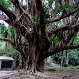
Natural phenomenons on Okinawa are often used as symbols for places of worship. Such places can be a water spring, a hilltop, or...a large tree. The tree you see above is commonly known as a Banyan Tree (Ficus microcarpa). The Okinawans call it 'Gajumaru'. The roots of a Gajumaru tree are well known to dig their 'claws' through hard soil and rocks. What makes this tree unique is that it sits on a large stone that has been carved out with a stone marker inside. The main Kanji reads 'Tenryu Daigoshin' and gives reference to a 'Dragon god from the heavens' hence the nickname, 'The Dragon Tree'*. In front of the stone marker is an incense holder for those who wish to offer prayers. What also makes this particular tree beautiful is its radiating symmetry of tree limbs shooting outward. The tree sits next to another utaki (place of worship) and a water spring down below. If you are into seeing the unique and unusual on Okinawa, then this might be a tree to see.

Getting there. The tree is located in a place that you would least expect. It sits behind an apartment and some commercial buildings in Naha City. Study the map carefully. The designated blue vehicle route is accessible for traffic going both north and south (note: northbound traffic just before this intersection cannot turn right due to a road median divider). Look at the Landmark Icon on the map to see what the turn-off looks like. 

Parking. There is no designated parking for this utaki. There may be an open lot just before the turn-off. In this picture it is to the left of the coke machine. Park at your own risk.

*the 'Dragon Tree' is a nickname created by the author to describe the tree and its association with the utaki (place of worship) collocated with it. It is not an official title.

Sunday, November 20, 2011

"Awase's God of Fire Utaki"

Awase's God of Fire Utaki


View Map It! Okinawa in a larger map
Awase's God of Fire


     GPS
     LatitudeLongitude
     N 26 19.151E 127 50.163


Awase's God of Fire Utaki


In many places around Okinawa you will see some sacred places of worship or 'utakis' that give homage to the fire spirit or 'god of fire'. This one is located in Awase of Okinawa City. It is collocated next to another place of worship called 'Ubugaa'. It is also about 150 meters near the 'Meinu Utaki' (not visible on map*). Information gathered about this site was derived from a stone inscription next to the utaki. It reads,
Place of Worship:  The God of Fire
The god of fire has been worshiped in ancient times (Okinawa) in people's kitchen.  To this day, it is known as the protector of homes and is very well respected.  From a family guardian, god of villages, and more importantly, Guardian of the Ryukyu Government during the Sho Dynasty, it became the highest level female guardian. On 24 December based on the lunar calendar it is said that she rose to heaven. January 4 on the lunar calendar the following year, is a festival welcoming the god of fire.  
Prior to 1945, Awase's God of Fire was placed facing the south side of the road, found on the northern part of 'Ubugaa.' (a water well collocated in the same area). It is symbolized by three stones (Umichimon) and an incense holder. In 1945, Awase was seized by U.S. soldiers. The original structure was burned down and damaged during the war. In 1951, part of Awase was re-opened to the Okinawan people and the prayer site was temporarily reestablished. The current location was rebuilt by the Awase Land Re-adjustment Committee. 
31August, 2002 - Awase Restoration Committee
The god of fire is also referred to as 'Hinukan' in Japanese, but it can also be referred to as 'Umichimon' as written above in the translation and gives reference to "three honorable things" (source: Encyclopedia of Shinto).

Other places of interest nearby: The Awase Shrine, The Meinu Utaki, The Awase War Memorial, Kanumou Well, Ubugaa.

*Reader's Note: Icons of nearby areas will not be visible on the above map. This is because Google Maps starts a new complete Map Page when a certain number of Icons been marked. Don't worry the other icons are still there. To see the other places of interest on the map, click the 'View Map It! Okinawa in a large Map' link above and scroll down at the bottom where you see the Previous and Next Links. I have provided feedback to Google that they should show everything on the map.

Thursday, October 27, 2011

"An Intriguing Utaki in Maehara"

An Utaki/Monument in Maehara of Uruma City


View Map It! Okinawa in a larger map
An Intriguing Utaki in Maehara

     GPS
     LatitudeLongitude
     N 26 20.507E 127 50.793


An Intriguing Utaki in Maehara


Curiosity often leads you to find the most intriguing things in life, particularly in Okinawa. If you like exploring, you probably realized that you developed a sixth sense of finding things here on this island. This happen to be one of those times. Despite being 3 feet from the road side, this monument/utaki is very well hidden. What gave it away was the stairway leading to somewhere and next to it, a white post with some Japanese written on it. Stairways are built for a reason and no one stakes a post in the ground for nothing.

This is no Seifa Utaki but it may give a glimpse of the past and what the Okinawans were going through at one time. The Kanji on the back of the inscription reads "Established in 1964, September 9th", and on the front "Renovation Monument". The word 'renovation' was the Japanese interpretation of the Kanji. But it could also mean 'restoration'. This is just my guess, but if you replace the word with 'Restoration' and juxtapose it with the date 1964 then this monument could possibly have something to do with Okinawa's Reversion back to Japan. Now the Official Reversion happened in 1972, but this did not happen over night. It was a decade long process. The Okinawan Reversion Council was formed in 1960 (see source). It is not unusual to see Okinawans or Japanese erect symbols of peace as, a means of moving forward. The statue of Shinran Shonin in Yomitan Village is an testament of that. I could be totally off the mark on this but with little information around this intriguing Utaki, it leaves one to wonder, why such an elaborate place of prayer? Somebody knows the answer. For now, it's another one for the Okinawa X-Files.

Note: The Maehara District referenced above resides in Uruma City. Though this Utaki is right off the road, it is easy to pass by. If you click on the balloon icon above, it will show you what to look for.

Other places of interest nearby: The Mysterious Esu Shirube Stone

Monday, September 5, 2011

"The Obscure 'Ato no Utaki' in Kyoda, Nago"

A view of Kyoda's Utaki from Highway 71


View Map It! Okinawa in a larger map

The Obscure "Ato no Utaki" in Kyoda, Nago

     GPS
     LatitudeLongitude
     N 26 32.591E 127 58.013


The Obscure 'Ato no Utaki' in Kyoda, Nago

Obscure? Perhaps more of a pun than anything. This Utaki (sacred place) is quite visible from Highway 71...only if you are looking in a certain direction and from a certain place. And you may barely see it from the 58. I speculate that most people driving on the 71 heading west towards Nago tend to be focused on what's straight ahead. This is understandable. You are going downhill at this stage at a good speed. You are almost about to hit the 58. You are wary of oncoming traffic. Even if you are driving eastward, you will more than likely miss it. That's because the way this Utaki is tucked in and masked partly by nature and partly by the overgrowth vegetation along Highway 71. But when you do happen to see it, you may say to yourself, "Wow! I drive through this place all the time and I didn't know that was there!".

I posted the photo above purposely to give you an idea what you may see driving along the 71 if you are looking to the north. There is a long stairway that leads to this Utaki. At the bottom is a Torii entrance gate. An inscription on the Torii itself says it was donated by the 'Toyota Car Company'. Next to the Torii is a large stone with the Utaki's named inscribed on it. It is called the 'Ato no Utaki'. The word 'Ato' can have several meanings in Japanese. It can mean 'later' or 'after'. I am not positive of the symbolic meaning it may have here. This Utaki looks relatively modern.  Inside, were concrete platforms to place ornaments or offerings. It was a very ordinary setup.

I'm not certain if the Utaki's location has any historical significance to the town of Kyoda. BUT! perhaps what lies around the corner is why the people of Kyoda chose this location. I used the word 'obscure' earlier to describe the Kyoda Utaki. Well,...what lies close by is really a tiny hole-in-the-wall. If I didn't take time to walk around the corner, I would have never known this little place existed in a 100 years...and I'm willing to bet that most people outside of the town of Kyoda ever heard about it too. It's Kyoda's legendary fountain, called the 'Water from Hands', in which I will blog about very soon.

Parking. You will have to find open areas nearby for parking. Be aware that some neighborhood roads are narrow and not advisable you park on them.  

Other places nearby of interest. Giant Red Shisas in Kyoda, 'Water from Hands' Fountain, Todoroki Waterfall, The Nangusuku Castle Ruins, The Nago Museum.

Monday, August 22, 2011

"The Mysterious 'Meinu' Utaki - Awase's Birthplace?"

'Meinu' Utaki in Awase, Okinawa


View Map It! Okinawa in a larger map

Meinu Utaki in Awase, Okinawa

     GPS
     LatitudeLongitude
     N 26 19.139E 127 50.147


The Mysterious 'Meinu' Utaki

This sacred place, or 'utaki' is found in Awase, Okinawa. It is called the 'Meinu Utaki'. According to the translation from the stone inscription right next to it and from the town office brochure. People at one time immigrated from the Shuri province to the island of Awase in the 18th Century. They would pray at this utaki for good fortune and luck as they embarked on their new life here at Awase. The stone inscription (see album) starts with the heading 'Mae no Utaki'. 'Mae' usually means in front of. It also has the meaning of 'before'. Putting the pieces together as best as possible, I think what the stone is saying, that "This is a Sacred Place from Long Before". Translation is often tricky and difficult. Even the local Japanese and Okinawans may have difficult translating the Kanji, since even a Kanji may have several meanings.

Why I use the word 'mysterious' is that according to the translator, the inscription says that the people immigrated to "The Island of Awase". Parts of modern day Awase might have been at one time an independent island. I didn't know that. Since then, it perhaps was built up over time and connected to the mainland. Doing a Google search I was not able to find another source to accurately confirm this. This adds to another long list of mysteries of Okinawa history. According to the translator, the sacred place marks the center of the old Awase Island, hence why it could be considered the birthplace of modern day Awase.

(Update, August 25, 2011: Here is literal translation of the inscription.

Awase was once known as the "Ase Island," "Awasu Kubanari," which was a desert island.  However, during the King Sho Boku (1768) era, people from Shuri, Naha started to move here and became a village. The origin of this stone is when the island people thought about building a shrine to worship and pray for the prosperity of the village.This coral-lite based structure has been withstanding over 200 years of wind and rain and is known to be the oldest place of worship. The shed was added later in 1997 to protect this stone from wind and rain.

August 31, 2001
Awase Restruction Committee)

Directions. If you follow the blue route that takes you to the Awase Shrine and continue on, you will eventually find some side streets that would lead to the location. You may have to count the streets to figure out which lane to turn on.

Parking. You should be able to park off on the side somewhere nearby.

What to bring. Definitely a camera. There are other areas nearby that have yet to post due to translation confirmation.

Other places nearby of interest. The Awase Shrine, The Awase War Memorial, The God of Fire Utaki, Kanomou Well, Ubugaa.