Search Map It! Okinawa

Showing posts with label castle. Show all posts

Monday, January 27, 2020

Nakijin Castle Night Illumination (Cherry Blossom Festival)

Nakijin Castle Night Display (Picture taken in 2012)


View Map It! Okinawa in a larger map
Nakijin Castle Night Display (Cherry Blossom Season)

    GPS
    LatitudeLongitude
    N 26 41.552E 127 55.677


Nakijin Castle Night Illumination, Cherry Blossom Festival 

Nakijin Castle has one unique feature that separates itself from other UNESCO Castles here on Okinawa. For about two weeks during the cherry blossom season, the evening hours are extended to the public and Nakijin Castle 'lights' up in an array of evening glory,...and if the cherry blossoms are in full bloom, you will see these pretty flowers like never before. During this special nighttime occasion, Nakijin Castle becomes one of the most romantic places here on Okinawa.

Basic Information.
When: Normally the last two weeks of January and early February. (2020 February 1 to February 9)
Time: Special hours during cherry blossom season 8am to 9pm (last admission is 830pm)
Admission Fee (to enter the castle): As of 2020, 300 yen for children, and 400 yen for adults. (Check website for current information.
Website (Festival Information): http://www.nakijin.jp  (Japanese only). Translator may be required.
To go directly to the event informationclick here.

Special Events. Normally there is an opening ceremony to kick off the night display with special events spread out during the next two weeks (normally happening on weekends). You can navigate through the Nakijin Village website (above) if you wish to see current schedule of events.

What to bring. During this season, it can become very cold and windy. Please dress appropriately. Definitely bring a camera.

Camera Recommendations. The night display offers great opportunities for photography, but you do have to have a basic understanding of your camera to take full advantage of your 'Kodak' moment. If you are new to photography, it is highly encouraged that you study the shutter speed and ISO settings on your camera first. Understanding these fundamentals will make a world of difference on your nighttime photography. Bringing a tripod is also highly recommended for this type of night time occasion. 

Amenities/Facilities/Parking. Food stands, toilets, indoor shelter facilities, and parking spaces are available on site. Wheel chairs; Unfortunately because of its historical nature, the castle compound is not wheel chair accessible. Baby Strollers; There are many uneven surfaces and stairs inside the castle compound. Bring baby strollers at your own discretion. 

Directions. The most simple route is to take Highway 58 north and turn on Highway 449 going into Motobu. Then take Highway 505 to Highway 115.  You will be approaching Nakijin Castle from the north.You will also see plenty of signs directing you to the castle location. An alternate route and more direct is to take Highway 58 north and then Highway 449. From there take Highway 84 east. Shortly after take Highway 115 going north. You will be arriving to Nakijin Castle from the south.

Other Cherry Blossom Events. Nago City Sakura Matsuri, Yae-dake Sakura Maturi.

Wednesday, December 21, 2011

"Sunset! Zakimi-jo"

Sunset at Zakimi-jo


View Map It! Okinawa in a larger map
Sunset! Zakimi-jo

    GPS
     LatitudeLongitude
     N 26 24.481E 127 44.520


Sunset at Zakimi-jo Castle


When the engineers built telecommunication towers and power lines near Zakimi-jo Castle, they probably didn't have the view of the sunset in mind. It didn't stop this couple, however, from capturing a commanding view of the Okinawa sunset. Like most castles and fortresses on Okinawa, Zakimi-jo sits upon at high elevation, good enough to get a good view of both the ocean horizon and the sun as it descends down in a blaze of fire.

If you don't mind a few man-made obstacles in the way and wish to spend some sentimental time watching one of the small joys of nature, then this is an ideal spot. And if you are lucky enough, maybe you too will have an unsuspecting photographer capturing your Kodak moment. This is Sunset at Zakimi-jo.

Getting there. Zakimi-jo is in Yomitan Village. If you take Highway 58 (north or south), get on Highway 12. Look for road signs that point to Zakimi-jo Castle.

Other places of interest nearby: Yomitan's Tucked Away Nature Trail.

Wednesday, November 30, 2011

"The Shiinagusuku Ruins"

Shiinagusuku Ruins


View Map It! Okinawa in a larger map
Shiinagusuku Ruins

     GPS
     LatitudeLongitude
     N 26 39.595E 127 58.396


The Shiinagusuku Ruins


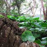
This is the Shiinagusuku Ruins. The history and research about this place is mired in mystery. It is not even quite clear which town or precinct it belongs to. It borders Nakajin Village, Nago City, and the town of Motobu. Nothing was mentioned in any of their official websites about this site. The only information that we obtained was its name, due to a small road sign in roman characters leading us to the ruins. The suffix 'gusuku' is Okinawan dialect for castle or fortress, and by its appearance and location it does give indication that it was once used as such. Once you are there, you do get the ambiance that it is an 'old' ruin site – preserved and untainted by modern construction. Mostly what you will see are large stones that seemed to be naturally part of the landscape, and then some makeshift stone walls further back (though it is not certain when those walls were erected). Now, it is mostly covered by Elephant Ear plants and trees interspersed throughout the area. One intriguing question does come to mind – what was its relationship which Nakajin Castle not too far away? Did it just serve as an outpost or lookout of the northern east side of the Motobu Peninsula? It's not quite clear.

There were signs that possible renovations may be done in the future. Engineer tape and reflective markers were placed at strategic points on location. However, at this time, the origins and the history of the Shiinagusuku Ruins shall remain a mystery.

Caution. I highly recommend you bring a good size guide stick, larger than a normal size umbrella. Though there are some well laid out paths, there are some areas you may be tempted to go. However, I highly recommend you just stay on the beaten paths. You can safely pretty much see all you need to see from there. Because of all the gaps between stones and sometimes dense ground vegetation along the unbeaten areas, you will need to probe these areas if you do decide to go. There are just too many places for snakes to hide. There are also plenty of spider webs in the area, so keep your eyes on top as well.

What to bring. Bring plenty of mosquito repellant. Recommend pants, good shoes, hat and long sleeve shirt (pending on weather), water, and your camera.

Getting There. Getting there is not difficult. If you look at the map you will see the turn off is off Highway 505. However, there is only one small road sign that points in that direction. Study the map carefully so as not to pass it. Once you turn you will see other signs (in Japanese only) pointing you the way. At some point you will reach an end point. You will see a construction area to the left and a tented farm center-right. The path is along this tented farm. The following pictures are the sequence you will see from parking to entering the ruin site: Picture 1, Picture 2, Picture 3, Picture 4, Picture 5, Picture 6

Friday, November 11, 2011

"Iha-jo Castle Ruins of Ishikawa"

Entrance to the Iha-jo Castle Ruins


View Map It! Okinawa in a larger map

Iha-jo Castle Ruins of Ishikawa

     GPS
     LatitudeLongitude
     N 26 25.285E 127 49.031


Iha-jo Castle Ruins of Ishikawa


This is the Iha-jo Castle Ruins of Ishikawa in Uruma City. It is a small castle site that sits on a hilltop over looking what is now Ishikawa district and Kinbu Bay. You will see remains of an old single layered stone wall that surrounds the castle site in different areas. The castle ruins covers about about 60 square meters, or 201 square feet in total area. Up on top you will see various spots where people pray, known as 'utakis'. Various artifacts have been discovered here to include pottery from other countries. There was also indications that poles to erect huts were used at one time on the castle grounds. Near the main entrance to the castle ruins you will see a large torii gate and a sign translated in English provided by the Okinawa Prefecture Board of Education and the then, Ishikawa City Board of Education. The source of the information was derived from that sign.  

One point of interest near this site is the burial tomb of Iha Nuru. This is supposedly about 200 meters away from the castle ruins. However, it could not be located. Either the path to it was overgrown by vegetation or the sign marker was removed. The word 'Nuru' is Okinawan dialect (Hogen) for 'Noro' in Japanese. A 'Noro' or 'Nuru' is a priestess, and for many centuries has played significant roles in Okinawan culture, religion, and society. To read up a little about Japanese/Okinawa Priestess please check out the Japan: Life and Religion website. As of now, the mysterious location of the Iha Nuru Tomb will remain in the O-Files.

Getting there. Getting these isn't difficult. It is not far from the Highway 329 (Ishikawa Bypass) and Highway 6 traffic intersection. Look for these brown and beige road signs along the road to see where to turn. It's not too difficult.

Parking. You can park off to the side near the ruin grounds.
What to bring. Camera, mosquito repellent, good shoes, umbrella and/or guide stick.
Caution. You may see areas of overgrown vegetation. Avoid walking in these areas if you cannot see around where you are stepping, the obvious danger being snakes.

Sunday, November 6, 2011

"The Nangusuku Castle Site Ruins in Nago City"

Steps leading up the Nangusuku Site Ruins


View Map It! Okinawa in a larger map

Nangusuku Castle Ruins of Nago City

     GPS
     LatitudeLongitude
     N 26 35.269E 127 59.424


The Nangusuku Castle Site Ruins in Nago City


The Nangusuku Castle Ruins is part of a much larger park known as the 'Nago Castle Site Park'. The ruins are collocated on the same mountainous region where they host the annual Nago Cherry Blossom Festival every January and February. English translated signs found near the site explain that the ruin grounds were residence to Nago Aji, once royal members of the Ryukyu Kingdom. Additionally research has shown that various artifacts excavated here have been said to have theirs origins traced to China and Korea giving belief that people first settled here around the 14th Century. Artifacts included Chinese ceramic pottery known as 'Kamwi-yaki' jars and Korean roof tiles and pots. Unlike many of the major castles found on Okinawa, the Nangusuku site does not have any stone walls. Instead, trench like defensive structures have been discovered at this site.

When you first arrive near the ruin grounds, it is not quite clear where exactly are the ruins. Everything seems to have been modernized (meaning modern construction) with the exception of a few old sacred prayer sites scattered about. There is a shrine at the top of the steps. This too is built from modern construction. As you walk around you will see a network of trails and beaten paths, and paved roads. You will be tempted to walk around the entire park. As stated before, the ruin grounds is part of a much larger park. If you do wish to venture off, prepare to walk a lot. Most of it will be up or down hills.

Location and Parking. Parking closest to the Nangusuku Castle Site is at the 'south entrance'. The Green Thumbtack icon you see above marks the base of the steps that lead up to the ruin site, and also marks one of the designated parking areas at the 'south entrance'. These landmarks are collocated near the end of Route 18 and the Nago Green Bridge.

If you wish to visit the entire park and see other stuff and have no desire to walk long distances, then view the last picture in the photo-album. It a photo of a map board taken at the park. The 'south entrance' will be a the lower left hand corner. Downloading the photo will not give you a high resolution. Use Google's zoom tool already affixed to the photo album instead to see more details. This map board is also located at the Lower Creek Park caddy corner to the Nago Green Bridge (both near the south entrance).

Note: Other photos of the park are included in the photo album in case you decide to visit other areas.

What to bring. Water, mosquito repellant, good foot wear, umbrella for rain and knocking away spider webs, camera, hat or sweat rag (optional), Bento lunch (optional).

Bathroom facilities. There are various bathroom facilities spread out through the park.

Friday, August 12, 2011

"Kin's Castle Rock"

Kin's Castle Rock


View Map It! Okinawa in a larger map
Kin's Castle Rock

     GPS
     LatitudeLongitude
     N 26 27.309E 127 55.407


Kin's Castle Rock 

At one time, Kin Town had a small castle. The last remnants of this castle is a stone that sits underneath a large tree in Kin Town (See picture album above). Next to the stone is a smaller stone with the Kanji meaning, "Stone belonging to the Castle of Kin". Okinawa has many large castle ruins island-wide, but little is publicly documented on the castle in Kin or its exact location. Next to the "Kin's Castle Rock" is a large rusted, metal gear intentionally planted in stone. There is no description or inscription next to it describing its purpose. (Update: August 15, 2011 - This was a metal press used by farmers decades ago to derive juice from sugar canes. A cow or horse would be tied to a cog wheel and turn to press against another press squeezing the juice out of the sugar canes.)

Perhaps like in many historical relics in Okinawa, The "Castle Rock from Kin Town" is yet another mysterious objects forgotten in time.

Other areas of interest nearby: Kin Watch Tower, Statue of Oshiro Kozo, Okawa Natural Spring, Kin Kannonji/Temple, Richamocha Cafe, The Gold Hall, Kinjo's Used Goods, Kin Town's Hidden Nature Trail,  Statue of Toyoma KyuzoBirth Place of Toyoma KyuzoKin Town's History Chronicles, Kin Town's Cherry Blossom Way.