|
| Mangrove roots. Like a million headless bodies crawling along the river... |
View Map It! Okinawa in a larger map
 |
| Legend of the Okukubi River |
GPS
| Latitude | Longitude |
| N 26 27.391 | E 127 56.487 |
A River of a Hundred Million Necks?
One of Kin Town's most attractive natural habitats is the Okukubi River. It has become a sanctuary for wildlife and a playground for nature lovers. Everyday, thousands of vehicles drive over the Kin Bridge as the Okukubi River streams quietly underneath. What's most intriguing about the river is not so much its natural beauty, but the mystery behind its name. How did it get it?
Written in its kanji (億首川), the Okukubi River, could be interpreted as a River of a Hundred Million Necks; a somewhat gruesome description for such a benign place. Did something very dark happen here long ago?
As of yet, there is no official story to the name's origin, but there is one popular legend that has been documented in Kin. The story takes places at the time of the Satsuma invasion of the Ryukyus, some time between the 16th and 17th century. Could the legend unlock the secret to its name?
The story...
A long time ago, a samurai from Shuri had traveled to the village of Kin. During his travels he had met a peasant girl and fell in love. But marriage was unthinkable; for she was a simple peasant and he, a noble samurai. Shortly after, the samurai was called back to Shuri. Destiny would keep them apart.
But something was about to change forever. After he had left, the woman realized she was pregnant with his child. Nine months later, she gave birth to their son and named him,
Tetsu-o.
Years later, Tetsu-o would grow up to be a man of super-human strength. It was also about the same time that soldiers from the Satsuma domain were constantly harassing the villagers of Kin. Using his natural powers, he defended the village and killed many, many Satsuma invaders. To the Satsuma soldiers, Tetsu-o was a man forged out of iron, a man impossible to kill. They needed to find someone to defeat him, the one person that could crush Tetsu-o once and for all.
They didn't have to look far... they found a man named Kochi Oyakata, a man very familiar with Tetsu-o.
Kochi, at one time, was the martial arts instructor for the village,... until he was promptly replaced by Tetsu-o. Now, only deep-seated, hatred fueled Kochi's blood for this so-called “iron man”. Sure enough, the Satsuma soldiers had found the enemy of their enemy.
But to kill a man of iron, one question still lingered...what made a mere peasant boy so powerful against the will of many?
After his samurai father had left, Tetsu-o's mother became shameful of her pregnancy. Out of desperation, she continuously digested small pieces of iron to kill her unborn child, but to no avail. She eventually accepted her destiny; gave birth to a son, and named him Tetsu-o, a name which means 'Iron Boy'. It was the iron in his veins, the very element that was once used to poison him, that had ironically become the source of his strength.
Still, every man has a weakness. Tetsu-o, a man skin-clothed in metal, could only be cut in one place; the one place made of flesh and not iron,... his neck.Kochi knew.
And on that fateful day, Tetsu-o's body lied their slumped, slayed like an animal. Kochi had gotten his revenge. He had stabbed Tetsu-o in the neck, killing him instantly,...leaving his body for all to see.
Now with Tetsu-o out of the way, the Satsuma soldiers were sure to wreak havoc once again. Chasing the villagers, they stormed up a large, steep hill. As the soldiers reached the apex they saw a haunting figure, a ghost from the past. It was Tetsu-o!..standing there tall and fierce! Frighten and full of despair, the Satsuma soldiers fell to their doom. A resurrected Tetsu-o had returned to destroy his enemies once and for all!
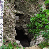
Epilogue. The villagers of Kin had out smarted their foe. After Tetsu-o's untimely death, the villagers knew the invaders would soon return. They took Tetsu-o's dead body and erected him on a hill, next to a river; the same river where Tetsu-o had slayed many, many Satsuma soldiers... and which happen to be the final location of his triumph.
Thereafter, that river became known as the Okukubi River... a River of a Hundred Million Necks; a name giving tribute to a hero, and a monument of the number of soldiers he had slayed.
Today. The story is not considered to be historical fact by the Kin Town Board of Education, it is however, officially recorded as a historical legend of Kin and is documented in their Book of Folklore and Legends publication (1989). The Kin Town Historical Office did offer one other possible explanation for the river's name. Okukubi could also be loosely translated as a river's neck. Oku, in this case, would mean something to the back or the interior, thus making it the neck at the a back of the river (or the neck upstream). However, the way the kanji is currently written, the Okukubi River (億首川) could only be interpreted as a “river of a hundred million necks”.
Is the River Considered Haunted? In the same folklore publication, a separate story was written (pg 80) where villagers claimed to see spirits along the Okububi River, but does not go any further in describing the incident or if it had anything to do with the Okukubi Legend. By my estimation, I do not sense that most people of Kin view the river as haunted. But they are somewhat familiar with the legend because of its name. There is even a recreational nature facility at the mouth of the river and a dam not far upstream. Farmers, construction workers, nature enthusiast, photographers,...all travel along the river every day. For now, the Okububi River seems to be in good standing.
For now.
Reference. Kin Town's Book of Folklore and Legends dtd 1989, (Okukubi Legend, pg 132).
Acknowledgment. Much appreciation is owed to the Kin Town Historical Office for their cooperation in bringing this story about. In particular, Ms. Nakama deserves much gratitude for her invaluable assistance and patience with the story's development.
Photo caption. The caption to the photo above is the author's own metaphoric comparison based on the legend. The comparison has not been heard, nor stated by any village resident during the research of this story.
Directons. Please view the map for the most direct route to the Okukubi River. If traveling north on Highway 329, take the first immediate left just before the Kin Bridge (designated by a pink thumbtack). You will travel down a hill and see the Kin Dam shortly after (it will be on your left). Near the bottom of the hill you will see an improved road that takes you east under the Kin Bridge and then towards the ocean. The Okukubi River will be on your right. You will have to travel on a dirt road if you wish to continue parallel with the river. The Balloon Icon in the map marks the last river bridge before you get to Nature Mirai-kan, Kin's nature recreational facility. There are are several observation decks and boardwalks along the river should you wish to get a closer look of the river.
Other Places of Interest Nearby. Joy and A Guinness World Record (Nature Mirai-kan).
Other Okinawan Ghost Stories. Haunted Ruins in Kyoda, The Legend of Nanga Bozu.
Other Okinawan Ghost Stories. Haunted Ruins in Kyoda, The Legend of Nanga Bozu.