Search Map It! Okinawa

Tuesday, January 31, 2012

"Modern Day Ruins of an Old 329"

Ruins of an Old 329


View Map It! Okinawa in a larger map
Modern Day Ruins of an Old 329

     GPS
     LatitudeLongitude
     N 26 34.240E 127 59.707


Modern Day Ruins of an Old 329


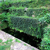
Ruins are abundant here on Okinawa, both from the Okinawan War and from the old Ryukyu Kingdom. But ruins don't become ruins over night. There is a natural cycle that slowly erodes and tears away at the structures that were once sought and used by men. History Channel had created a television series called 'Life After People' where they used computer simulated models to expedite the aftermath of a town or city if people were to suddenly disappear. But seeing the actual process unfold in modern times is an interesting spectacle to witness - take for example, Highway 329 going into Nago City. You may not have realized it when you were driving, but there is about a 1 km stretch that is elevated on a bridge just before the 329 hits Highway 58.

And down below you can almost say it is a world all unto itself...an underworld of sorts of over growing vegetation, streaming water, and signs of a deteriorating old road. This underworld is part of the Old 329 that once zigged-zagged down the Nago landscape going into Nago City. It is a very eerie place to wander around as you hear cars zip by above and yet, no sign of animated life down below. And yet it is a strange, but intriguing thing to see – a structure once used by men, now left at the mercy of a relentless forest slowly closing in.

It's not certain why this road was replaced by the now standing bridge.

See more pictures of the Old 329.

Parking. Recommend you park at the location of the balloon icon and start from there. There is small area where you can park your car. I don't recommend you park at the top 1km away where the bridge starts. Getting out of there can be a safety hazard. Cars going north tend to travel at high speeds around the corner.

Wednesday, January 25, 2012

"Fukugawa Falls"

Fukugawa Falls


View Map It! Okinawa in a larger map
Fukugawa Falls

     GPS
     LatitudeLongitude
     N 26 36.325E 128 03.420


Fukugawa Falls


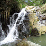
Maybe one of the most beautiful places on Okinawa, this waterfall lies in the very remote part of Nago City. It is probably one of the least known waterfalls on Okinawa, but its beauty may surpass that of its elder siblings. You might consider this the baby sister of waterfalls. When you arrive, you will be mesmerized as soon as you step on the gravel trail. Beautiful tall ferns along the Nago landscape blanket the tree line. The adjacent stream flows quietly and gently over the river bed. And at last, there she is...flowing perfectly and harmoniously down the earth as if she was nestled in the arms of mother nature. She is immaculate in as many ways and yet by her humble stature, commands much respect. She is Fukugawa Falls.

Click the above photo album to see more photos of Fukugawa, Or click here.

Author's Note: No where is it written on how to conduct oneself when you arrive. But as a humble suggestion if you are going for the first time, I recommend going with a sense of humility and quietness as if you were entering a shrine. Part of the beauty of Fukugawa is listening and allowing the nature to speak to you; the soft wind, the swaying trees, and the sound of dripping water. Go as you please, but leave no trace behind – not even what would seem like a harmless etched inscription of a 'Jane and John Doe Were Here' at the wooded pavilion. This is a place where families and love ones, both foreigners and Okinawans, can enjoy the serenity and peace of the Ryukyu spirit together. Be modest in your conduct. Gauge the atmosphere. Loud noise may not be advisable at times since this can be a place of meditation for some.

Family Accessibility. Fukugawa is ideal for families and is something that all families should see together since this will be one moment they will treasure together. The trail is about a 15 minute walk, on mostly gravel and dirt. There are some places where you have to watch your step and may have to guide little children by hand (mainly when on the steps). There is one little area you have to cross that may get your shoes wet. On a normal day it should be about inch or so deep. Always be on the lookout for spider webs.

Getting to the Top. There is a trail that can take you to the top. It does not start at the base of the waterfall however. The trail starts from highest point the log steps reach – so you may have to backtrack if you are already at the waterfall. This picture shows portion of the trail branching from the steps (it is to the right). CAUTION: CLIMBING NOT RECOMMENDED FOR YOUNG CHILDREN. There are some areas where you can trip, fall, and tumble down if you have poor coordination skills. Once you are on top, use EXTREME CAUTION when approaching near the edge of the waterfall. The rocks are very slippery with little to grip. If you get too close and slip, you will have nothing to grab onto. You will fall...all the way down. Fukugawa is beautiful, but respect it and respect your limits.

The 'Tarzan Rope'. There is a small 'Tarzan Rope' to the left facing the waterfall but by the looks of it, it does not look sturdy enough to hold someone of average adult weight. Highly discourage any adults to use it. Use good judgment with your kids. The end result could be a broken tree in the pool of water.

Getting there. Study the map carefully and study the designated landmarks. Once you are on the blue route, go at a moderate safe speed so as not to pass any landmarks. There are two simple ways you can get to this waterfall. If you are familiar with the Haneji Dam/Highway 18 route, you can approach the starting point of the blue designated route from the southeast or you can come from Highway 58. Again depending on what direction you are coming from, look for these landmarks that are identified on the map; Statue of boy (turn-off on the 58), Radio Tower (Start of the Blue Route), Utaki at T-intersection (last major turn-off to the waterfall), Stone Marker (Halfway point to the waterfall). Near the end of the blue route you will approach a awkward T-intersection. Make a right here and about 20 meters to the left look for this chained off trail. This is where your trail starts. The sign says no vehicles allowed. You will have to park somewhere off to the side.

Hunting Season Advisement: CAUTION LEVEL: VERY LOW. Though not often known, Okinawa does have a hunting season (November 15-February 15).  You won't see any hunters near any public places, nor this waterfall. They usually go deep in the Nago Mountains away from any kind of population. This advisement  is for those who may wish to venture off later in the Nago Mountains after visiting Fukugawa. Only qualified and trained personnel are allowed to have such a hunter's license. It is mainly to hunt pest such as wild boar or other animals that have a negative effect on the land, crops, and other wildlife. Should you decide to go on a vehicle excursion in the Nago Mountains just be advised. They will be wearing bright orange, and sometimes organized in groups. There should be little to worry about if you stay on the blue route and known public areas, such as this waterfall.  Don't be surprised during this time though if you hear a shotgun go off in the distance. The Nago Mountains echo loud noises in this area.

Other waterfalls of Okinawa (沖 縄 滝).
Azaka Falls, Hira Falls, Meoto Falls, Ogimi Waterfall, Taa Waterfall, Todoroki Waterfall, Nameless Waterfall (Fukugawa II), Kijoka Falls, Nameless Waterfall (Kunigami Village).

Sunday, January 22, 2012

"The Golden Forest Utaki"


View Map It! Okinawa in a larger map
The Golden Forest Utaki

     GPS
     LatitudeLongitude
     N 26 37.391E 128 01.709


The Golden Forest Utaki – Nago City


This is the Golden Forest Utaki* in Nakaoshi of Nago City. It sits along one of Nago City's back roads near the base of the Nago Mountains. The name 'Golden Forest' harmoniously describes the immediate surrounding area. Off in the back you will see shades of gold tinted foliage and leaves. The stones in the foreground too are covered in tinted shades of gold. The inscription on the back of the main stone reads:

"This is a sacred utaki of Nakaoshi. Because of construction, part of the road now covers this utaki. This monument is built to pray for the safety of those who live in this region. 1986 February."

If you were to venture off to the tree line in the back you will eventually see a small rock-side waterfall. See photo album above. The entire area is very quiet and peaceful with a slight breeze swooshing through every now and then. 

Getting there. The are two simple ways you can get to this utaki. If you are familiar with the Haneji Dam/Highway 18 route, you can approach the blue designated route (in the map above) from the south. The landmark (radio tower) at the beginning of the blue route is your signal to turn. See post on Haneji Dam/Scenic Route 18 for more information about this route. The other means is through Highway 58. The landmark for the turn-off will be a small statue of a little boy. The utaki will be on your right as your are driving.

Parking. There are no designated parking areas near this utaki. You have to find a wide area in the road nearby to park safely. Be careful of on coming traffic. Because the utaki sits along a somewhat unknown backroad, vehicles tend travel little faster along this route.  

Hunting Season Advisement: Though not often known, Okinawa does have a hunting season (November 15-February 15). CAUTION LEVEL: VERY LOW You won't see any hunters near any public places, nor this utaki. They usually go deep in the Nago Mountains away from any kind of population. This advisement  is for those who may wish to venture off later in the Nago Mountains after visiting this utaki. Only qualified and trained personnel are allowed to have such a license. It is mainly to hunt pest such as wild boar or other animals that have a negative effect on the land, crops, and other wildlife. Should you decide to go on a vehicle excursion in the Nago Mountains just be advised. They will be wearing bright orange, and sometimes organized in groups. There should be little to worry about if you travel on public roads and to known public areas. 

Note1: *'Utaki' is a place of worship in Okinawa
Note2: Not all icons will appear on the same map from earlier post. For example, the Haneji Dam/Scenic Route 18 do not appear in the above map. Much like Google's search results, you have to click 'Next' or 'Prev' to see the next group of icons when you view the map in screen size. This is a Google protocol and is trying to be resolved.   

Friday, January 20, 2012

"Joy and A Guinness World Record"

Father and daughter playing on location of the Guinness World Record


View Map It! Okinawa in a larger map
Joy & A Guinness World Record

     GPS
     LatitudeLongitude
     N 26 27.257E 127 56.558


Joy and A Guinness World Record


There are at least two events that can be 'mapped' at Nature Mirai-kan of Kin Town; A father's love and the location of the Guinness World Record for the largest Taco Rice ever made. Just where this father and daughter are playing lies the field, that on November 14, 2010, a total combined weight of a whopping 746 kg (1,644 lb 10 oz)  of rice, beef, lettuce, cheese, and tomatoes where combined to make Kin Town as one of Okinawa's Guinness World Record holders. Taco Rice is no stranger to Kin Town. In fact, popular legend has it that the first taco rice ever made was at a local taco shop just outside of Gate 1 Camp Hansen in Kin Town – making this World Record all the more special.

At the present moment, there are no stone markers that mark the exact spot of where and when this accolade was received. The future of Nature Mirai-kan is uncertain for the next few decades. Places come and go. Years from now and with the help of modern technology, people will be able to point to where it all happen and a father can show his daughter a fond memory they had together.

Nature Mirai-kan of Kin Town, November 14, 2010 Guinness World Record Holder for the Largest Taco RiceGuinnessworldrecords.com

Information: Nature Mirai-kan is a recreational facility that promotes outdoor activities like camping and kayaking. Visit their website www.nature-kin.com (Japanese only). It sits on the southern side where the Okukubi River and the ocean meet. All along the Okukubi River you will see mangrove trees and observation post to view the indigenous and migratory wildlife.

Photographs of the World Record Event. To see pictures of the actual event on November 14 2010 please go to Mike's Ryukyu Gallery and Nature Mirai-kan's Blog dated November 14, 2010.

To see an example of a taco rice dish click here.

Tuesday, January 17, 2012

"The Dragon Tree"

Size comparison: A photographer stands in front of  'The Dragon Tree'*


View Map It! Okinawa in a larger map
The Dragon Tree

     GPS
     LatitudeLongitude
     N 26 13.935E 127 40.959


The Dragon Tree


Natural phenomenons on Okinawa are often used as symbols for places of worship. Such places can be a water spring, a hilltop, or...a large tree. The tree you see above is commonly known as a Banyan Tree (Ficus microcarpa). The Okinawans call it 'Gajumaru'. The roots of a Gajumaru tree are well known to dig their 'claws' through hard soil and rocks. What makes this tree unique is that it sits on a large stone that has been carved out with a stone marker inside. The main Kanji reads 'Tenryu Daigoshin' and gives reference to a 'Dragon god from the heavens' hence the nickname, 'The Dragon Tree'*. In front of the stone marker is an incense holder for those who wish to offer prayers. What also makes this particular tree beautiful is its radiating symmetry of tree limbs shooting outward. The tree sits next to another utaki (place of worship) and a water spring down below. If you are into seeing the unique and unusual on Okinawa, then this might be a tree to see.

Getting there. The tree is located in a place that you would least expect. It sits behind an apartment and some commercial buildings in Naha City. Study the map carefully. The designated blue vehicle route is accessible for traffic going both north and south (note: northbound traffic just before this intersection cannot turn right due to a road median divider). Look at the Landmark Icon on the map to see what the turn-off looks like. 

Parking. There is no designated parking for this utaki. There may be an open lot just before the turn-off. In this picture it is to the left of the coke machine. Park at your own risk.

*the 'Dragon Tree' is a nickname created by the author to describe the tree and its association with the utaki (place of worship) collocated with it. It is not an official title.

Saturday, January 14, 2012

"Noroga and Remnants of an Old Sugar Factory"

A tall chimney left over from an old 1940 sugar factory


View Map It! Okinawa in a larger map
Noroga and Remnants of an Old Sugar Factory

     GPS
     LatitudeLongitude
     N 26 18.300E 127 54.630


Noroga and Remnants of an Old Sugar Factory


It is pretty rare to see an old style brick chimney here on Okinawa. What you see above is what's left over from an old sugar factory built in 1940. Four years after its construction it was destroyed during the war (the translation on the sign did not specify if it was destroyed as a result of the war). The only thing left now is an old chimney and a sugar cane field that overlooks the western side of Katsuren Peninsula. To the east is a spring called Noroga (or Nuruga) and people of the nearby village come here to pray for prosperity. The trail to the spring is pretty noticeable off to the side. As you get closer you will see a large tree slumped over the spring. Water flows gently down a small dug out reservoir.

Other places nearby. From the sugar factory location, if you continue north along the peninsula you will eventually get to the backside of Katsuren Castle where you can take a good photograph of the castle elevated on a hill top. At several points you can get a good view of the ocean down below. If you are really into the 'off the beaten path' stuff, then there are some roads along the farms that take you further down to the beach side where you can see some unusual coral rock formations. If you do so, you may have to park your car at a reasonable distance and walk the rest of the way towards the beach. Roads in this area can be tight. Please study the map above. 

Getting there. Getting to the Old Sugar Factory grounds is not difficult. The turn-off is about 500 meters away from the main entrance to the White Beach U.S. Naval Facility. If you look at the map you will see a landmark with a historical sign that points to the 'Heshikiya Takino' historical site. Once you make the turn, 500 meters later you will see the chimney on your left-hand side along with a sign marker

Wednesday, January 11, 2012

"Car Blessing at Naritasan Fukusenji Temple"

Car and its Driver getting Blessed at the Naritasan Fukusenji Temple grounds


View Map It! Okinawa in a larger map
Car Blessing at Naritasan Fukusenji Temple

     GPS
     LatitudeLongitude
     N 26 16.986E 127 47.892


Car Blessing at Naritasan Fukusenji Temple


Experiencing a local custom is one way to immerse yourself into Japanese culture. One such way is to have your car blessed at the Naritasan Fukusenji Buddhist Temple, or commonly referred to as Narita-san (Narita Mountain). The Main Hall is an impressive structure that can be vividly spotted as you cruise along Highway 146 in Nakagusuku Village. It sits along a mountain side not too far away from Nakagusuku Castle. There are two main buildings on the temple grounds. There is the Main Temple Hall that rest higher in elevation, and then there is a smaller temple-like structure that sits at the lower section near the main parking lot. The latter is where you can get your car or motorcycle blessed. The entire ceremony takes about 10-15 minutes. Though it would be of help to have someone fluent in Japanese accompany you, it is not necessary. Many foreigners come here to have their automobiles blessed. Here are the steps to guide you should you go through the process.

1.  Fee. There is a ceremony fee. At the time of this post the cost was 3000 Yen for a normal size vehicle, 4000 Yen for large vehicles, and 2000 Yen for mopeds/motorcycles.

2.  As you just arrive with your car be watchful if there is a ceremony already taking place. If there is, then you may not want to park right up close just yet, so as to not disturb the ceremony in progress. Just park your car at a distance and wait. Note: Sometimes, the local priest will do multiple automobile blessings at a time.

3.  If you show up and no one is there, you will see a bell near the front office to the left. Just ring this bell and someone will attend to you.

4.  The local priest or attendant will ask you to fill out your name and license plate information on a sheet of paper (if you know how to write your name in Katakana then please do so. This makes it easier for the priest to mention you by name during the ceremony). Go ahead and pay your fee at this time.

5.  The priest will then ask you to stand in front of the main alter area. He will ask you for your keys, and then place them in an orange tray. He will also ask you to park you car up close (if not already done so).

6.  At this time he will commence with the ceremony. He will gesture that you clasp your hands in prayer form and then he will commence with a set of chants, prayers, and beating of the drums.

7.  At some point during the ceremony, here will take a foliage of paper to burn in a fire. This is to symbolize burning away the bad spirits.

8.  He will then return to the main prayer area to finish up the ceremony, bless you with a large wand-like item, then return your keys. The entire ceremony takes about 10-15 minutes. Once the ceremony is concluded you will receive three items from the priest. First item is what called an 'Omamori' which is essentially a good luck charm. Specifically, the writing on it says “For safe driving”. This 'Omamori' is to be placed in your car somewhere. The second item is a sticker that you can place on your vehicle. It says Okinawa Naritasan on it and “Drive safe”. The last item is a bottle of sake that is to be used to bless all your tires. This is something that you yourself can do and once you are done, you can return the empty bottle to the recycle box in front of the main alter.

Please Read:
Note 1: If you go with your family, he will kindly ask your family members or friends to join in on the ceremony. This is great! Make this a family event as you share the fruits of Japanese culture.

Note 2: Taking photographs. The local priest had mentioned that taking photographs during the ceremony was okay, however, all that was asked was that the photographer do so at a respectable distance off to the side so as to not disturb the ceremony. Use your best judgment. A camera man constantly moving is not advisable.

Note 3: The Naritasan Main Temple Hall does daily prayers 3 times a day; 545am, 1015am, and 215pm. Normal Hours of Operation: 9am-5pm daily (both for the automobile blessing and the Main Temple). Taking photographs inside the Main Temple is not permissible. You can however take photos from the outside looking in. Phone number to the Naritasan Fukusenji Temple: TEL :098-895-2076.

Note 4: During the blessing ceremony, you may notice a Buddha in the background. This Buddha is known as Fudo-Myoo. Fudo in Japanese meaning something as immovable. Source 1, Source 2.

Sunday, January 8, 2012

"Tabagaa"

Tabagaa Spring


View Map It! Okinawa in a larger map
Tabagaa Spring

     GPS
     LatitudeLongitude
     N 26 22.006E 127 52.086


Tabagaa Water Spring


On the eastern side of Taba, a district in Uruma City, lies a sacred well called Tabagaa or sometimes referred to as Ubugaa. What you will see at the spring are two main water wells, a reservoir in between, and a place of worship known as an utaki. The explanation on a nearby sign does mention several stone stacking techniques used to set up this spring. They are referred to as akata, nozura, and kiriishi techniques of stacking.

At the beginning of the New Year you may see heighten activity at this location by local villagers. It is here where local villagers participate in a custom known as 'wakamizu', which is the first drawing of water on New Years Day*. The well is also used by local farmers for agricultural reasons and another practice called kauri/ubumizu which is a way of celebrating or welcoming a new baby into the world. These types of customs are similarly described at another well in Awase of Okinawa City which just happens to be named 'Ubugaa'.

Getting there. Not a difficult find. If you are on Highway 8 going towards Katsuren Castle look for this road sign to the left. Both the sign and the turn-off will be right before a Family Mart. The well is roughly 70 meters from the turn-off.

*the translated explanation did not specify which type of New Years. It could represent New Years both from the Gregorian Calendar and the Lunar Calendar (Chinese New Year).

Wednesday, January 4, 2012

"The Taa Falls"

The Taa Waterfall


View Map It! Okinawa in a larger map
The Taa Waterfall

     GPS
     LatitudeLongitude
     N 26 38.048E 128 05.682


The Taa Falls


This is Taa-taki or the Taa Falls of Ogimi Village. It sits about 1.5 km south from its sister waterfall, Azaka. And unlike the cascading Azaka Falls, this waterfall drops straight roughly 50 meters below. To get an idea of the scope and size, click on this photograph with two people standing next to it. The Taa Falls is unique among the many known waterfalls here on Okinawa in one aspect; there are no man-made trails to get to it. You have to hike along (and sometimes) in the river to get there. With the exception of a few guide ropes along the way, you are on nature's terms. The walk is not that bad, only about 20-30 minutes depending on your pace. However, the walk does require some balance and coordination skills because of the sometimes awkward rock formations you must negotiate over. This venture is not recommended for very young children, but use good judgment as you see fit.

Once you get there you have no choice to embrace the beauty. Sit and relax with the family. On a hot summer day this place is ideal to cool off.

Getting to the top. PLEASE READ. There is a path that takes you to the top. It is to the left as you are facing the waterfall. There is makeshift rope to aid in you climbing up the slope. Once you get on top of the initial slope, there are two more trials that split but both get you to the outlet of the waterfall. One trail continues straight and down while the other to the right and up. RECOMMENDATION. I highly recommend you do not take the one that goes to the right. Although it seems closer to the outlet, it can be quite a task. There are many roots to trip on and can be very slippery, and in most cases, you are required by the assistance of a makeshift rope along the way. This route can be very painful on your hands as you balance your weight while holding the rope. I recommend taking the other route. You will only have to travel about 50 meters till you meet the river stream. Once you get on the stream, take a right and walk along the stream till you get to the outlet.

Advisement. PLEASE READ. Again, this hike is not recommended for very young children with low coordination skills. Use sound judgment. You will get wet. On a normal day of good weather, at most you can get wet up to your knees. Recommend having an extra pair of shoes and/or socks and a towel in the car. It is also recommended that you do not wear any soft sole shoes. If you do, you will feel every rock along the way as if you were walking barefoot. Tennis shoes should be find. Have shoes with good traction. If you already have some kind of hiking gloves, bring those as well so as to help you with grip and protection. During colder months, the gloves will also keep your hands warm. Recommend also bringing a small backpack to stuff food or other items like small towels or extra pair of clothing. You can take a short swim at this waterfall.

Directions. The route is almost identical on how you get to the Azaka Falls. If you drive north on Highway 58 just as you pass into Ogimi Village you will approach the Henan Bridge (there is no sign marker of the Henan Bridge in English characters on the southern side). But look for the bridge that has two Okinawan traditional flower hats known as 'hanagasa' on each side. You can either take the turn-off immediately before the bridge or immediately after the bridge. Continue along the road. About 1 km you will run into a 'Y' Fork in the road. Continue on the road to the right. At some point will see a very visible parking area next to the stream. You can park here. If you are facing the stream from the parking area. You hike to the left going up stream. There may be a sign hanging on the tree limb pointing you in the right direction.

Other Places of Interest Nearby: Azaka Falls.

Other Waterfalls of Okinawa (沖 縄 滝). Azaka Falls, Fukugawa Falls, Hira Falls, Meoto Falls, Ogimi Waterfall, Todoroki Waterfall, Nameless Waterfall (Fukugawa II), Kijoka Falls, Nameless Waterfall (Kunigami).

Monday, January 2, 2012

"Azaka Falls"

Azaka Falls


View Map It! Okinawa in a larger map
Azaka Falls

     GPS
     LatitudeLongitude
     N 26 38.767E 128 05.418


Azaka Falls


Surprisingly, this waterfall sits wide open, inconspicuously next to a road about 200 meters away. There are no signs that point to it and though it makes a loud thundering sound from a distance, you wouldn't hear it if you had your car windows rolled up. Perhaps more people pass right by it on their way to see the Taa Waterfalls just down the road. But if you happen to look at the right moment as you are passing by, you will notice a tiny pocket view of water streaming down between the trees. A closer view however, gives you something more impressive to see. This is the Azaka Falls of Ogimi Village.

At a vertical height roughly at a 100 meters, this natural beauty is not your typical waterfall with a straight vertical drop. It has several cascading levels where the gushing water descends down upon. Gold tinted colored rocks in which the water flows through gives the scenery its majestic ambiance. And unlike most waterfalls here on Okinawa that are surrounded by high vegetation, the Azaka Falls are pretty much under open skies, allowing the sun to shower you as you embrace the cool air from the streaming water. Bring a friend and lunch, this is a great spot to inhale the nature.

Caution. The view from down below is impressive enough to get a good picture. There are no designated trails, however, that take you to some of the cascading levels. Use extreme caution if you decide to skirt the landscape to get a higher view. Have good shoes and use the '3 Points of Contact' rule. It is easy to slip or trip. Climbing is not recommended for young children.

Getting there. Getting there is not too difficult, but you have to look for visible landmarks. If you drive north on Highway 58 just as you pass into Ogimi Village you will approach the Henan Bridge (there is no sign marker of the Henan Bridge in English characters on the southern side). But look for the bridge that has two Okinawan traditional flower hats known as 'hanagasa' on each side. You can either take the turn-off immediately before the bridge or immediately after the bridge. About 1 km after the turn-off, look for a small bridge and building. Park around here off the road. The trail to the waterfall is a vehicle trail along the stream. Don't bring your vehicles on it. Farmers still use it to tend their farms next to the waterfall. The walking distance to the waterfall from the road is about 200 meters.

Other places nearby of interest: Taa Falls.

Other waterfalls of Okinawa (沖 縄 滝).
Fukugawa Falls, Hira FallsMeoto Falls, Ogimi Waterfall, Taa Waterfall, Todoroki Waterfall, Kijoka Falls, Fukugawa II, Nameless Waterfall (Kunigami).