Search Map It! Okinawa

Showing posts with label Well. Show all posts

Sunday, January 8, 2012

"Tabagaa"

Tabagaa Spring


View Map It! Okinawa in a larger map
Tabagaa Spring

     GPS
     LatitudeLongitude
     N 26 22.006E 127 52.086


Tabagaa Water Spring


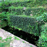
On the eastern side of Taba, a district in Uruma City, lies a sacred well called Tabagaa or sometimes referred to as Ubugaa. What you will see at the spring are two main water wells, a reservoir in between, and a place of worship known as an utaki. The explanation on a nearby sign does mention several stone stacking techniques used to set up this spring. They are referred to as akata, nozura, and kiriishi techniques of stacking.

At the beginning of the New Year you may see heighten activity at this location by local villagers. It is here where local villagers participate in a custom known as 'wakamizu', which is the first drawing of water on New Years Day*. The well is also used by local farmers for agricultural reasons and another practice called kauri/ubumizu which is a way of celebrating or welcoming a new baby into the world. These types of customs are similarly described at another well in Awase of Okinawa City which just happens to be named 'Ubugaa'.

Getting there. Not a difficult find. If you are on Highway 8 going towards Katsuren Castle look for this road sign to the left. Both the sign and the turn-off will be right before a Family Mart. The well is roughly 70 meters from the turn-off.

*the translated explanation did not specify which type of New Years. It could represent New Years both from the Gregorian Calendar and the Lunar Calendar (Chinese New Year).

Tuesday, November 22, 2011

"Ubugaa"

Ubugaa, Awase's Sacred Well sits behind this Utaki


View Map It! Okinawa in a larger map
Ubugaa

     GPS
     LatitudeLongitude
     N 26 19.143E 127 50.168


Ubugaa


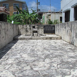
Though small in stature, this sacred site has significant meaning to the people of Awase and their history. This is Ubugaa, Awase's sacred well. The picture you see above is the utaki or place of worship for the well. The well actually sits behind this small structure. Like its counterpart, the 'God of Fire', that sits only a few meters away, Ubugaa too has an interesting story about its origin. The sign (translated in English) reads,
Ubugaa was built during the first part of 1768 when the village was formed.  It is a well built from natural springs for the villagers to use as drinking water. It was not only used for drinking but also used as a baby's first bath after they were born. People also drink this water on New Years day and has been esteemed for years. During birth, people also took this water to wipe the baby's forehead. The water was also  used to wash the body of dead. It was the children's duties to fetch the water from this well when used for a new born baby and New Years. They are taught not to switch hands when carrying the water back home.
31August, 2002 - Awase Restoration Committee
One obvious question is, why is switching the water in the other hand considered a 'no-no'? It was something that couldn't be answered with the given resources. Further research is required. This could be a local tradition or something part of a wider custom. As January 1st comes closer and closer (or later, depending on what day the Lunar New Year falls on),  you may see activity heighten as people prepare for the upcoming New Year . It is also not uncommon for people to come here and pray during other parts of the year as well.

Language note: The word "gaa" is of Hogen dialect. It understood as a 'well' or 'spring' when it is appended to another group of words as a suffix. It this case this well is called "Ubu-gaa". The Nakandakari Hijya Spring in Nanjo-Shi is also referred to as "Ufugaa".

Other places of interest nearby: The Awase Shrine, The Meinu Utaki, The Awase War Memorial, Kanumou Well, God of Fire Utaki.

Thursday, September 22, 2011

"Kanumou Well (Awase)"

Kanumou Well in Awase


View Map It! Okinawa in a larger map
Kanumou Well (Awase)

     GPS
     LatitudeLongitude
     N 26 19.146E 127 50.342


Kanumou Well (Awase)

If you recall in an earlier posting, we talked about 'Old Awase' at one time being a deserted island many, many years ago (See Meinu Utaki). As more and more people moved here in Awase the need for more water became apparent. The villagers dug and built a well. "It became a common place for the villagers and a symbol of prosperity" (translation from the headstone). The well has gone through many makeovers over the years. What you see above is the current structure restored in 1983. If you noticed to the right of the picture, there is a place of prayer and worship to give thanks.

The name of this well is called 'Kanumou'. On the inscription, it is written in Katakana, which suggest it is a Hogen word (Okinawan native language). I do not know exactly what it means. Part of the inscription suggests that it may mean 'greenery' (see below). It could not be verified at this point with any accuracy. Hogen dialect can vary as well from village to village. Right now, it is on my list of things to find out and will update this post accordingly. Below is a translation that outlines significant events related to this well.

In 1906, there was major work done to this well.  Layers of rocks were placed at the bottom and surrounded with greenery,  'Kanumou'. In 1923, the top portion of the well was built with concrete and a roof of elegant structure. In 1948, there was an accident. A stack of U.S. Military drums containing coal tar caught fire near the well and burned everything down. In 1983, the 'Kanumou Well', still remaining on its original soil, was restored by the Awase Land Adjustment Committee.
- 31 August, 2002, Awase Reconstruction Committee

How to get there. The Well is not difficult to get to. The Kanumou Well is right in front of a U.S. Military telecommunication installation. It is a straight shot from the Highway 85 intersection. It is basically on the same road along the Awase Shrine and the Meinu Utaki. (Reader's note: Icons of nearby areas will not be visible on the above map. This is because Google Maps starts a new complete Map Page when a certain number of Icons been marked. Don't worry the other icons are still there. To see the other places of interest on the map, click the 'View Map It! Okinawa in a large Map' link and scroll down at the bottom where you see the Previous and Next Link. I have provided feedback to Google that they should show everything on the map. Hopefully they will listen).

Other places of interest nearby: The Awase Shrine, The Meinu Utaki, The Awase War Memorial, The God of Fire Utaki, Ubugaa.