Search Map It! Okinawa

Sunday, December 28, 2014

The Yabu Temple, Ryounin

The Yabu Temple, Nago City


View Map It! Okinawa in a larger map

The Yabu Temple

     GPS
     LatitudeLongitude
     N 26 36.342E 127 57.127


The Yabu Temple, Ryounin - Nago City

The Yabu Temple (屋部寺) is a small Buddhist temple believed to originated some time in the 17th century. The temple resides in the town of Yabu of Nago City bordering the coastline along Highway 449 on the Motubu Peninsula. Formally, the temple is named Ryōun'in (凌雲院). The original temple was destroyed during the Okinawan War.(1)(2)(i) It was later rebuilt in 1956.(1)(2)(ii)

Though the temple is quite small, it was officially recognized by the Old Ryukyu government along with three of its local legends.(2)(3) The temple, and its legends, were recorded in an official document known as the Kyuu-you (or Kyuyo).(3)(iii) It is an historical account of the Ryukyu islands that was completed in 1745. James Robinson author of the book, Okinawa: A People and their Gods, published in 1969, also writes of one legend that have similarities to those in the official record. It's not certain if his account was derived from local villagers or from official documents belonging to the Ryukyu government. The following is a breakdown of those legends.

Legends derived from the Kyuyo
Legend One.(3) In the year 1692, drought had plagued the village of Yabu. Around the same time, sporadic fires too had wreaked havoc on the village. In an act of desperation, a Buddhist monk by the name of Ryun Washo was asked to bring prosperity to Yabu. The monk granted their request and prayed for seven days on a large stone at the base of the hill. On the seventh day rain had finally come saving the village from despair. The once problematic fires too ceased their torment on the townspeople. In his honor and to show their gratitude the villagers erected the small temple. The rock that Ryun Washo had meditated on still sits behind the temple untouched and unmarked. It sits inconspicuously in its natural environment. A documented photograph can be found on page 51 of the Yabu Historical Chronicles.(2) An photograph taken in December 2014 is shown here.

Legend Two.(3) Behind temple lived a very large snake up in the hills. It was said that this snake could blow fire from its mouth. The people frantically requested help from a Chuzan kingdom lord. The lord agreed and dispatched a man by the name of Kinjo-san from the Tenkai Temple [Note. It wasn't clear by the translation if Kinjo-san was a monk and it is not certain by the author where the Tenkai Temple is located]. Kinjo-san prayed fervently and the snake was defeated. Later, Kinjo-san had placed a large statue of Buddha inside the temple to mark the occasion. [Note. The statue is believed by the author to be the one in the middle seen in this picture].

Legend Three.(3) One day a Buddhist monk from Shuri had visited the temple. He had said that the large hill behind the temple showed great promise [perhaps indicating its spiritual value, author assertion]. However, he said that there was a split within the hills that resembled a snake's mouth. He declared that this was a bad omen under the concept of Feng Shui (Fu Sui in Japanese).(iv)(v) However, to offset this premonition the monk then placed seven statues of Buddha inside the temple to thwart off any misfortune.[Note: those statues can be seen here inside the temple].

After his work was completed, the monk decided to return to Shuri. A man from Yabu was sent with him to assist with his belongings. When they arrived back to Shuri, the monk had made a prophetic comment to the Yabu villager. He said, “tomorrow will be my death, so today please eat from the ufurunme [a type of hospitality dish?] on my behalf before you return to Yabu".(vi) As foretold, the monk passed away the very next day.

Legend from James Robinson's Research.(1) James Robinson, in his 1969 book, writes “there was a spirit named 'Akamata' which had the power to transform himself into a handsome young man”. However, Robinson does not add much in his book about the spirit's sinister deeds other than trying to lure a farmer's daughter. Interesting however, he does explain that an Enkakuji Temple monk by the name of Ryun Washo (same person from Legend One above) came from Shuri and defeated the spirit 'Akamata' by use of incantations. The Yabu Temple was then built in honor of Buddha. [Note. It is important to note that the word 'akamata' is a type of snake found in the Okinawan islands. A picture can be seen here, photographed by Shawn Miller. It's not uncommon to find snakes in Okinawan legends. See Related Links below for other snake legends of Okinawa.]

Local Ceremonies. On October 15th of the old calendar (kyureki/lunar calendar) some of Yabu's elderly and prominent townspeople preside over prayer ceremonies within the district. Ceremonies are held at 10 different places in sequential order. It is to give thanks and to pray for the the town's prosperity. The Yabu Temple is third in the order of ceremonies.(2) The ceremonies are typically lead by a kaminchu, a term meaning spiritual leader in the Okinawa language.

The Yabu Temple during New Years (Jan 1 - 3)
Local Villagers, as well as some from the nearby area, come to the Yabu Temple to celebrate New Years Day. A small ceremony starts around 2345 (1145pm) on December 31st. For those who wish to attend the Yabu Temple during New Years, below is the general sequence of events to help you through the process.

General Sequence of Events. Please note, the Yabu Temple is not a Shinto Shrine. However, there are similarities to attending both temples and shrines during New Years. The Yabu Temple is small so the process is typically is more simplified. 
1. Entering the Premise. There is a small gate entrance. This is not a torii gate. However, the gate does alert visitors they are entering a sacred area.
2. Purification Fountain. There are no purification fountains at the Yabu Temple. Typically, these kinds of fountains are found at major Shinto Shrines.
3. Omikuji (optional). People who attend the temple have the option of receiving their fortune for the New Year. This fortune is called an omikuji and can be purchased for about 100 Yen. [Note. Because of the low expected volume of foreign visitors to the temple, the omikuji here at the Yabu Temple is typically written in Japanese]. You can either take the fortune with you or tie it to a tree branch or place provided. Depending on whether your fortune is great or not, it is believed that by leaving it at the shrine or temple grounds, your fortune will either multiply in prosperity or bad luck will be diverted.(5)
4. Approaching the Temple. Typically there will be a line to approach the temple. As you approach the temple you will notice a saisen, a box where you deposit monetary offerings, anywhere from 5¥ to 100¥.
5. Prayer. Normally, you pray after you make your monetary offering. Most people bow and clap twice and say a small prayer in silence. Some may just fold there hands.
6. Ringing of the Temple Bell (optional). After you have said your prayers, individuals, couples, or family members are welcome to ring the temple bell. For proper etiquette, this is just done once as an entity.

Reference.
1. Book, Okinawa: A People and their Gods, 1969, James Robinson, Tuttle Publishing Company, pg 59, Link
2. Book, Yabu Historical Chronicles, 2002 October 27 (Japanese), published by the Town of Yabu, pg 52
3. Information Handout, Ryounin - The Yabu Temple, Published by the Town of Yabu, Image Link
4. Website, Compilation of Official Histories and Establishment of the Legal System, Okinawa Prefectural Board of Education, Link
5. Website, Shinto Shrines, Japan Guide, Link

Author's Notes.
i. The references stated that the original temple was destroyed during the Okinawan War but it did not specify details as to who or what caused its destruction.
ii. In James Robison's research he states that the temple was rebuilt in 1957. However, the Yabu Historical Chronicles, a more recent publication, states it was rebuilt in 1956.
iii. The Kyuyo is a compilation of historical events that took place in the Old Kingdom. It was completed in 1745. It also contains legends found throughout the Old Kingdom.(4)
iv. In essence, Feng Shui deals with the balance of nature. More can be read about it here at About.com
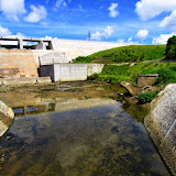
v. It's not certain where this split or "snakes mouth" is in relation to the temple. There is a split (now a road) that goes between two hills next to the Yabu Temple. See picture here
vi. The term ufurunme could not be found in any official resource. But interviews with Okinawan people have lead us to believe it is an Okinawan word meaning some kind of hospitality food. The latter suffix -me can mean food in the Okinawan language. Additionally, during some Okinawa funerals, family members of the deceased eat from a specially prepared meal called usande (ウサンデー) . It is not certain if the two terms have identical meaning in this context. It was theorized during this research that ufurunme could possibly be dialect from an aristocratic society, such as that found at Shuri during the Old Kingdom. As stated, there are no official references as of yet to support any of this.

Parking/Amenities. Parking. You will have to park somewhere off to the side of the road near the temple grounds. There is a parking field across the from the temple but it is own by the nursery school and gated. It may be open for the New Years. Amenities. There is a walk ramp leading up to the temple for baby strollers and those using a wheel chair.

Directions. Take Highway 58 into Nago City. Then take Highway 449 (coastline) going towards Motubu. Please study the map carefully. You will pass the Yabu Post Office (on the right) before you reach the turn-off (on the right), about 400 meters later. The turn-off is not easily recognizable. Warning. You are more likely to pass the turn-off the first time around. Be careful of making sudden stops as you see the turn-off. It will sneak up on you. See picture of turn-off here. In the interest of safety, if you pass it just turn around later. Avoid making sudden stops. There typically is a high volume of traffic on the main route. From the turn-off, follow the Blue Vehicle route designated in the map above. LandMarks (yellow diamond icons) have been placed to help you reach the temple.

Related Articles (Snake Legends of Okinawa). The Matsuda Cave & Mega Gama Ruins, Legend of Yara Muruchi.

Saturday, December 27, 2014

Hatsumode, New Years at the Naminoue Shrine

Hatsumode, New Years at Naminoue Shrine


View Map It! Okinawa in a larger map
Hatsumode, Naminoue Shrine

     GPS
     LatitudeLongitude
     N 26 13.142E 127 40.134
        *GPS to Pink Thumbtack Icon


Hatsumode, Naminoue Shrine

It is a Japanese tradition to start off the New Year with a visit to a Shinto Shrine. In Japanese this is called hatsumode (hatsumōde, はつもうで, 初詣) which literally means “first visit to a shrine”. Typically, families try to go on the very first day of the New Year. Others, because of their work schedule for example, may attend on the second or third day. Usually, people visit Shinto Shrines for hatsumode, but they can also visit Buddhist temples with the same aspirations. Some Japanese or Okinawan people choose to go to a certain shrine (or shrines) based on personal or local beliefs. This could depend on the person's zodiac sign and/or the upcoming zodiac year.

The Naminoue Shrine is without question the most popular Shinto Shrine in the Ryukyu Islands. Many people visit here on New Year's Day. Below is the general sequence of events on visiting the shrine on this occasion. With a few minor exceptions, it is no different than visiting any other Shinto Shrine on any given day. If you feel uncomfortable going alone, ask a Japanese friend to accompany you. Staff members at Naminoue are accustom to foreigners attending this shrine. You need not fear, just go with a little humility and patience.

Date: January 1st starting at midnight usually to January 3rd or longer.

General Sequence of Events.
1. Entering the Premises. Enter the Naminoue Shrine through the torii gate. The torii gate lets travelers know they are about to enter a sacred area. It is considered proper etiquette to stop and bow just before you enter.
 2. The Purification Fountain/Cleansing of the Body. The following is based on questions and interviews with various Japanese and Okinawan people. No official guide can be referenced on this process and not everyone may follow these steps exactly. Some may even skip it all together. But the below guidelines are the most complete. It is recommended that you observe others during this process first. The fountain at Naminoue will be on your left if you are facing the Main Prayer Hall (haiden, 拝殿).
Step 1. Approach the trough and with your right hand, pick up the ladle and scoop the "pure water" from the basin or fountain.
Step 2. Pour the water to clean your left hand. NOTE: When you are washing your hand do not let the water fall back into the pure water basin after cleansing. Let the water rinse off on the outside of the basin onto the ground. This prevents the now "soiled water" from falling back into the pure water basin
Step 3. Next, take the ladle with the left hand and pour the water over your right hand using guidelines in Step 2.
Step 4. (Optional) Next, you are to clean the body by taking the ladle with the right hand and making a cup with your left hand. Pour water into your left hand and then pour it into your mouth. DO NOT SWALLOW IT or GARGLE LOUD. Just rinse it quietly in your mouth for a few seconds and quietly spit it out onto the ground. Try to do this in a very respectful manner. 
Step 5. Finally, you will take the ladle with your right hand again, pour some water into it and tip the ladle up so that the water pours down the ladle. You are now cleansing the ladle.
3. Standing in Line/Approaching the Main Prayer Hall (haiden, 拝殿). On New Years there will be a long line in front of the Main Prayer Hall (haiden), but it moves rather quickly. As you approach the haiden, normally you would find a saisen box where you would deposit your monetary offering (saisen). In the case of Naminoue during New Years this box may not be present. Because of the expected large crowds, coins are thrown in an open lot instead. Most people deposit somewhere between 5¥ to 100¥.
4. Prayer. After you make your monetary offering, bow and clap twice and say a small prayer in silence. You will either exit to the left or right as people behind you step forward.

Omikuji/Omamori. After you have made your offerings and prayers, a common custom is to then obtain your fortune for that year. This is called an Omikuji. It will be a little folded-up paper with your fortune on it. Typically you pay a small sum, such as 100¥ and then you randomly pick it from a box. At Naminoue, you can ask for an English version. It is traditional to then tie your fortune on a place provided. You can also purchase an Omamori, which is essentially a good luck charm. There are varieties to choose from and some serve specific purposes. For example, you can purchase an omamori for exam testing or driver safety. Most people tend to get one for general health and prosperity.

Parking. On New Years Day parking will be problematic. Fortunately, most people do not stay very long and thus there will be a continuous flow of people leaving. Additionally, near the shrine you will find parking attendants moving the traffic along. People also park at a distance and then walk to the shrine. The Green Thumbtack icon in the map above is the parking lot closest to the shrine and closest to the main road. Other parking attendants may direct you to other parking locations. You will most likely see a steady flow of cars lined up. Expect to wait anywhere from 20 to 30 minutes. This could vary based on the time of day. You will have to pay to park, typically around 500¥. Other parking locations may vary.

Directions. Because of the lack of Highway signs, written instructions will be more complicated. Please study the map carefully. The Blue Route is the easiest to follow from Highway 58. The Green Route however may be easier to access the parking area but little harder to navigate to.

What to Bring. Plan for cold weather and rain no matter what the forecast. Bring an umbrella, warm coat, Yen/change, and a camera.

References.
1. Japan Guide, Visiting Temples and Shrines
2. Japan National Tourism Organization, New Year in Japan

Friday, November 21, 2014

The Heart Rock, Kouri Jima

The Heart Rock, Kouri Jima


View Map It! Okinawa in a larger map
The Heart Rock

     GPS
     LatitudeLongitude
     N 26 42.774E 128 00.919

       *GPS to Parking Lot


The Heart Rock, Kouri Jima

On the northern shores of Kouri Jima is a small natural wonder known as the Heart Rock. Recently, this has become a popular tourist attraction as hundreds visit daily to get a glimpse of this inspirational phenomenon. Many Japanese may call this specific area a 'power spot' (pronounced phonetically by the Japanese as such). It is a term often used to describe a place that's a source of positive spiritual energy.

There are actually two protruding coral rocks. Together they may look like a pair of whale tails flipping in the ocean. It is the rock on the left that is known as the Heart Rock. Please view the photo album above or click here for more images.

Entrance Fee. Cash/Yen Only. Individual: 300 Yen. Groups: For groups with 2 or more people, you only need pay 300 Yen for the entire group. Parking and Entrance Gate is located on the map above.
Amenities/Parking. Toilet facility is available near the entrance. Parking available.
Caution. Use caution when taking the trail to the Heart Rock. Some areas are uneven and can cause to lose balance. Not accessible by wheel chair or baby strollers.
Video. Map It! Okinawa Video Short, "The Heart Rock"

Directions. Take Highway 58 North into Nago City. Then take Highway 110. You will have to cross Yagaji Island before you get to the Kouri Island Bridge. There will be signs posted on Yagaji Island directing you to Kouri Jima. Once you cross the Kouri Island Bridge navigate around the island in a clockwise direction on the main road. There will be small makeshift signs with the Japanese word, ハート ロック, which means Heart Rock directing you to the parking lot location. 

Thursday, October 30, 2014

The Legend of Nanga Bozu

A lonely road near Benoki Mountains


View Map It! Okinawa in a larger map
Benoki Dam

     GPS*
     LatitudeLongitude
     N 26 47.199E 128 15.339

     *GPS is to the Benoki Dam


The Long Road from a Demon's Past...

Every other year on the 16th of January, people from the town of Benoki come together and pay their respects to a fallen ancestor. Incense burning and prayers are part of the formalities to this melancholy, yet solemn occasion. It is their way of keeping the peace in Benoki; a reverent act to tame a demon with hopes that he never returns.

Some time at the beginning of the Meiji Period...
Angry voices reverberated through the forest trees. Soon the mob would reach him. Closer and closer, they narrowed in. The man knew his attackers were not far behind.

Fate had turned against him; For it was not too long ago, when he was the one doing the chasing and harassing. Now, the shaven-headed man found himself fleeing for his life... for the second time. Shortly before that, he had fled Shuri. Something there too had caused him to go into exile. When he escaped to Benoki, he sought refuge in the Nanga Forest, high up in the Benoki mountains. No one knew his real name. He was just a shaven-headed man from Nanga. The Nanga Bozu they called him.(ii)

But his welcome was a short one. Soon after he arrived, he took advantage of the town's meek and kind-spirited demeanor. He would often maraud through the village taking whatever he wanted, especially their livestock. Women and children were constantly harassed. No one knows why he did it. He was just a wicked man. Something very dark had swelled in his soul. Now, the villagers were forced into a dilemma. Evil had made its way to their home; and the once humble and good-hearted people of Benoki found themselves in a very precarious situation. They were going to do the unthinkable.

The chase had finally come to its end. The Nanga Bozu was trapped like a wild animal. Armed with sickles, the villagers cornered the unruly man. Time, as if capable of fatigue, had limped to a halt. All that could be heard now was whispering cries of the wind; and then suddenly, that too had quietly faded away. Fear had taken root; it seemed to be the only life force the villagers had left. One by one, they closed in on the shaven-headed man. There would be no turning back now.
History for the town of Benoki was about to change... forever.
January 16th, better known as Jyuu Ryoku Nichi, is no ordinary date. In the old calendar system(iii), this is New Years for the Dead in Okinawa. The townspeople of Benoki chose that particular day to pay homage to the Nanga Bozu, or whoever that man really was many years ago. It was their way to make peace with what had happened on that tragic day; for they were truly sorry that it ended with his death. Did he deserve to die? Was justice served? Lingering questions like these continue to haunt the Benoki people.

As time went on, rumors and ghost stories drifted about of what really happened on that day in the Nanga Forest. It was said that when they slayed him, his body had fallen near a creek and that his blood had filled the entire stream. Villagers have later claimed to see the creek turn into a pool of blood. "The Nanga Bozu is returning!", they believed. This creek later became known as Uninga. In the Okinawan language this means the demon's creek.(6)(i) It was also said that when the villagers attacked the shaven-headed man, he unleashed some kind of dark magic and sorcery against them. He or it was not from this world. "Could the Nanga Bozu really come back from the dead?", they thought. For fear that he would return, the villagers would offer a pig's head as a sacrifice to appease him. But that particular tradition had faded away over time, as well as the whereabouts of the Nanga Forest and Uninga. Their location and all memory of them... lost with time. Perhaps, it was meant to be.

For now, it would seem that the true demon is nothing more than a haunted past, for it was a tragic time indeed. Humanity had suffered a loss; a man had sold his soul into a world of darkness, and a once innocent town was now left to bear the guilt for the rest of time. Despite it all, hope still remains in Benoki. In a word, the 16th of January means reconciliation. Though it is a sad moment in their history, it is a way for the villagers to revisit and learn from the past and move forward towards a happier future. The road to peace may be long, but as villagers gather on that 16th Day, it is an occasion to face their demon head on, much like their ancestors did many, many years ago in the woods of the Nanga Forest.

The Origins of the Story. The Benoki Village Chronicles (dtd 20 January 1998) explains that the incident involving the Nanga Bozu was the reason why the villagers first embraced the 16th of January as a communal occasion. But the overall story is believed to have some basis in the truth; the Nanga Bozu man did exist and that he was later hunted down for his crimes. And as for the Nanga region, that too is thought to be somewhere high in the Benoki mountains. No one really knows for sure anymore. But a different version of the story may give clues to its location. The village chronicles states that the Nanga Bozu may have been killed by the people of Uka, the next village to the north. After they killed him, they discarded his body in Benoki. Author's speculation. If this is true, then it seems highly unlikely that anyone would carry a body great distances through the mountains. This would hint that maybe the Nanga region lies somewhere near the border of Uka and Benoki.

Additionally, the village chronicles never mentions anything about Uninga, the Demon Creek, or the use of demonic powers by the Nanga Bozu. It was only mentioned in Kunigami's Historical Chronicles, dtd 1967 (note: Benoki is a town within the Kunigami Village District). This same version was later retold in the Ryukyu Shimpo, March 17th 2013 edition. It appears it was just a ghost story version that took a life of its own. So it would seem.

The Man from Shuri. An intriguing question remains; Who was this Nanga Bozu? Did he have a name? Where did he really come from? Many believe he was indeed from Shuri. Villagers had observed that he could read and write, implying that he had a formal education. This would seem to make sense, especially for someone who had lived in Shuri. It would have been rare for a commoner to have such an education during that period. Some villagers today speculated that he even might have been a monk because of his apparent level of knowledge and shaven head.

There is one last clue. The Benoki chronicles infers that the Nanga Bozu story originated some time at the beginning of the Meiji Period (1868-1912) and that he fled Shuri because of a 'conflict' that had occurred there (based on the interpretation, the translation seems to hint that it was some kind of armed conflict). It makes no mention of exactly what that conflict was.

Author's observation and conjecture. The closest and perhaps the largest political upheaval involving Shuri was in 1879 (eleven years after the birth of the Meiji Period) when the last Ryukyu King, Sho Tai, surrendered Shuri Castle and the kingdom to the Meiji Government.(5) In 2012, the Ryukyu Shimpo featured an article covering a historical play that relives that transition of power.(4) The play was titled “The Surrender of Shuri Castle”. Interesting enough, the Ryukyu Shimpo writes, “The play tells the story of when the Meiji government ordered the abolishment of the Ryukyu han (feudal domain) and forced the surrender of Shuri Castle. A confrontation ensued between the pro-Japan party and the pro-China party.” Could this confrontation be the conflict the Nanga Bozu's story was referring to? And the reason why the mystery man went into exile? This is pure conjecture. There are no facts to support this theory.

Epilogue. Benoki is a quiet town, and just as quiet is the Benoki Dam further up the hill. At first glance this functioning dam seems deserted. Not many people come here. There is a certain emptiness about the place. And when you arrive at the dam, you'll find yourself immediately engulfed by the Benoki mountains. Somewhere in that vast abyss of forest greenery lies the Nanga Forest. And what of the Nanga Bozu? Today, there is no indication that people of Benoki believe in any such ghost. It is just a haunted memory. But a stroll around the perimeter is revealing. As you explore the back roads, one cannot help but to feel that you are being watched. And as you gaze into the whispering treeline, one cannot help but to wonder that somewhere within the forest shadows is a lost soul, a specter of the past, silently waiting his return.

Related Articles. Jyuu Roku Nichi - New Year's for the Dead.

Other Okinawan Ghost Stories. Haunted Ruins in Kyoda, Legend of the Okukubi River.

Other Places to Visit Nearby. The Benoki Utaki.

Reference.
1. Nanga Bozu, Benoki Village Chronicles, Book, dtd 20 January 1998 (Azashi Benoki January 20 Heisei 16), pgs 213 -214
2. Nanga Bozu (Ghost Story), Kunigami's Historical Chronicles, Book, dtd 1967, pg 78
3. Nanga Bozu (Ghost Story), Ryukyu Shimpo, Newspaper, dtd 17 March 2013
4. Historical Play - "The Surrending of Shuri Castle", online article, dtd 12 December 2013
5.  Sho Tai surrenders the  Ryukyu Kingdom - Resistant Islands: Okinawa Confronts Japan and the United States, book, McCormack, Norimatsu, Pub 16 July 2012, pg 4
6. Definition of uni - Okinawan-English Wordbook, book, Sakihara, University of Hawaii Press 2006, pg 195 .
7. Dates of the Meiji PeriodEncyclopedia Britannica, online reference

Notes.
i. Uni in the Okinawan dialect means demon. In Japanese this is pronounced as Oni. Ga is Okinawan (usually annexed as a suffix) is a term that means water or stream. The extra n in the middle of Uninga could be a variant of the Okinawan language of how it is pronounced. In the Benoki Chronicles it is spelled with an extra n.
ii. Bozu is a Japanese term often referring to someone or something that is bald.
iii. The Old Calendar (kyureki in Japanese) refers to the Lunar Calendar which is still observed in many parts of Okinawa, particular in rural areas. The New Calendar (shinreki) is the current Gregoria Calendar System. It is not uncommon to find calendars made in Okinawa that have both dates. Typically, spiritual occasions are observed on the Old Calendar System.

Directions. Take Highway 58 north into Kunigami Village. The turn-off will be at large Silo-like structure off of Highway 58 (See LandMark Icon on the map). The road will zig-zag up the hills. You will pass a large wooden Torii next to a small concrete fenced off building (See LandMark Icon on the map). Continue further up the hill until you run into the Benoki Dam.

Monday, September 29, 2014

"The Naha Tug-of-War"

Read, Set, Go! Spectators rushing to get near the rope.


View Map It! Okinawa in a larger map
Naha Tug of War

     GPS
     LatitudeLongitude
     N 26 12.950E 127 40.709


The Naha Tug-of-War 那覇の大綱引き

UPDATE: Due to the recent typhoon, the Naha Tug-of-War Festival has been postponed to SUNDAY, OCTOBER 19th. The Hatagashira Parade 1130-1400 Kokusai Street. Tug-of-War 1430-1700 Kumoji Crossing. RBC's Citizen Festival CANCELLED.

Every year in October, thousands of people flood to the streets of Naha City to see the annual Naha Tug-of-War (Naha O-tsunahiki). This is the 'mother' of all tug-of-wars held throughout Okinawa. The tug-of-war (tsunahiki) is a common event that happens in many small villages throughout Okinawa to help promote prosperity, but the annual Naha Tug-of-War has one 'big' distinction. It holds the Guinness World Record for the largest rope made by 'rice straw'. It was first recognized in 1995 with the rope weighing just over 31 metric tons (31 tons 730kg) at a length of 172m, and a rope diameter of 1m 54 cm. It was renewed for the 3rd time in 1997, with new record weighing in at 40 metric tons & 220kg at a length of 186 meters with a rope diameter 1m 58cm, and an estimated attendance of 275,000 people.

Early History. According to the Office of Conservation Society of the Naha Giant Tug of War, Naha at one time consisted of four towns (Nishi-Machi, Higashi-Machi, Wakasa-Machi, and Izumizaki) and they were simply divided into two sections, East and West, and thus the tug-of-war has become an East versus West kind of rivalry. The tug-of-war event was only held for special occasions of celebration before it started to become an annual event beginning in 1971. The first annual Naha Tug-of-War was held to commemorate Naha's 50th Anniversary as a municipal government. Since its debut, the number of towns have grown, and the grand event is now held on a Sunday before the second Monday of October (the second Monday being Health and Sports Day).

Today. The event is actually a three day spectacle with the first day (Saturday) consisting of fork art performances along Kokusai Street (Kokusai Dori). The second day is the Parade of Flags (Ufunnasunei), also along Kokusai Street, which then leads up to the Naha Tug-of-War at Kumoji Crossing (along Highway 58), and the final day (Monday) is the Naha Tug-of-War Festival which occurs at Onoyama Park.

General Timeline*.
Saturday – Folk Art Performances, 1430-1830 . Location Kokusai Street.
Sunday – Parade of Flags, 1130-1400. Location Kokusai Street.
               The Giant Naha Tug-of-War, 1430-1700. Location. Kumoji Crossing. (The actually pulling of the                    rope is 30 Minutes, starting about 1630).
Sat, Sun, Mon – Naha Tug-of-War Festival, 1100-2030. Location Onoyama Park.

*The schedule of events are generally the same year to year. To check for changes or updates visit http://www.naha-navi.or.jp/nahamatsuri.html

Location. GPS coordinates above is the location the actual tug of war event.(Kumoji Crossing in Naha along Highway 58).

Current Schedule of Eventshttp://www.naha-navi.or.jp/nahamatsuri.html (Available in English)

Recommendations. Because the actually tug-of-war event draws a large crowd, recommend getting their early to find parking and to position yourself early for viewing. Traffic along Highway 58 (at Kumoji Crossing) halts at around 1400. Recommend taking your pictures of the rope before 1400. Once they allow people near the rope (around 1430), the rope will not be visible at all.

Source of Information.
http://www.naha-otsunahiki.org/en/ (English)
http://www.naha-navi.or.jp/nahamatsuri.html (Available in English - translation machine)

Related Articles. http://voices.yahoo.com/guinness-world-record-tug-war-okinawa-japan-11145378.html
Past photos. http://blog.mikesryukyugallery.com/2011/10/2011-naha-okinawa-tug-o-war-photos.html

Monday, August 25, 2014

Sukumichi Road and the Old Okukubi Bridge

Ruins of the Old Okukubi Bridge


View Map It! Okinawa in a larger map
The Old Okukubi Bridge

     GPS
     LatitudeLongitude
     N 26 27.877E 127 55.977


The Sukumichi Road and the Old Okukubi Bridge

In the days of the Old Ryukyu Kingdom, Okinawans developed an early road system to help them travel from one end of the island to the other. One major road was called Sukumichi which had passed through the village of Kin (present-day Kin Town). The route closed in at a very narrow portion of a major river within the village. This location was called ukukubi, an Okinawan word meaning 'the neck towards the back'. In this case, it is referring to the river's neck up the stream (the narrowest part of the river). The present term for ukukubi is okukubi (奥首), which is the Japanese pronunciation. It was in 1931 at this narrow channel that an arch-shaped bridge constructed of concrete was erected to aid travelers crossing the river. However, the bridge was later demolished by a Japanese garrison before the US invasion took place during the battle of Okinawa.

The bridge became known as the Okukubi-bashi, (bashi - a term meaning bridge). An image of the bridge intact can be seen on location on a historical sign (see image here). Intriguingly, the major river that flowed underneath this bridge became known as the Okukubi River, however the current kanji representation for the river's name (億首川) leads to a different story of how the river's name came to life. See the Legend of the Okukubi River.

Directions/Parking/Amenities. Take Highway 329 till you reach the south end of the Kin Bridge (see Blue Route on map). Turn towards the direction of the dam. You will travel down a hill and see the Kin Dam shortly after (it will be on your left). Near the bottom of the hill you will see small parking area with a toilet facility. The Okukubi Bridge ruin is about a 75 meters in front of the dam spillway.

Author's Notes
1. It is not certain by the author where exactly Sukumichi begins and ends

Reference.
1. Historical Sign on location, Kin Town Board of Education

Friday, August 15, 2014

The Iha Nuru Tomb

The Iha Nuru Tomb


View Map It! Okinawa in a larger map
The Iha Nuru Tomb

     GPS*
     LatitudeLongitude
     N 26 25.376E 127 48.924

     *GPS is to the LandMark


The Iha Nuru Tomb, Uruma City

Directly above the Ishikawa Tunnel is an Ohaka (grave) that scholars believe house the remains of a Noro, a female priestess assigned by the royal government during the Old Ryukyu Kingdom. It is believed that this particular Noro was responsible for the areas belonging to Iha, Yamashiro, Kadekaru, and Ishikawa. (1)

Contents. Inside the grave are said to be 15 urns with each urn containing the remains of 2 individuals (a total of 30 people). However, none of the urns had names inscribed on it. It is not certain how the then-Ishikawa City Board of Education (Now Uruma City) made the conclusion that the remains belonged to the Noro of that region. Other source documents (chronological records, etc.) are being pursued that may unravel the history behind the tomb's contents. The grave sits in the Iha District of Uruma City.(1)

Author's Speculation (Conjecture). The style of the urns may be indicative of the status of each individual. It cannot be assumed that every Okinawan was buried with the same honors or care during that time frame. It would seem to make sense that significant individuals (lords, priestess etc.) received extra care and attention during their burial. The sign on location posted by the Uruma City Board of Education does show an image of the somewhat decorative urns found inside. Additionally, it is quite possible that the tomb houses remains of more than one Noro.

Notes.
i. The Uruma City historical sign uses the word Nuru. Nuru is the old Okinawan pronunciation for Noro.(1)

Reference.
1. Sign, on location, Uruma City Board of Education.

What to Bring. Be prepared for mosquitoes during all times of the year. Vegetation may be little high in some areas. Recommend a guide stick to move through the vegetation as well as good shoes. Be on the lookout for snakes.

Other Places to Visit Nearby. Iha Castle Ruins.

Other Noro Tombs. The Kanna Noro Tomb.

Directions. Take Highway 329 into Uruma City till you run into the Highway 6/Highway 329 Intersection (South of the Ishikawa Tunnel). Continue east on Highway 6 for a few hundred meters. You will see brown historical markers on your left (signs for both the Iha Castle and Nuru Tomb). When you get to the Iha Nuru Tomb Historical sign, you will see a dirt trail going north. Walk about 100 meters. To the right you will see an opening. Vegetation may be a little high. Continue through this opening to you see a set of steps leading you to the tomb.

Thursday, July 31, 2014

The Okawa Water Park, Kin Town

The Okawa Water Park


View Map It! Okinawa in a larger map
Okawa Water Park, Kin Town

     GPS
     LatitudeLongitude
     N 26 27.246E 127 55.674


The Okawa Water Park, Kin Town

The Kin Town Water Park sits across the Okawa water spring in the Namisato district of Kin. Though the water park is somewhat small, on a hot summer day the water can be extremely enjoyable, especially for young children. Parents are welcome to partake in the fun. All ages are welcome.

Then and Now. Long ago, where the water park currently sits, stood large washbasins. Water flowed from the Okawa spring into these centralized basins where villagers would use the water for their daily needs (laundry etc.). You can see part of this area in Donn Cuson's website, Remembering Okinawa. Please also visit Michael Lynch's photo comparison of the Okawa Spring, Then and Now.

Information.
Amenities. There are some shaded areas on site. Family members may want to bring their own shade as a precaution. A bathroom and a small playground facility is on location.
Hours. There are no opening or closing hours at the park. However, water at the park does not begin to gush until about 945am. The water will turn off some time before dark.

What to Bring (Recommendations). Mats for sitting, water amusement attire (bathing suits etc.), towels, set of dry clothes, shade, sun screen, garbage bags (please pack out what you pack in).

Directions/Parking. Take Highway 329 into Kin Town. You will see signs along Highway 329 pointing you to the spring. The turn-off sits across a 'Family Mart'. Once you make the turn, follow the green asphalt road downhill. Parking is available on location.

Monday, July 14, 2014

The Nankabama Monument

The Nankabama Monument


View Map It! Okinawa in a larger map
Nankabama Beach

     GPS
     LatitudeLongitude
     N 26 26.417E 127 50.708


Tracing the First Shō Lineage, The Nankabama Monument

The first Sho Dynasty (or Shō Dynasty) ended around 1469 at the hands of King Shō Toku, who plundered his kingdom into dire straits. He had sought a military campaign to conquer Kikai Island(1), now part of Kagoshima Prefecture(2)(3). Though, his invasion was deemed a success, there was no economic value gained from this venture and as a result, squandered the royal treasury in the process. A rebellion ensued and the King later died(1). The details of his death is not exactly clear.

The first Shō lineage is perhaps more known by its first king than the last. He was King Shō Hashi and in 1429, unified the entire Ryukyu Kingdom under one rule(1) thus making him the first King of the Ryukyus. But the distinguished Shō bloodline vanished from history with the demise of Shō Toku some 40 years later. Whatever happen to the famous lineage from there on after remains a mystery.

But there may be clues to where the remaining family members fled to.

In the Yaka district of Kin Town there is a shoreline called Nankabama Beach. The area was known for its deep sand which made it difficult for travel. Yaka village chronicles claim that family members of Shō Toku fled north after the King was overthrown. They hid in the mountains during the day and traveled under the cover of darkness. On the 7th day they reached Nankabama Beach. A monument now stands in the vicinity to mark the occasion. Where they traveled to afterwards is uncertain. It is believed they fled further north towards the Kunigami region. Author's speculation. It would seem by this written account that someone from the entourage discussed the details of the journey with someone significant in the Yaka community.

The Nankabama area, is also mentioned in two kumiodori's (Okinawan classical operas) called 'Kushi-no-Wakaaji' and 'Yagura-nu-hya' thus adding to its historical importance to the people of Yaka.(i)

Notes. 
i.. 'Kushi-no-Wakaaji' means 'The Young Lord of Kushi' and 'Yagura-nu-hya' is a name of a person
ii. The Second Shō lineage begin right after the demise of Shō Toku. The first king of the Second Shō Dynasty was Shō En (Kanamaru). There is no blood relationship with the First Shō Dynasty.(1)
iii. Nankabama beach area is highlighted in yellow in the map above. This is an approximation based on a graphic image from the Kin Town's Board of Education's Historical Chronicle (2012) pg 34. The northern edge of Nankabama beach is said to be an area called Kohamabaru.(4) 

Reference.
1. History of an Island People, by George Kerr, Charles Tuttle Publishing Co, 2000, pg 86 (King Shō Hashi unifies the Ryukyus) , pgs 100-101 (The Fall of Shō Toku), pgs 101-104 (The Rise of Shō En)
2. Kagoshima Prefectural Website
3. Kikai Island Website
4. Kin Town Historical Chronicle, Kin Town Board of Education, Published 2012 pg 35

Directions/Parking. The Nankabama Monument Stone lies near the southern border of Kin Town in the Yaka District. The monument can be seen from Highway 329 next to the shore. It stands next to a much larger structure seen here.

Thursday, June 12, 2014

The Hydrangea Cafe

The Hydrangea Cafe overlooking the ocean


View Map It! Okinawa in a larger map
Hydrangea Cafe

     GPS
     LatitudeLongitude
     N 26 37.824E 128 02.699


The Hydrangea Cafe, Nago City

A small cafe with a wonderful view, the Hydrangea Cafe sits comfortably overlooking the ocean. The cafe named after the Hydrangea flower, is owned by Mr. Sueyoshi who opened the cafe on 18 May 2013. On the surrounding hillside is his garden. During the months of March and April it's filled with Begonia flowers followed by Hydrangea's in May and June. On or off-season, the Hydrangea Cafe is a great place to relax and enjoy. Please see information below entrance fees and times.

Sueyoshi Hana-en (Garden Only)
Begonia Flower Season: Late March through April (See website below for current dates)
Hydrangea Flower Season: Late May through June (See website below for current dates)
Entrance Fees: 300 Yen for Adults, 100 Yen for Middle School and below (Cash only)
Where to pay: You can pay below at the desk counter located at the large parking lot at the bottom of the hill or inside the Hydrangea Cafe
Hours: 9am to 6pm.
Open: Daily during flower season. Closed Tuesdays during the off-season
Telephone: 098 058 1768
Blog: suehanaen.ti-da.net
Facebook Page: www.facebook.com/SueyoshiHanaen
Parking. For garden viewing, please park at the bottom of the hill (see picture with the white car)

The Hydrangea Cafe
Currency: Cash Only (Yen)
Hours: 10am to 8pm. After 6pm, must make reservations (Last order 7pm)
Open: Closed on Tuesdays. Open daily during flower season
Telephone: 098 058 4488
Blog: suehanaen.ti-da.net
Facebook Page: www.facebook.com/HydrangeaCafe
Menu: English and Japanese (See menu here)
Parking. There is designated parking under the cafe. Or you can at the bottom of the hill.

Directions/Parking. Take Highway 58 north into Nago City. Please study the map carefully since there are no official street signs directing you the way. The cafe resides in the northwestern part of Nago City. If you pass Highway 14 you have gone too far. There is a graffiti picture on the seawall opposite of the turn-off. Once you make this turn, the cafe parking area is about 500 meters. You can park at the bottom (large lot) or take the road going up to the cafe. There you can park underneath the cafe building.

Recommendations. Flower viewing. June marks the beginning of typhoon season. It is highly recommended that you should visit the garden prior to the first typhoon. Route Recommendations. On weekends the merging traffic from the Okinawa Expressway onto Highway 58 will cause long delays. If you are taking the expressway, it is recommended that you get off on Exit 9 in Ginoza Village, then take Highway 329 north passing Camp Schwab. Then take Highway 331 as if you are going to travel on the east side of the island. Then take Highway 18 taking you to the other side of Nago City. Use the Haneji Dam Route off of Highway 18. This will take you back to Highway 58. Proceed north on the directions above.

Other places to visit nearby. Fukugawa Falls, Minzoku Shiryokan Museum

Saturday, May 24, 2014

The Adaniya Gusuku & The Tomb of Lord Wakamatsu

Grave of Lord Wakamatsu
The Grave of Lord Wakamatsu


View Map It! Okinawa in a larger map
Adaniya Gusuku & the Tomb of Wakamatsu

     GPS
     LatitudeLongitude
     N 26 17.891E 127 47.274


Wakamatsu Park (若松公園), Kitanakagusuku Village

In the Adaniya district of Kitanakagusuku Village there are two large hills on the grounds of what is now called Wakamatsu Park.(i) The smaller of the two is called Yunahan Hill and is the final resting place of Lord Nakagusuku Wakamatsu l.(1)(ii) To the east, on a much larger landmass, are ruins of the Adaniya Gusuku.(2) At one time, Lord Wakamatsu was the leader of this domain and by all accounts was as a very good leader.(1) His fame became the subject of royal Okinawan poems called Omoroshoshi, and his persona was the driving force behind the main character in a famous play titled, Shushin Kane Iri, authored by the great Chokun Tamagusuku in 1719.(1)(iii) After his tenure in Adaniya, he was assigned as Land Stewart (Jito) for Uema Village, now the Uema district of Naha City.(1) To honor his legacy and contributions, the park was named in his honor and is known as Wakamatsu Koen (Wakamatsu Park, 若松公園).

Son of a King? According to the Kitanakagusuku Board of Education, legend has it that Lord Wakamatsu was the son of Noro Adaniya and King Shō En, the first king of the Second Shō Dynasty (1469).(1) (vi) There seems to be a discrepancy on this historical account however. The book, History of an Island People written by George Kerr, briefly outlines Shō En's life from the time he was born to his rise of power. King Shō En was born on Izena-jima, a small island just north of the Okinawa main island.(7) He was believed to be a son of a farmer and given the name Kanamaru.(6) He married his first wife, said to be a local girl from his home village, while they were both very young.(6) However, it was not mentioned (or is unknown) that they had a son together. As of yet, there is no account to what happened to his first wife.(6)

Kanamaru eventually moved from Izena. He temporarily settled in a village called Ginama, located on the northwestern side of the Okinawa main island. Later, he set forth to Shuri where his talents were quickly recognized by the royal government. Once established, he rose high in the ranks before he seized the throne in 1469 and assumed the title of King Shō En in 1470.(6)(8) Years before he became king however, he had married another woman by the name of Yosoidon. Together they had a son (Shō Shin) who would become the third king of the Second Shō Dynasty.(viii) There is no account in George Kerr's book that a Lord Wakamatsu was an off-spring of Shō En. How this legend came about is uncertain by the author. Further research is pending. Perhaps the answer lies with the woman, the Noro Adaniya. Her role may shed light to this myth, as it doesn't seem to be documented anywhere else.

Wakamatsu's Tomb. Wakamatsu's grave sits on top of Yunahan Hill. As of March 2014, renovation was in progress to stop the erosion near his tomb. According to the historical sign there was spherical rock (hoju) that once laid on top of his tomb.(1) The Kitanakagusuku Historical Office said it was removed during the renovation process. The remains of Wakamatsu's wife and children (located near Lord Wakamatsu's tomb) was also said to been removed. It is not certain if both the stone or the remains will return to their original location.

The Adaniya Gusuku. The term gusuku can have different meanings. It could mean castle, domain, or a sacred grove. Typically they are found on a large landmass. No dates were given about the origins of the Adaniya Gusuku. Considering Wakamatsu's time of existence, possibly during the 15th century (author's speculation(v)), the Adaniya Gusuku would then seem to predate this time period. Currently, there is a network of trails throughout the gusuku location with areas deemed sacred by local villagers. Please see photo album for additional pictures.

The Three Hinukans. Around both the Yunahan Hill and the Adanyia Gusuku area, you will find three major uganjyu's (worshiping structures) that house hinukans (monuments dedicated to the fire god). The one closest to the Yunahan Hill (see picture) belongs to a separate family (unknown by the author). The hinukan belonging to Lord Wakamatsu's family is pictured here, located about a 100 meters from Yunahan Hill. Both are pinpointed on the map above. According to a local official, the Wakamatsu hinukan was removed from its original place when the park was created and resettled at the current location.(iv)

The Niidukuru Hinukan. The third and the most significant hinukan is the Niidukuru Hinukan. This monument, made of Ryukyu limestome, belongs to the village of Adaniya and is considered the center piece to the Adaniya Village. Religious rituals are held here during significant spiritual events.(2)

The Cave. Near the Niidukuru Hinukan is a path that skirts the treeline and takes you to a small cave. Local villagers call this the Kuganijiga. Typically, the term gama, an Okinawan word for cave, is affixed to the name of a cave. However, this cave is not revered for its cavity. The suffix -ga refers to a spring and at one time a spring existed at this location. Residents offer prayers near the entrance of this cave.(4) Advisory. Please show religious sensitives as local villagers often pray at this location.

Wakamatsu's Residence and his Descendents. The location of Lord Wakamatsu's residence now stands across the street (Highway 146) just below Yunahan Hill. See map above. The home is no longer in existence. All that remains now is a very large hinpun (spiritual wall protector), an old spring, and a kamiya house (spirit house). During the month of April, Okinawans (said to be descendants of the Wakamatsu lineage) visit during the month of April for shimi, an Okinawan custom of visiting one's grave/ancestors. A religious ceremony is held at the kamiya house.(5)

Notes.
i. The Adaniya areas is(was) sometimes referred to as Asatobaru.(2)
ii. Lord Wakamatsu is sometimes referred to as Wakamatsu of Adaniya.(1)
iii. Shushin Kane Iri (Passion and the Bell), was a famous Ryukyu musical drama (kumiodori) created by the founder of kumiodori, Chokun Tamagusuku in 1719.(1)(3)
iv. No date was obtain on when Wakamatsu's family hinukan was relocated.
v. A timeline of Wakamatsu life was not provided by the Kitanakagusuku Village Office. If the legend of Wakamatsu being the son of King Shō En (1469) were true then that would put Wakamatsu 's existence some time during the 15th through the early 16th century.
vi. The Noro Adaniya(1), believed by the author to mean the noro of Adaniya, meaning the priestess of Adaniya.
vii. In George Kerr's History of an Island People, Kanamaru is spelled as Kanamaro. Additionally, George Kerr seems to imply that the birth place of Kanamaru was Iheya Island.(6)
viii. After King Shō En's death, his brother Shō Seni took over but abdicated the throne 6 months later(6)(9)

Reference.
1. Kitanakagusuku Historical Sign, The Tomb of Wakamatsu
2. Kitanakagusuku Historical Sign, Niidukuru Hinukan
3. Kumiodori /Chokun Tamagusku, Okinawa Prefectural Board of Education website
4. Kitanakagusuku Historical Office, interview
5. Kitanakagusuku, Adaniya Community Center, interview
6. History of an Island People, by George Kerr, Charles Tuttle Publishing Co, 1958, pg 101-104
7. Izena Island's Official Travel Website
8. Okinawa Tour Guide, Bank of the Ryukyus 1998 Edition, pg 175
9. Ryukyu Cultural Archives, website, Okinawa Prefectural Board of Education

Directions. Wakamatsu Park is in Kitanakagusuku Village near the intersection of Highway 81 and Highway 146. The entrances to the parking lot however, lie along Highway 81. You can only access the parking lots on the westbound lane. See Map above for LandMark icon to the main parking lot.