Search Map It! Okinawa

Tuesday, December 27, 2011

"The Goddess Sunset at Nago City"

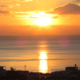
The Goddess Sunset at Nago City


View Map It! Okinawa in a larger map
The Goddess Sunset at Nago City

     GPS
     LatitudeLongitude
     N 26 34.983E 127 59.333


The Goddess Sunset at Nago City


It's normal tradition among friends and love ones to see the very First Sunrise of the New Year. But what about the very Last Sunset of the closing year? There are many places on Okinawa to view the beautiful Okinawa sunset, but Nago City host one of the most beautiful sunset viewing locations on the island. This brings us back to the same location of the statue known as The Goddess of Mercy – Hence the title, The Goddess Sunset*. The location is picture perfect in many ways; the right angle and elevation, the calm reflecting waters below, and the sitting Bodhisattva that evenly splits the Nago Bay. Regardless if it's New Year's Eve or not, at anytime of the year the sunset here leaves you with a sense of amazement and peace. This is Map It! Okinawa's 2011 Sunset of the Year. 

What to bring: A peace of mind...and your camera. For Directions & Parking: See post on Kannon-sama, Goddess of Mercy.

Other places of interest nearby: Ato no Utaki (Kyoda), Big Okinawan House, Scenic View Mount Tanodake,Giant Shisas (Kyoda), Green Bridge/Lower Creek Park, Haneji Dam Family Picnic Area, Mikaya Dam, Nago Museum,Nangusuku Castle Ruins, Route 18/Haneji Dam Route, Todoroki Waterfall (Sukata), Water From Hands (Kyoda)Kannon-sama, Goddess of Mercy.

*The name was created by the author of this post to describe the event and location. It is not an official title. 

Sunday, December 25, 2011

"Kannon-sama, The Goddess of Mercy – Nago City"

Kannon-sama, Goddess of Mercy sitting in front of Cherry Blossom Trees - Nago City


View Map It! Okinawa in a larger map
Kannon-sama, Goddess of Mercy

     GPS
     LatitudeLongitude
     N 26 34.983E 127 59.333


Kannon-sama, The Goddess of Mercy – Nago City


The statue you see above is a Bodhisattva referred to in Japanese as Kannon or Kannon-sama, also known as the 'Goddess of Mercy'. She is referred to by many different names in different languages and has taken both male and female forms depending on the folklore and legend. There are many such statues of this Bodhisattva that exist of much, much greater size and magnitude in other East Asian countries, to include Mainland Japan. This one, in Nago City, is a modest size of about 15-16 feet in height. Nevertheless, the scenery itself is a trifecta of sorts. First, the Bodhisattva is surrounded by Nago's greenery of trees and mountains. And then there is the Cherry Blossoms behind the statue strategically laid out on a hill top making this an ideal spot for your photographic moment during blooming season. And finally, the statue overlooks a very calm and beautiful view of the Nago Bay.

The Poem. Next to the statue lies a stone inscription of a poem in Japanese, written by a person with the  family name Yokoyama. (The Kanji of the first name could not be accurately determined). Translated, it reads: 

     “Those who won and those who lost are now gone, and the Okinawa ocean is now calm.

Behind the stone inscription it says: “Those who chant the poem will be touched by the truth. By understanding the poem it will awaken the good in your heart. And by understanding the poem you will be inspired by its beauty.

The interpretation of the poem, of course, is left open for discussion. But being that this is the 'Goddess of Mercy', the message is certain to be one of peace.

Getting there. The location is south of the Orion Beer Factory on a hilltop. There are several ways to get there. You can either take Highway 58 and approach it from the west or approach it from the east on Highway 18. Please see map above for recommended entry (blue route). Depending on which highway you use, the turn-off will either be the very last turn-off to the right before you go up the Nago Green Bridge or the very first turn-off to the left as you are coming down the Nago Green Bridge.

Parking. If this is your first time attending this location, I recommend parking at the base of the hill and walking up, especially during Cherry Blossom season. At some point the road is only wide enough for one vehicle and 3-point turns are difficult. It is not too difficult of a walk from the bottom. Possible parking spots have been plotted above. The Pink Thumbtack icon marks another entrance way to the statue location from Highway 18, but it is easy to miss. It can also be used to exit onto Highway 18 as you leave the statue area.

Caution. If you notice on the map there is another route branching off that goes further south roughly paralleling Highway 18. Be advise that tremendous road damage existed on this route when last visited in early December 2011. Warning signs have been place. Do not go past these signs. The roads were severely damaged due to an eroding hillside.

Other places of interest nearby: Ato no Utaki (Kyoda), Big Okinawan House, Scenic View Mount Tanodake,Giant Shisas (Kyoda), Green Bridge/Lower Creek Park, Haneji Dam Family Picnic Area, Mikaya Dam, Nago Museum,Nangusuku Castle Ruins, Route 18/Haneji Dam Route, Todoroki Waterfall (Sukata), Water From Hands (Kyoda).

Wednesday, December 21, 2011

"Sunset! Zakimi-jo"

Sunset at Zakimi-jo


View Map It! Okinawa in a larger map
Sunset! Zakimi-jo

    GPS
     LatitudeLongitude
     N 26 24.481E 127 44.520


Sunset at Zakimi-jo Castle


When the engineers built telecommunication towers and power lines near Zakimi-jo Castle, they probably didn't have the view of the sunset in mind. It didn't stop this couple, however, from capturing a commanding view of the Okinawa sunset. Like most castles and fortresses on Okinawa, Zakimi-jo sits upon at high elevation, good enough to get a good view of both the ocean horizon and the sun as it descends down in a blaze of fire.

If you don't mind a few man-made obstacles in the way and wish to spend some sentimental time watching one of the small joys of nature, then this is an ideal spot. And if you are lucky enough, maybe you too will have an unsuspecting photographer capturing your Kodak moment. This is Sunset at Zakimi-jo.

Getting there. Zakimi-jo is in Yomitan Village. If you take Highway 58 (north or south), get on Highway 12. Look for road signs that point to Zakimi-jo Castle.

Other places of interest nearby: Yomitan's Tucked Away Nature Trail.

Sunday, December 18, 2011

"Manko Waterbird & Wetland Center"

Grey Heron at the Manko Wetlands (About 300m from the Center)


View Map It! Okinawa in a larger map
Manko Waterbird and Wetland Center

     GPS
     LatitudeLongitude
     N 26 11.638E 127 40.915


Manko Waterbird & Wetland Center


This is the Manko Waterbird and Wetland Center of Tomigusuku City just outside the borders of Naha. It's not too far from the very visible Toyomi Ohashi Bridge often seen to the east as you are driving down Highway 58. Because of its significance as a stopover point during the winter season for various migratory birds, the Manko Wetlands became a registered wetland area under the Ramsar Convention in May 1999 (Ramsar site no. 996). Inside the center you will see various picturesbird displays, and information on the various birds often seen in the Manko Wetlands. On the second deck, there are birding scopes so you can get a glimpse of some of the wildlife that take refuge there. Just outside the center there is a man-made boardwalk that takes you to an outdoor observation post.

For the most part the center is a very English friendly place. They have a well done English pamphlet that talks about the various wildlife seen there and the history behind the Manko Wetlands. Make sure you grab one of these pamphlets. The pamphlets are located at the sign-in booth as soon as you walk in. If they don't have one, then be sure to ask for one. Also inside the pamphlet is a field map of other observation areas surrounding wetlands. And please don't forget to sign in. There is no entrance fee to go inside, but your name and where you come are important to keeping the place open.

In the photo album you will see some of the various birds just taken in one hour's time: Osprey, Grey Heron, Japanese White-eye, Common Redshank, and the Little Egret. The captions in the photo album will have the scientific name. To see other wildlife in action at the Manko Wetlands visit Mike's Ryukyu Gallery.

Getting there. Getting there is not difficult, however the turn-off can often be missed cause one of the street signs is blocked by a group of trees. Please look at the map and study the landmark and the blue designated vehicle route. Entrance to the wetland center is the very first left as soon as you commence on the road designated by the blue route. It is a 'J' hook turn to the left.

Open: 9am-5pm daily except Mondays, the next day after a holiday, and during Dec 29-Jan 3
Phone Number: 098-840-5121
Website: http://www.geocities.jp/manko_mizudori/ (Japanese Only)
Entrance Fee : Free

They ask you to call in advance for groups of 15 or more.

Other birding areas on Okinawa: Birding Observation Point (Awase).

Other places of interest nearby: Fukushuen Chinese Garden, Monument to Hibari Misora, Pineapple House Store, Sumiyoshi Shrine.

Wednesday, December 14, 2011

"Kin Town's Cherry Blossom Way"

Cherry Blossoms in Kin Town


View Map It! Okinawa in a larger map
Kin Town's Cherry Blossom Way

     GPS
     LatitudeLongitude
     N 26 27.729E 127 55.934


Kin Town's Cherry Blossom Way


Normally not recognized for its Cherry Blossoms, Kin Town does have its own little tucked away corridor of Cherry Blossom trees. It sits beneath the Kin Town Bridge often unnoticed by the daily traffickers that skirt north and south along Highway 329. What you see above are the trees in their non-blooming season, but during full bloom this can be quite the photographic spectacle given the small ground it covers compared to some of the more popular locations like Mount Yaedake. Currently, in the background you will see the construction of the new Kin Dam. Though not an ideal scene yet for a panoramic photograph, but with a little imagination, good use of angles, and some cropping you will still be able to capture the photographic and natural beauty of these small wonders of nature. In a few years time, the completed Kin Dam will be a wonderful addition to the blend of Cherry Trees in the foreground. 

What to bring. Definitely a camera. If you are into photography, recommend you bring a step ladder or better in order to get a better vantage point. A little higher elevation can make a tremendous difference in your angle perspective and thus automatically crop out unnecessary obstacles that might be in a the way (i.e. overgrown vegetation).

Cherry Blossom Season: January-February time frame, pending climate conditions. 

Getting there. The location is just north of Camp Hansen. It is the first turn-off to the left heading north once you pass the Highway 104 and 329 intersection. The turnoff is immediately before the Kin Town Bridge.  

(Note: Photos of the full bloom will be added to the album once blooming season starts.)

Other places of interest nearby: Birth Place of Toyoma Kyuzo, Gold Hall, Kin Kannonji Temple, Kin Watch Tower, Kin's Castle Rock , Kinjo's Used Goods, Kin's Hidden Nature Trail, Kin Town's History Chronicles, Okawa, The Natural Spring, Oshiro Kozo Statue, Richamocha Cafe, Toyoma Kyuzo Statue.