Search Map It! Okinawa

Showing posts with label 沖 縄 滝. Show all posts

Wednesday, January 4, 2012

"The Taa Falls"

The Taa Waterfall


View Map It! Okinawa in a larger map
The Taa Waterfall

     GPS
     LatitudeLongitude
     N 26 38.048E 128 05.682


The Taa Falls


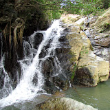
This is Taa-taki or the Taa Falls of Ogimi Village. It sits about 1.5 km south from its sister waterfall, Azaka. And unlike the cascading Azaka Falls, this waterfall drops straight roughly 50 meters below. To get an idea of the scope and size, click on this photograph with two people standing next to it. The Taa Falls is unique among the many known waterfalls here on Okinawa in one aspect; there are no man-made trails to get to it. You have to hike along (and sometimes) in the river to get there. With the exception of a few guide ropes along the way, you are on nature's terms. The walk is not that bad, only about 20-30 minutes depending on your pace. However, the walk does require some balance and coordination skills because of the sometimes awkward rock formations you must negotiate over. This venture is not recommended for very young children, but use good judgment as you see fit.

Once you get there you have no choice to embrace the beauty. Sit and relax with the family. On a hot summer day this place is ideal to cool off.

Getting to the top. PLEASE READ. There is a path that takes you to the top. It is to the left as you are facing the waterfall. There is makeshift rope to aid in you climbing up the slope. Once you get on top of the initial slope, there are two more trials that split but both get you to the outlet of the waterfall. One trail continues straight and down while the other to the right and up. RECOMMENDATION. I highly recommend you do not take the one that goes to the right. Although it seems closer to the outlet, it can be quite a task. There are many roots to trip on and can be very slippery, and in most cases, you are required by the assistance of a makeshift rope along the way. This route can be very painful on your hands as you balance your weight while holding the rope. I recommend taking the other route. You will only have to travel about 50 meters till you meet the river stream. Once you get on the stream, take a right and walk along the stream till you get to the outlet.

Advisement. PLEASE READ. Again, this hike is not recommended for very young children with low coordination skills. Use sound judgment. You will get wet. On a normal day of good weather, at most you can get wet up to your knees. Recommend having an extra pair of shoes and/or socks and a towel in the car. It is also recommended that you do not wear any soft sole shoes. If you do, you will feel every rock along the way as if you were walking barefoot. Tennis shoes should be find. Have shoes with good traction. If you already have some kind of hiking gloves, bring those as well so as to help you with grip and protection. During colder months, the gloves will also keep your hands warm. Recommend also bringing a small backpack to stuff food or other items like small towels or extra pair of clothing. You can take a short swim at this waterfall.

Directions. The route is almost identical on how you get to the Azaka Falls. If you drive north on Highway 58 just as you pass into Ogimi Village you will approach the Henan Bridge (there is no sign marker of the Henan Bridge in English characters on the southern side). But look for the bridge that has two Okinawan traditional flower hats known as 'hanagasa' on each side. You can either take the turn-off immediately before the bridge or immediately after the bridge. Continue along the road. About 1 km you will run into a 'Y' Fork in the road. Continue on the road to the right. At some point will see a very visible parking area next to the stream. You can park here. If you are facing the stream from the parking area. You hike to the left going up stream. There may be a sign hanging on the tree limb pointing you in the right direction.

Other Places of Interest Nearby: Azaka Falls.

Other Waterfalls of Okinawa (沖 縄 滝). Azaka Falls, Fukugawa Falls, Hira Falls, Meoto Falls, Ogimi Waterfall, Todoroki Waterfall, Nameless Waterfall (Fukugawa II), Kijoka Falls, Nameless Waterfall (Kunigami).

Monday, January 2, 2012

"Azaka Falls"

Azaka Falls


View Map It! Okinawa in a larger map
Azaka Falls

     GPS
     LatitudeLongitude
     N 26 38.767E 128 05.418


Azaka Falls


Surprisingly, this waterfall sits wide open, inconspicuously next to a road about 200 meters away. There are no signs that point to it and though it makes a loud thundering sound from a distance, you wouldn't hear it if you had your car windows rolled up. Perhaps more people pass right by it on their way to see the Taa Waterfalls just down the road. But if you happen to look at the right moment as you are passing by, you will notice a tiny pocket view of water streaming down between the trees. A closer view however, gives you something more impressive to see. This is the Azaka Falls of Ogimi Village.

At a vertical height roughly at a 100 meters, this natural beauty is not your typical waterfall with a straight vertical drop. It has several cascading levels where the gushing water descends down upon. Gold tinted colored rocks in which the water flows through gives the scenery its majestic ambiance. And unlike most waterfalls here on Okinawa that are surrounded by high vegetation, the Azaka Falls are pretty much under open skies, allowing the sun to shower you as you embrace the cool air from the streaming water. Bring a friend and lunch, this is a great spot to inhale the nature.

Caution. The view from down below is impressive enough to get a good picture. There are no designated trails, however, that take you to some of the cascading levels. Use extreme caution if you decide to skirt the landscape to get a higher view. Have good shoes and use the '3 Points of Contact' rule. It is easy to slip or trip. Climbing is not recommended for young children.

Getting there. Getting there is not too difficult, but you have to look for visible landmarks. If you drive north on Highway 58 just as you pass into Ogimi Village you will approach the Henan Bridge (there is no sign marker of the Henan Bridge in English characters on the southern side). But look for the bridge that has two Okinawan traditional flower hats known as 'hanagasa' on each side. You can either take the turn-off immediately before the bridge or immediately after the bridge. About 1 km after the turn-off, look for a small bridge and building. Park around here off the road. The trail to the waterfall is a vehicle trail along the stream. Don't bring your vehicles on it. Farmers still use it to tend their farms next to the waterfall. The walking distance to the waterfall from the road is about 200 meters.

Other places nearby of interest: Taa Falls.

Other waterfalls of Okinawa (沖 縄 滝).
Fukugawa Falls, Hira FallsMeoto Falls, Ogimi Waterfall, Taa Waterfall, Todoroki Waterfall, Kijoka Falls, Fukugawa II, Nameless Waterfall (Kunigami).

Monday, October 17, 2011

"Todoroki Waterfall in Nago City"

Todoroki Waterfall in Sukata District of Nago City


View Map It! Okinawa in a larger map
Todoroki Waterfall in Nago

     GPS
     LatitudeLongitude
     N 26 33.766E 127 59.294


Todoroki Waterfall in Nago City

This is the "Todoroki-no-taki" or the Todoroki Waterfall in Nago City. It lies in the Sukata District just south of the Highway 329 and Highway 58 intersection. Not as well known as its sister waterfall in Hiji, the Todoroki Waterfall nevertheless still stands as an impressive art of nature. The word "Todoroki" in Japanese means to "roar" or "rumble". Without a doubt, you will feel the vibration of the thundering water as it hits the surface down below.

There is plenty of shade by the nearby trees and seats where you can enjoy the surrounding nature. You will see a small place where people pray from time to time. Please see photo album above. Though this is somewhat of a makeshift altar please show proper respect when around that area. There is also a trail that you will see to the left if you are facing the waterfall. Portions of the trail lead to a power line tower and another to a dead end. There is trail that goes further back away from the waterfall (destination unknown) . The trail is uneven, slippery, and sometimes steep - so use caution. Always be aware of critters and snakes. There was nothing I found that lead to the top of the waterfall. Use proper judgement for traversing the hillside on these trails should you decide to do so.

CAUTION. The boulders and rocks near the waterfall are slippery. Please use caution if you decide to get close to the bottom.

Video. Video footage of Todoroki after Heavy Rainfall (May 23, 2013/Rainy Season) - Click Here

Directions. One direct route is to take Highway 329 till you hit the Highway 58 Intersection. Turn left on 58 and turn left on the first traffic light. See map above. Make sure you then navigate your way to the south side of the stream (right side) as you are driving towards the waterfall.  

Parking/Amenities. Parking and toilet facilities are available.

What to Bring. Definitely a camera.

Other Places of Interest Nearby:  Ato no Utaki (Kyoda)Giant Shisas (Kyoda)Green Bridge/Lower Creek ParkWater From Hands (Kyoda), The Nangusuku Castle Ruins, Nago Museum

Other Waterfalls of Okinawa (沖 縄 滝). Azaka Falls, Fukugawa Falls, Hira Falls, Meoto Falls, Ogimi Waterfall, Taa Waterfall, Nameless Waterfall (Fukugawa II), Kijoka Falls, Nameless Waterfall (Kunigami)

Friday, August 19, 2011

"Ogimi Village, and a Waterfall of Longevity?"

Ogimi Waterfall


View Map It! Okinawa in a larger map

Ogimi Village and a Waterfall of 'Longevity'?

     GPS
     LatitudeLongitude
     N 26 41.402E 128 06.476


Ogimi Village, and a Waterfall of Longevity?

The waterfall you see in the above picture is the Ogimi Waterfall. It resides along Highway 58 several miles south of the 'Okuma' recreational resort. If you are not looking, you may fly right past it. Perhaps not as impressive as the Hiji Waterfall several miles north, but it offers good picture moments for you and the family.

Ogimi Village is perhaps more well known for its populace holding the highest longevity record in all of Japan. There is a stone next to the waterfall with a poetic inscription on it translated as best as possible:

"The Elders of Ogimi seek nourishment from the blessings of nature. We live to the fullest by following the traditional culture of how we gather our food.

At age 80, we are "sarabarabi" a child,
When you reach 90 and if 'They' came to take you up... Send 'Them' away by saying 'Wait till we're 100!'

As we age, we grow in high spirits. When we age, let's not depend on our children.
If you wish to talk about aging, visit our village. We shall talk about the blessings of the nature and secrets of our longevity.

We, the Elders of Ogimi Village, declare with pride that we rank number one in longevity of all of Japan."


Could the source of longevity be from the Ogimi Waterfall? Who knows? But it's worth the 10 minute stop. There is a large sign of an Okinawa jungle boy (See picture album) that serves as a good landmark. But there is also a food market adjacent to the waterfall if you wanted to get some 'nourishment' (hint, hint).  There is plenty of parking. Definitely have a camera. Note: There is a man-made walkway to allow you to get closer to the waterfall safely for picture moments.

Other places of interest nearby: Scenic View from the Shioya Hilltop, Ogimi War Memorial.

Other waterfalls of Okinawa (沖 縄 滝). Azaka Falls, Fukugawa Falls, Hira Falls, Meoto Falls, Taa Waterfall, Todoroki Waterfall, Nameless Waterfall (Fukugawa II), Kijoka Falls, Nameless Waterfall (Kunigami).