Search Map It! Okinawa

Sunday, July 21, 2013

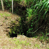
The Gohezu Cave

The Gohezu Cave


View Map It! Okinawa in a larger map
The Gohezu Cave

     GPS
     LatitudeLongitude
     N 26 43.403E 127 46.898


The Gohezu Cave, Ie Jima

In 1975, explorers made a fascinating discovery on Ie Island in an area called Gohezu Yama (ゴヘズ山). It is here, inside a cave, that human remains were found dating back to the Paleolithic Era (between 2.5 million to 10,000 B.C). Specifically, these remains were thought to originate some time around 20,000 B.C. (1).

Deer Remains. It may be hard today to imagine deer ever existing on Okinawa, particularly on a small island such as Ie Jima. But in addition to the human remains, primitive tools made from deer bones were also excavated(1), suggesting that a species of deer either once thrived there or were later brought to the island. Today, you can find deer on the Kerema Islands of Okinawa, such as Aka Jima, where they are now protected under law(2). The question that obviously comes to mind is 'how did they get there?', and why were some islands inhabited while others were not. The mystery continues.

Interesting Semantics of the Kanji '山' (Yama). Most people have come to understand the Kanji and the word 'Yama', as a word meaning 'a mountain'. However, it is not clear why they refer this place as Gohezu-Yama (ゴヘズ山). When you arrive, clearly you will see no mountain that most people have come to conceptualize. The area is somewhat elevated if seen from a distance however. From its highest point, it sits above sea level at 82 meters(1). This confusion with the Kanji, '山', has come up before where local people's concept of the term 'Yama' varies. To some Okinawans it may be a piece of land that is elevated above the surrounding terrain, and not necessarily like a real 'tall' mountain like Mount Fuji in Japan. There may be a scientific reason that has dubbed this area as a mountain. Research brought us to a Japanese hiker's website in which the author set out to locate 'ultra-low mountains' (100 meters or less) that are identified in Japan's Yamana Encyclopedia (Japan's Mountain Encyclopedia). On the hiker's website, the Gohezu-Yama Mountain is listed as #26 of ultra-low mountains he has since located. (See website). Note. The Yaman Encyclopedia has yet to be reviewed for its contents on 'ultra-low mountains'.

Author's Notes.
1. The Gohezu Cave is barred from entry. Please do not attempt to enter.
2. The time period describing the Paleolithic Era may vary slightly depending on sources. It is sometimes referred to as the 'Old Stone Age', describing a period where the first humans made primitive tools out of stone. For more about the Paleolithic Time Period please visit http://archaeology.about.com.

Getting to Ie Jima. The Gohezu Cave is on Ie Jima Island. Please referred to Map It! Okinawa's Travel Prep to Ie Jima Island.

Directions to the Cave. The Gohezu cave is in close proximity to the Ie Airport Facility, which is identified in the LandMark Icon in the map above. There will be a turn-off on the opposite side of the main road that sits along the airport facility. It will be a dirt road as seen in this picture. Follow that straight till you see the cave explanation sign. 

Other Places of Interest Nearby. Niya-Thiya Cave, Ahashagama Cave, Statue of Asato Gura, Yuri Matsuri (Late April to 1st Week of May).

Source of Information.
1. History of the Gohezu Cave, Japanese sign on location, provided by the Ie Jima Education Office.
2. Deer on Aka Jima, Japan National Tourism Organization website.

Saturday, July 6, 2013

"Sefa Utaki"

A family posing for pictures at Sēfa Utaki


View Map It! Okinawa in a larger map
Sēfa Utaki

     GPS
     LatitudeLongitude
     N 26 10.331E 127 49.599


Sefa Utaki

Today, Sefa Utaki (or Sēfa) is widely considered one of the most sacred sites in all of the Ryukyu Archipelago. It ranks up there with the islands, Kudaka and Hamahiga – soil where legends claim the first gods walked upon. Its triangular-like entrance captivates hundreds and hundreds of visitors daily to this special place. But its unique shape isn't what makes the sacred grove special. It's whats on the other side that gives Sefa Utaki its true intrinsic value, and once there...it's not hard to understand why many Okinawans believe that the gods themselves had a say in its design; there you will find a viewpoint, like a window through the forest, and dead center...a lowly island known as Kudaka-Jima, Okinawa's claimed 'Garden of Eden'. If not for Kudaka, Sefa Utaki would not have the reputation it does today.

It is said, here and around Sefa Utaki, that the first Okinawan people settled on the main island. As legend would have it, Amamikiyo – one of the first Okinawa gods, created the area around Sefa Utaki for her people after leaving Kudaka. In subsequent years, the King and the Supreme High Priestess (kikoe ogimi) would come here to pay homage to their earlier ancestors as they faced towards Kudaka Island (1)(2)(3).

Yuinchi and Ufuguui. The relationship between Shuri and Sefa Utaki is not one by mere coincidence. You'll find similar areas at Sefa Utaki that mimic the names of special places at Shuri Castle. One is the Yuinchi, meaning “a place full of abundant harvest and catches of fish”(4). At Shuri Castle, this was the cooking quarters for the royal family and at Sefa Utaki, a place where fortunes were told(4). The other is Ufuguui, a place where ritual ceremonies were held at Shuri Castle and its meaning holds similar to that at Sefa Utaki(5). (Author speculation. Perhaps the similarity in names was to give legitimacy to the authority at Shuri Castle being that Sefa Utaki already had a strong appeal with the early Okinawan people. It would make sense for any ruler to blend its relationship with a site widely believed to be sacred).

The Two Stalactite Stones. Next to the great triangular-like entrance, you will find an area called the 'kifujinsama oyasumidokoro' where certain rituals were held during the turn of the New Year. Up on top you will see two stalactite stones with pots underneath. Water dripping from these stones is liken to be holy water and was once used to provide the fortune for the King and the high priestess(6).

The Agari Umaii & UNESCO Sponsorship. Sefa Utaki is one of many areas that are considered part of the Agari Umaai Pilgrimage (to be mapped in its entirety). The pilgrimage was used in the Old Kingdom to offer homage to sacred areas that have strong ties to the earlier ancestors, particularly to the goddess Amamikiyo. On May 15, 1972 Sefa Utaki was listed as a National Historical Site and on December 2, 2000, it received UNESCO sponsorship under the United Nations' World Heritage Program (7).

Hours. 9-1800 (Final Admission 1730)
Closed. December 29 – January 3
Admission Fee. 200 High School & above, 100 Elementary/Junior High, 150 Group (20 or more High School or above)
Phone Number. 098-949-1899
Website. For update information visit Okinawa Convention & Visitors Bureau website
Amenities. Public restrooms available. Because of its historical layout and unique nature, it is not wheel chair accessible, nor recommended for baby strollers. Please plan accordingly.
Parking. Free.

Directions. Sefa Utaki sits above Cape Chinen off of Highway 331. Though you will see signs directing you to Sefa Utaki it may not be so evident where you turn off on Highway 331. Look for the post office which sits across from the sign pointing you to Cape Chinen. This is the turn-off that takes you up to the parking lot and visiting center.

Source of Information. 1. Okinawa Convention & Visitors Bureau 2. Okinawa Prefectural Board of Education 3. Okinawa – A People and Their Gods, James Robinson, 1969, pg 42. 4. Reference to Yuinchi (sign on site in English) 5. Reference to Ufuguui (sign on site in English) 6. Reference to Kifujinsama oyasumidokoro (sign on site in English) 7. Reference to Agari Umaii & World Heritage Program (sign on site in English).

Related Articles. Azama: Gateway to Kudaka, In the Beginning...there was Kudaka-jima, Gateway to the Otherside? Hamahiga Island.

Other Places of Interest Nearby. Cape Chinen.

Thursday, June 27, 2013

"The Legend of Asato Gura"

A stone stature of Asatogura


View Map It! Okinawa in a larger map
Legend of Asatogura

     GPS
     LatitudeLongitude
     N 26 42.853E 127 47.982


The Legend of Asato Gura 

"if they can't stop you, then you become something else entirely.
— Which is?
...Legend, Mr. Wayne."

Okinawa is full of legends. Some big. Some small. Eventually, they all fine their way across distant lands in the ears of the intrigued. Some time during the 19th century, word had spread in old Naha, that there was man of extraordinary strength. This man had lived up north on an island known today as Ie Jima. His name was Asato Gura. But to the villagers of Ie Island, he is known as Uputeimun, (the Strong Man) Asato Gura (ウプテイムンアサトグラ ). As word continued to spread, five men from Naha made the ambitious journey to challenge this man to see if the stories were true. Predictably, all five men, in an Okinawan-style sumo match, would succumb to Asato Gura's overpowering strength, henceforth, making him sort of a local hero and a 'bragging right' among village folks.

Asata Gura's exact age was never determined. It is believed though that he died in the year 1890. At Miisui (ミースィ) Park, on Ie Island, you will see this statue erected in his honor. You may wonder why he is standing firm like a mountain on boat while holding a flask in his left hand. Asato Gura was known for three things: being very strong, being a fisherman, and being a man who always had a bottle of liquor at his side.

Source of Information. Sign in Japanese underneath the Statue.

Directions. The statue and Miisui Park is on Ie Jima Island and is marked in the map above. Please refer to the article 'Travel Prep to Ie Jima' on getting there.

Other Places of Interest Nearby. Sen-nin Gama (Niya-Thiya Cave), Ahashagama Cave.

Notes. 1. The opening quote was taken from the motion picture, 'Batman Begins' 2. Uputeimun (ウプテイムン) is of the Okinawan Language (possibly an Ie Jima variant)

Sunday, June 9, 2013

"The Tale of Two Caves - Ahashagama"

The Ahashagama Cave


View Map It! Okinawa in a larger map
The Ahasha Cave, Ie Jima

     GPS
     LatitudeLongitude
     N 26 43.610E 127 49.061


The Ahashagama Cave

June 22nd, 1945 – The Great Okinawan War' comes to an end. The day after, the long road to recovery begins.

June 23rd is a day of healing. It is Okinawa's Memorial Day, known to the Okinawans as 'Irei no Hi' (慰霊の日). The 22nd and the 23rd of June are two bookends of an era tied to a significant event. One is an end to a war-torn past. The latter, a beginning to a brighter future. This is Okinawa's past and with it, countless wartime stories told by the Okinawans – stories that did not always have a peaceful end. Telling them is their way of preserving the honor and memories of those who tragically lost their lives many, many years ago. Telling them is their way to remind us, the consequences of war. On Ie Jima, there are two caves that are connected by the Battle of Okinawa. One is about life, the other about death. Sen-nin Gama (now called the Niya-Thiya Cave) was said to have a 1,000 people take refuge in its domain as war waged on between American and Japanese forces. There were no reported deaths as a result of the war. And inside, you will find a stone about life. It's a fertility stone. Visitors to Ie Jima come here to feel a special power. To them, it is a 'Power Spot' and is pronounced as such in their own language.

Then, there is the Ahashagama Cave. It is a cave that for two decades that was seemingly left to be forgotten, and for understandable reasons. In 1971, just twenty-six years after the war, the cave was revisited and excavated for its remains. A dark past was about to be revisited. It was discovered that about 150 people died. The cause... suicide by use of grenades, given to them by the then Japanese Imperial Army. About 20 survivors walked away from that dreadful aftermath. All remains were removed and sent to a separate location. A phone number is left behind for those relatives who come back to Ie Island wishing to pay respects to their ancestors (it should be of no surprise that some Ie villagers left the island after the war to get away from the horrific memories of the past). Stories like this are not uncommon during the Battle of Okinawa, where mass suicides were committed to avoid being captured by the oncoming US Forces – a fear that was propagated by the then Japanese Army. It is a sensitive and controversial subject even today.

But 'Irei no Hi' is not supposed to be a day of controversy. Like Memorial Day in the United States, all political positions are set aside for one day in what should be a solemn and quiet moment to honor and remember the fallen. June 23rd is a day that helps Okinawans move forward to the next horizon. The story of Ahashagama – an end to a terrible past, and yet a monument that reminds us to strive for a better future.

Author's Note. The word 'then' is highlighted to emphasize that it was the then Japanese Imperial Army. It is a sometimes human tendency to inadvertently convict an entire current generation of people to the tragedies that took place long, long ago... or to convict an entire group of people over the misdeeds of one individual. The Okinawan War can be a topic of heated debate. I realize this especially as someone who has both an American father and a Japanese mother. History, in the author's opinion, should always be viewed in the context of the times they occurred.

Source of Information. Ie Jima Tour Guide phamplet (Japanese Only), provided by the Ie Village Office.

Related Articles. Beggars’ Belief: The Farmers’ Resistance Movement on Iejima Island, Okinawa (The Asia-Pacific Journal), Survivors Remember Commotion Then Calm Inside Okinawa Cave (Shimuku Gama), Okinawans Outraged....Cover-up of Mass Suicides During WWII Battle (Chibichiri Gama).

Directions. Ashahagama Cave is on Ie Jima Island. Please refer to the article 'Travel Prep to Ie Jima' on getting there. The cave itself borders a golf course (LandMarked on the map above) on the northeastern side of the island.

Other Places of Interest Nearby. Sen-nin Gama (Niya-Thiya Cave).

Thursday, May 30, 2013

"The Grave of Two Frenchmen, The Oranda Baka"

An Easter Lily blooms in the foreground of one tombstones at the Oranda Baka


View Map It! Okinawa in a larger map
Oranda Baka

     GPS
     LatitudeLongitude
     N 26 40.505E 127 59.938


The Grave of Two Frenchmen, The Oranda Baka

It is somewhat of a mystery on how deep and complicated the relationship the Ryukyus had with other countries, particularly when much of Okinawa's written and recorded history was destroyed at Shuri during the Great Okinawan Battle. Vestiges of history are sometimes told by the graves they leave behind. On Yagaji Island of Nago City, you will find the graves of Jacques Sallus and Francois-Charles Guitart, two Frenchmen that were laid to rest in June of 1846. The two men had died of an illness during their one-month stay as trade agreements between the Shuri Government and France were being negotiated. The ships (total of three) had anchored in what is known as present day Unten Harbor. Oranda Baka literally translates to as the Hollander's Grave. The word, 'Oranda' (オランダ) is the Japanese word for Holland (or Netherlands) and was derived from 'Uranda', a term used by the Old Kingdom to describe anyone that was a 'westerner'(1). Despite their true origins, Oranda now remains as part the two men's legacy today.

At the grave you will find tomb stones for both men. It reads below(1):

(Left Tombstone)(Right Tombstone)
NameJacques SallusFrancois-Charles Guitart
Country of OriginFranceFrance
ShipVictorieuseCléopâtre
Died on 11 June 1846Died on 20 June 1846

More Questions. As with any historical place, there are endless questions that are tied with it. Why were the negotiations held in Nakijin (a much farther location) and not closer to Shuri (near Naha port)? Was it negotiations out of secrecy? The Okinawa Prefectural Board of Education does summarize activities of 1846 in the following passage(2):
"British ship HMS Starling made landfall at Naha Harbor. The English missionary Barnard Bettelheim arrives in the Ryukyus for an 8-year stay. French ship Sabine lands in Naha with Pierre-Julien Le Turdu, successor to Focade. Later the French ships Cleopatoru and Victorious arrive at Unten Harbor seeking reply to the request made in 1844 for friendship and trade relations. They were refused by the Ryukyuans. Visit to Naha of three British fleet vessels. Consent was granted for the start of trade between the Satsuma-han and France."
As you can see, both France and Britain, were very much involved with activities in the Ryukyus during that period, and since the two countries 'seemingly' were competing for trade rights, separate port location (whether for secrecy or not) might have deemed best.

Epilogue. Jacques Sallus and Francois-Charles Guitart may have both been lowly crew members at the time of their passing, but their grave serves as reminder of a much larger relationship the Old Ryukyu Kingdom had with foreign countries. Since WWII, it has been local tradition that on the 24th of December a small memorial service is held their honor by the people of Utenbaru(1). It is not certain why the 24th of December was chosen.

Author's Note.
1. It is not clear on the third ship that ported in Uten Habor in 1846. (Possibly, the Sabine as noted in (Source 2)) 
2. The term Ohaka or haka (墓) means tomb. However, with the words 'Oranda Baka' the letter 'H' is omitted and replaced by the letter 'B'. This sometimes occurs in the Japanese language when certain words are affixed to another. For example, the word Kawa means river, but when sometimes affixed with a proper noun, the letter 'K' is dropped and replaced with a 'G' as in Hiji-gawa. It is not so much the sound of the word than it is the Kanji that describes the word's meaning.
3. Speculation. It is not certain what kind of illness the two sailors died of. It is the author's speculation that the decision to bury the men on land was an immediate one to prevent possible disease from spreading on the ship. Keeping the body on ship any longer may have been deemed risky. This part is not very clear.

Source of Information.
1. Translated Sign in English (on location) provided by the Nago City Board of Education
2. Okinawa Prefectural Board of Education Timeline (online)

Related Article. Japan Times: Memorial service held in Okinawa for French sailors

Directions/Parking. The grave is on Yagaji Island and can be reached by vehicle from the main island.The most direct route is to take Highway 58 into Nago City. From there you will want to take Highway 110 as if you were going to Kouri-jima Island. Initially you will be on the east side of Yagaji Island then Highway 110 will veer towards the western part of the island. Look for this LandMark sign that says 'Oranda Baka' in English. Once you make the turn, you will be headed towards a small port. Park there. Look for a trail that takes you away from the port. It will skirt the coast. You will see log rails from a distance as seen here. It is about a 300 Meter walk.