Search Map It! Okinawa

Showing posts with label Motobu. Show all posts

Saturday, January 18, 2020

Cherry Blossoms on Yaedake (Mt. Yae)

Cherry Blossoms during peek season on Mt. Yae


View Map It! Okinawa in a larger map
Cherry Blossoms on Yaedake

     GPS
     LatitudeLongitude
     N 26 39.414E 127 54.696

        *GPS to Mt. Yae Entrance


Cherry Blossoms on Yaedake (Sakura Matsuri, 桜祭り)

Cherry Trees in Okinawa Prefecture are said to bloom before anywhere else in Japan. Mid-January marks Cherry Blossom season and every year, thousands of visitors travel to Yaedake and Nakijin Castle, to see the first blooms. It is claimed that over 7000 Cherry Trees occupy the hillside of Mt. Yae.(1) The Cherry Trees found here (Prunus campanulata maxim)(1)  are different than those found in Mainland Japan. They are said to come from Taiwan and southern regions of China.(1) Every year, the Motobu Town Office sets up a Cherry Blossom Festival or Sakura Matsuri (桜祭り) towards the latter part of January for about two weeks. Below is basic information for the Yaedake Cherry Blossom Festival.

Festival Information.
When: Normally the last two weeks of January and early February. (2020 January 18 to February 2)
Time: There are no opening or closing hours to enter. However, the best time to view the flowers is during the day.
Peak Viewing Time. Typically, last week of January.
Admission Fee: Free (games and other amenities my require a fee)
Amenities: Food Stands/Restrooms Available (various locations)
Parking: Available (various locations). Parking attendants should be available to direct traffic.
Websites: Motobu Town Website  (Japanese only). To go directly to information site visit here. Translator may be required.

Recommendation (Please Read). Expect heavy traffic up the hill on Mt. Yae during the festival period. If you wish to see Cherry Blossoms without the traffic, it is recommended that you see them the week prior (though they may not be in full bloom). There are different access routes to Mt. Yae as you can see on the map above. However, the blue route has Cherry Trees along both sides till you get close to the top (Note. You cannot reach all the way up Yaedake. There is a communications tower that is off limits to non-official personnel). The Nakijin Castle Cherry Blossom Festival will be held January 26th to February 11th. Consider going to both during the overlapping dates. The Nakijin Castle Night Illumination during the festival period has the edge over any Cherry Blossom Festival after hours. Please see article, Nakijin Castle Illumination (Cherry Blossom Festival). 

References.
1. Okinawa Story (Okinawa Convention & Visitors Bureau (OCVB))
2. Motobu Town Office.

What to Bring. Camera, warm clothing, Cash (Yen)

Related Articles. Nakijin Castle Night Illumination (Cherry Blossom Festival), Nago City Sakura Matsuri.

Directions. Take Highway 58 into Nago City, then Highway 449 to Motobu Town. You will then want to take Highway 84 heading east. You will see a sign marking the Mt. Yae Entrance (Pink Thumbtack in the map above).

Saturday, April 29, 2017

"Yuri Matsuri - The Lily Festival, Ie Island"

Easter Lilies sitting in formation


View Map It! Okinawa in a larger map
Yuri Matsuri ( ゆり まつり)

     GPS
     LatitudeLongitude
     N 26 44.309E 127 48.541


Yuri Matsuri (ゆり まつり), Ie Island


From late April to the first week of May, Ie Island (Ie Jima – sometimes written as Ie Shima) host the Yuri Matsuri (ゆり まつり), also known as the Lily Festival. Here you will see arrays and arrays of white trumpets along an entire field in a small section of Ie Jima's northeastern corner. The area couldn't be any more perfect with the open ocean in the immediate background accompanied by the nice ocean breeze. It is one of the more scenic flower festivals you will find here on Okinawa Prefecture. These flowers (Lilium longiflorum) are better known by their common name, the 'Easter Lily', which are actually native to the Ryukyu Islands. If you are looking for a small off-island adventure to another small island then this will be the perfect trip. Ie Jima has many beautiful areas that can be seen during a one-day-stay such as Wajee Viewpoint, Mt. Gusuku, and the Niyathiya Cave.

Festival Information.
Time Period. Late April to 1st Week of May (2017, April 22 to May 7)
Admission Fee. Free
Phone Number (Festival Infomation). 098 049 2906
Official Festival Bloghttp://lilyboo2009.ti-da.net/
Download Flyer (Japanese). http://lilyboo2009.ti-da.net/e9423368.html
Parking. Available at the Lily Field
Shuttle Transportation (Festival Period only). Shuttle transportation is available from Ie Port to the Lily Field. Shuttle fee (may vary over time). As of 2013, 12 years to Adults, 250 Yen / Children between 5 and 12, 100 Yen. Kids 5 and under are free. Each price is one way.
Bike Rentals. Generally, 1000 Yen rental fee for the entire day. The bike rental facility is at the port. It is an estimated 25-30 minute bike ride to the Lily field from Ie Port.
Bringing Your Own Bicycle. You can bring your own bicyle on the ferry. A surcharge will be added. See website below under Motobu Port/Ferry Transportation Information for pricing.

Motobu Port/Ferry Transportation Information.  In order to get to Ie Island you can depart from either Naha or Motobu Port. The following information is for Motobu only.
Motobu Port Directions. To get to Motobu Port take Highway 58 going north towards Nago City and then turn onto Highway 449 going towards the Motobu Peninsula. The port will be just before the Sesoko Bridge. Scroll downward on the map above. There will be a balloon icon designating Motobu Port. GPS coordinates for Motobu Port are N26 38.442, E127 52.803
Motobu Port Phone Number. 098 047 3940 (although not fluent in English, staff members are accustom to English speaking travelers)
Ferry Schedule. See website below.
Individual Ticket/Vehicle Prices. See website below.
Vehicle Reservations. Reservations in advance are required in order to bring your vehicle to and back from Ie Island. Make reservations at the phone number above. See website below for fee prices. You will have to provide your name, make of vehicle and vehicle length in meters to the Motobu Port Office.
Vehicle check-in. When you check in at the ticket office in person, they will give you a ticket stub and instruct you which lane you have to line up your car (the lane numbers will be visible. They are near the ferry loading ramp). Please check in at the ticket office about 30 to 40 minutes before the ferry departs.
Vehicle Loading. Only the driver is required to be in the vehicle during loading. All other passengers can walk on the ferry. When ready, a port personnel with a whistle will direct vehicles one by one. Once he directs you, you will have to position your vehicle so as to back it in. Once you have your car in position he will take your ticket stub. Port personnel will direct you all the way in. You are not required to stay in the vehicle during the ferry ride. Just ensure your car is turned off, doors locked, and parking breaks engaged. Just ensure you return back to your car 10 minutes before the ferry arrives at Ie Port. The process is the same on your return trip. Do not lose the other half of your round trip ticket stub. You will need it in order to return to the main island. Caution. Once the ferry ramp drops down there is tremendous amount of loading and off-loading activity at an amazing speed. Please watch your children at all times in this area.

Website.  http://www.iejima.org

Directions to the Lily Field from Ie Port. You will have to navigate to Highway 225 which is relatively close to Ie Port. Once you are on Highway 225, travel initially in an easterly direction (going in a counter-clockwise direction). You will see tourism signs directing you the way, as well as festival banners that guide you in.

Travel Tips. 1) Golden Week. The last week of the festival coincides with Golden Week, A Major Tourism Period for Japanese Citizens. It will be crowded. Consider making vehicle reservations as early as possible. 2) ATM. Bring plenty of Yen to cover your entire stay. The Japanese Post Office on Ie Jima does have an ATM that accepts the Plus© System. You can withdraw Yen there (additional service fees will be applied). 

Easter Lily Informationhttp://www.the-genus-lilium.com/longiflorum.htmhttp://easterlily.org/History.shtm

Saturday, January 16, 2016

The Okinawa International Orchid Show

An Orchid Flower on display at the Okinawa International Orchid Show


View Map It! Okinawa in a larger map
Okinawa International Orchid Show

     GPS
     LatitudeLongitude
     N 26 41.244E 127 52.567


The Okinawa International Orchid Show - Expo Park


The beginning of the year marks the flower season here on Okinawa. First there are the Cherry Blossoms, then Sunflowers, and then in February, the annual Okinawa International Orchid Show takes place at Expo Park in Motobu. It is here that orchids from around the world are put on display in an array of beauty to be judged for competition. If you are a flower lover, then this is one event you don't want to miss. According to their website, there are at least 10,000 entries from around the world.

About the Competition. There are two divisions for competition: the 'Certification Division' and the 'Competition Division'. The Certification Division covers new hybrids species not yet certified by other organizations and the Competition Division is broken into five sub-categories which include: Potted, Cut Flower, Flower Display, Flower Design (small-large arrangement), and International Entrants. First, second, and third cash prizes are awarded per respective Division/category and a then an overall Grand Champion is selected.

Please go to photo album above, or click here to see other photos of orchids.

Show Period. February (normally about 9-10 days) (2016 January 30 - February 7).
Information. For exact dates, times, entrance fees etc., please go to their website (in english): http://oki-park.jp

Directions. The Orchid Show is at Expo Park in Motobu Town off of Highway 114. To get close to the Orchid Show look for the landmark sign, Parking Area 8, (see map above) and several signs for the Okinawa International Orchid Show. You can also use the swirly tower as a navigating landmark.

Genus Categories: Some of the genus categories of the orchid family found on display include, but not all: Paphiopedilums, Brassavola, Broughtonia, Cattleya, Epidendrum, Lealia, Encyclia, Phragmipedium, Calanthe, Lycaste, Bulbophyllum, Maxillaria, Zygopetalum, Habenaria, Odontoglossum, Cochlioda, Dendrobium.

Other places of interest nearby: Fukugi Trees of Bise Village, Bise Village Shell Shop.

Saturday, May 16, 2015

"The Yohena Ajisai (Hydrangea) Gardens"

Ajisai or Hydrangea Flowers at the Yohena Ajisai Garden


View Map It! Okinawa in a larger map
Yohena Ajisai Garden, Motobu

     GPS
     LatitudeLongitude
     N 26 38.831E 127 56.707


The Yohena Ajisai (Hydrangea) Gardens, Izumi


You can never fall short of seeing beautiful flowers here on Okinawa. Around mid-May to the end of June marks the season for Ajisai's, or better known in English as Hydrangea Flowers. In Izumi of Motobu Town, and elderly woman named Mrs. Uto Yohena, turned her home landscape into beautiful flora display of Hydrangea Flowers. She first opened her garden to the public in 2001 (Mrs. Yohena turns 96 in 2013). Since then she has greeted visitors from all over the island as they come and gaze over her purple beauties. In October of 2010, Mrs. Yohena was formally recognized for her deeds and received the “Regional Contribution Award” by the Okinawa Times Newspaper. She is one of the friendliest 'Oba-chans' you will ever meet. Though Hydrangea Flowers make up most of the scenery (mainly purple), you will see various other flowers of different colors and species.

Visitor Information.
Time Period. Mid-May to end of June (2015, May 17 - 30 June)
Admission Fee. Adults: 300 Yen, Children Ages 7 – 18: 100 Yen, Children 6 and Under:  Free
Hours. Open Daily during viewing season 9am to 6pm (till June 30)
Parking. Available and Free.
Website (In English). http://www.geocities.jp/tomotakayo/englishM.htm
Website (In Japanese)http://www.geocities.jp/tomotakayo/
Phone Number. 098 047 2183
Restrooms. Available
Baby Strollers. Though there are some areas that will facilitate the use of baby strollers, there are other areas that can only be accessed by the use of stairs. Plan accordingly.

Considerations. Consider visiting the garden before the first Typhoon hits Okinawa. June marks the beginning of Typhoon season.

Related Articles. Other photos visit www.ryukyulife.com

Directions. From Highway 58, take Highway 84 going towards Motobu. You will see signs for Highway 123. Continue on Highway 84 passing the Highway 123/Highway 84 T-intersection. Shortly after, you will pass an ENEOS gas station (on the right). As soon as you pass this Gas Station, you will turn left. Look for this Orange-shape structure on the left-hand side. The turn-off will be before this structure. From here look at the Google Map and follow the Blue and Green Route. The Green Route takes you to the Yohena Ajisai Gardens. Look for this sign off the main road which directs you to the Yohena Garden parking lot. (Note: The entire Blue Route takes you to the Natural Stone Garden).

Source of Information. Interview with Mrs. Yohena's daughter, Yohena Ajisai Garden Website.

Other Places of Interest Nearby. Shizen Sekitei (The Natural Stone) Garden.

Monday, May 11, 2015

Minna Jima

Minna Beach, Minna Jima


View Map It! Okinawa in a larger map
Minna Jima
     GPS
     LatitudeLongitude
     N 26 39.560E 127 53.367
     * GPS is to Toguchi Port


Minna Jima

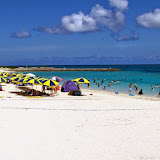
Off the coast of the Motobu Peninsula sits a small, sparsely populated island called Minna Jima. So small that as of July 2013, there were only 4 students at the Elementary/Junior High School. During the summer season, vacationers flock here in droves,...and for good reason, it has one of prettiest sandy beaches here on Okinawa. Only 15-20 minute ride from the main island, you can easily get away for a one day excursion at a reasonable price. 

Minna Beach. You will find most of your vacationers on Minna Beach which is on the eastern side of the island (it is the beach you see as you enter Minna Port). You will find most of the beach goers on the north end as most of the gear rental stations are on that side as well. If you are looking for more privacy you can head towards the southern end. The beach is just as beautiful. 

The Cove. From an aerial view, the cove on the western side of the island may have the appearance of a beautiful lagoon. However, it can be one of the least attractive areas on Minna Jima, particularly at low tide. More of a marshland than a paradise of tide pools, you will not find too many tourist at this location. The north and south sides of the islands you will find more coral tide pools and jagged coral reefs. Click on the different icons on the map to see photos taken of that particular area. Please also click on the photo album above to see other photos of Minna-jima.

Minna Jima Boat Schedule / Boat Fare / One-DayTrip Travel Packet.
Please download the following PDF for the Boat Schedule, Boat Ticket Prices, and Other Information for your One-Day Trip. Note. Because there were no official sponsored websites for the Minna-jima boat schedule and ticket prices, the PDF was reproduced for the internet for your convenience. Information is subject to change without notice by the Motobu Port Authority. For an updated schedule you can call the Toguchi Port office at 098-047-5179. >>>>> DOWNLOAD PDF.

Weather Cancellation (IMPORTANT!). Please be advised that boat trips are subject to cancellation due to severe weather. This includes severe wind conditions. Please call before you go! The Toguchi Port Office can be reached at 098-047-5179.

Directions. The following directions is for Toguchi Port on Motobu. (Note. Please do not confuse Toguchi Port with Motobu Port which is just a little further south). Go north on Highway 58 and then take Highway 449 along the Motobu Peninsula. You will continue and pass the Sesoko Bridge (which will be on your left as you are going north). The following directions is little out of the way, but you will get a better visual sense of where the port is if this is your first time. As you continue on Highway 449 you will cross over on another major bridge (you will then see a harbor to your right. The Toguchi Port is on the southern end of this harbor as identified by a balloon icon. You must scroll to the right one map). Once you cross the bridge you will run into the Highway 449/Highway 84 T-Intersection. Left takes you to the Churaumi Aquarium. You will want to go right. You will momentarily travel along side of the north end of the harbor, but you will want to navigate your way to the southern side. The port office is very recognizable. GPS coordinates above are for Toguchi Port. There are easier ways to get there, but if it's your first time it may seem like traveling through a maze. 

Author's Note. There will be a follow up post for overnight trips on Minna-jima.

Sunday, April 12, 2015

"Traveling to Ie Jima"

Ie Jima as seen from Sesoko Island (Mt. Tachu in the background)


View Map It! Okinawa in a larger map
Ie Jima Highlights

     GPS 
     LatitudeLongitude
     N 26 38.442E 127 52.803
        *GPS to Motobu Port


Traveling to Ie Jima (伊江島)

Maybe one of the most noticeable islands seen from the Okinawa main island is Ie Jima (伊江島) which sits off the coast of the Motobu Peninsula just north of Sesoko Island. Its hallmark feature is a large rock hill that appears to sit dead center on this good size isle. In the modern era, this little mountain is referred to as Mt. Gusuku. However, to many Okinawans of yesteryear, and even today, she is called Mt. Tachu (タチュ). Ie Jima, like others islands of Okinawa witnessed its moments of wartime dread. But today, she is one of the more touristy islands one can travel to during your time here on Okinawa Prefecture. You can spend one day or just a few days depending on what you are looking for. This article is dedicated on getting to Ie Jima and some of the amenities that are provided to make your stay enjoyable. Future articles will cover in more detail on specific areas, with the stories and history behind each location. The Google map above identifies most areas that have historical significance. Your adventure begins at Motobo Port.

Travel Information to Ie Jima.
To get to Ie Jima, you have to use a ferry which is about a 30 minute ride from Motobu Port. Ie Jima also has a tiny airport that is not frequently used, however, small commuter planes travel there from time to time. If you fly, there will be more logistical considerations that must be taken into account once you arrive such as your on-island transportation, and all this will have to be coordinated by you the traveler. There are no accommodations at the airport. The following information is from leaving Motobu Port only.

Motobu Port Directions. To get to Motobu Port take Highway 58 going north towards Nago City and then turn onto Highway 449 going towards the Motobu Peninsula. The port will be just before the Sesoko Bridge. Scroll downward on the map above. There will be a balloon icon designating Motobu Port. GPS coordinates for Motobu Port are N26 38.442, E127 52.803.

Motobu Port Phone Number. 098 047 3940 (although not fluent in English, staff members are accustom to English speaking travelers).

Website/Ferry Schedule.  http://iekanko.jp/modules/pico/index.php?content_id=15 (Japanese only) or click here for Google Translated Version in English.

Website/Individual Ticket/Vehicle Prices.  http://iekanko.jp/modules/pico/index.php?content_id=15 (Japanese only) or click here for Google Translated Version in English.

On-Island Transportation. You have several options when traveling to Ie Island. The most convenient options are to go as yourself, bring a bicycle, or bring some kind of vehicle transportation with you. If you want to see most of the island in one day it is recommended that you have some kind of vehicle transportation with you. They do have bike rentals as well as vehicle rentals at Ie Port (inventory may be limited).
Bike Rentals. Generally, 1000 Yen rental fee for the entire day. The bike rental facility is at Ie Port. Mitsuba Rental Bicycle 090 9781-3063.
Vehicle Rental. Tama Rental, 098 049 5208.
Bringing Your Own Bicycle. You can bring your own bicycle on the ferry, but an added fee will be added when you pay for your ticket at Motobu Port. See website above for prices.

Personal Recommendations. If you just want to get to the Island and immediately explore, then bringing your own personal transportation is recommended but you will need to make vehicle reservations in advance to ensure that there is space available.
How to Make Reservations. Reservations in advance are required in order to bring your vehicle to and back from Ie Island. Make reservations at the Motobu Port Office, phone number (098) 047 3940. See website above for fee information. You will have to provide your name, make of vehicle and vehicle length in meters to the Motobu Port Office. Generally, the larger the car the more you have to pay.
Vehicle check-in. When you check in at the ticket office in person, they will give you a ticket stub and instruct you which lane you have to line up your car (the lane numbers will be visible. They are near the ferry loading ramp). Please check in at the ticket office about 30 to 40 minutes before the ferry departs.
Vehicle Loading. Only the driver is required to be in the vehicle during loading. All other passengers can walk on the ferry. When ready, a port personnel with a whistle will direct vehicles one by one. Once he directs you, you will have to position your vehicle so as to back it in. Once you have your car in position he will take your ticket stub. Port personnel will direct you all the way in. You are not required to stay in the vehicle during the ferry ride. Just ensure your car is turned off, doors locked, and parking breaks engaged. Just ensure you return back to your car 10 minutes before the ferry arrives at Ie Port. The process is the same on your return trip. Do not lose the other half of your round trip ticket stub. You will need it in order to return to the main island. Caution. Once the ferry ramp drops down there is tremendous amount of loading and off-loading activity at an amazing speed. Please watch your children at all times in this area.

English Friendly. If you are concerned about the English/Japanese language barrier, you will find that Ie Jima is one of your more English friendly tourist areas to travel to. Travel Tip: At Motobu Port they have tourist handouts in English as well as in other languages. The travel staff are accustom to English speaking people. You can pick up more English pamphlets at Ie Port, at the Information Office. 

Convenience Stores. Ie Jima has two main convenience stores (Family Mart and Cocos) that are designated by the Green Balloon Icons in the map. They are in the vicinity of the main town area next to the port. You will also see many 'Obaa-san' stores on the island.

Gas Stations. There are a few gas stations in the vicinity of the main town area near Ie Port. Travel Tip: recommend you fill up gas prior to departing to Ie Island.

Cash/ATM/Credit. The main medium for payment is done in Yen. Few areas may accept credit card. The Japanese Post Office does offer an ATM service that uses the Plus System which is compatible with some American Banking/Credit Union institutions. ATM hours are based on Post Office hours. Travel Tip: Bring plenty of YEN! The post office is located near the Coco Convenience Store (marked by the Green Balloon Icon).

Places for Overnight Stay. There are a variety of minshuku's (private host homes/lodging) that you can stay at overnight. The English Tourism Handout at the Motobu Port will have a list of minshuku's available.
YYY Club Resort (English Friendly). If you looking for great hotel accommodations then you may want to look into the YYY Club Resort. Website in English at http://www.ie-resort.com/english/ . Location: southeast of Ie Island. Street Signs in English will be available directing you to the YYY.
Overnight Camping. You can also camp at the Ie Village Youth Excursion Village (Generally, 300 Yen and 200 Yen per adult and child, respectively, per night for camping). On the same premises you will see public showers near the public cooking and beach area. Location of the Youth Excursion Village: Southeast of Ie Island (marked by a Pink Balloon Icon).

Shower Facilities. If you just want to use the shower then you have to enter the Ie Village Youth Excursion Village (Entrance fee only is 100 Yen Adult, 50 Yen Child/The staff may wave you on through if you let them know you just want to use the shower). The shower facility will be near the public cooking area and convenience stores. The cost to use the shower per person is 200 Yen. You have to pay the staff at the convenience store (closest to the shower room). Shower Hours are 0900-1800.

US Military Compound. There is a US Marine Compound on Ie Jima if Service Members require emergency assistance.

What to Bring. What you bring is dependent on the type of transportation you bring with you and how long you plan on staying on Ie Island. At a minimum, you may consider bringing proper attire for shade and sun protection, a neck towel, mosquito repellent, water and snacks for nourishment, hiking gloves for protection. You will definitely want to bring a camera.

Places to See. The following links are major highlights of Ie Jima to see. (All places are marked in the above map). Please click links above for other places to visit. Mt Tachu (Mt. Gusuku) (photo), Niyathiya Cave (Senin Gama), Wajee View Point (photo), Ahasha Cave (photo).

Wednesday, April 16, 2014

The Ernie Pyle Monument

The Ernie Pyle Monument


View Map It! Okinawa in a larger map
The Ernie Pyle Monument

     GPS
     LatitudeLongitude
     N 26 42.656E 127 47.877


The Ernie Pyle Monument, Ie Island

"At this spot the 77th Infantry Division lost a buddy...."

It may be hard to imagine a time when wars were not covered by 24 hour instant media. With real-time news outlets and the power of the internet, information now travels across the globe and in the hands of millions within seconds. But it wasn't always like that. During World War II, most people back home lived the war through newspapers, radio waves, and personal letters. But who best could tell the story of the common soldier? How would the good folks back home know what their loved ones were facing thousands of miles away? Perhaps someone who lived through their struggles, witnessed their pain, and ultimately... joined them in death.

Forty-two years before America would enter the second World War, on a small farm in Dana, Indiana, Ernest Taylor Pyle was born on August 3rd, 1900 to a William and Maria Pyle. He would be their only child.(1) Ernie, as his friends would later call him, never had any strong ambitions in a career of journalism. Nevertheless, he would go on to study the profession at Indiana University. But in 1923, he quit just 3 months shy of graduation.(1) Instead, he went on to work as a small time reporter in his home state and then later found himself working for the Washington (D. C.) News.(1)

Ernie detested war, but for some ill-strange reason always found himself in its cross-hairs. He felt it was his duty to tell the soldier's story. He had already been covering the war in 1940 in London before the United States had entered. As the war escalated, he would go on to North Africa, Italy, and France.(3) He would be in the trenches with the troops witnessing the carnage as they saw it.
"His columns, done in foxholes, brought home all the hurt, horror, loneliness and homesickness that every soldier felt. They were the perfect supplement to the soldiers' own letters."(1)
With reluctance, Ernie took his new post in the Pacific and eventually laid foot on Okinawan soil. He first entered with the Marines but then later joined the Army's 77th Infantry Division.(1)(2) The 77th was ordered to take Ie Jima on April 16th. It was a small island to the north just off the coast of the Motobu Peninsula. Their mission was to seize its airfield.(2) Two days later, Ernie Pyle, joined by Lieut. Col. Joseph B. Coolidge (Regimental Commander), moved towards the front lines in a jeep when suddenly, they received fire from a nearby enemy gun position. It was around 10:15am.(1) Both the Regimental Commander and Ernie took refuge in a nearby ditch. Both laid there waiting. Moments later, the enemy opened fire again.(1)(2)

Ernie died instantly. He had just looked up for a moment when a bullet, barely missing his helmet, entered his left temple.(1)(2) For three hours, fighting continued before the enemy gun position was finally overtaken.(2) But by then, America had already lost a voice, a compatriot, and a dear friend.

Secretary of the Navy, James V. Forrestal announced Ernie's death to his friends backs home. Notable individuals to include President Truman, Army Chief of Staff , Gen. George C. Marshall, Gen. Dwight D. Eisenhower, and Governor Thomas E. Dewey of New York all gave honorable tributes to Ernie and the life he had lived.(1) But no doubt it was the common soldier in the foxholes and trenches that felt the sharp pain of losing a dear friend.

Ernie's body was buried with his fellow brothers in a temporary cemetery on Ie Island. That grave was soon replaced by a monument which continues to stand to this day (see vintage photo). The assistant commander of the 77th Infantry Division, Brig. Gen. Edwin R. Randle, presided over the ceremony and the boys of 77th gave their final farewells. On Ernie's monument they inscribed, "At this spot the 77th Infantry Division lost a buddy, Ernie Pyle”.

Ernest Taylor Pyle, August 3, 1900 – April 18, 1945.

References.
1. Obituaries (archive), New York Times, www.nytimes.com/learning/general/onthisday/bday/0803.html
2. World World II, Okinawa, US Army website, www.history.army.mil/books/wwii/okinawa/chapter7.htm
3. Public Broadcast Service (PBS) website, www.pbs.org/weta/reportingamericaatwar/reporters/pyle/

Places to See NearbyYuri Matsuri, Lily Festival (ゆり まつり) - Late April to 1st Week in MayNiyathiya Cave (Senin Gama)Statue of Hando-Gwaa (Mike's Ryukyu Gallery), Ahashagama Cave, Gohezu Cave, Legend of Asato Gura.

Directions. The Ernie Pyle Monument is on Ie Jima Island. Please see article on “Traveling to Ie Jima” for travel preparations. The monument is along Highway 181, about a kilometer west of Ie Port.

Sunday, March 16, 2014

Yamagawa Kakiuchi Gongen Cave

The Yamagawa Kakiuchi Gongen Cave


View Map It! Okinawa in a larger map
Yamagawa Kakiuchi Gongen

     GPS
     LatitudeLongitude
     N 26 40.749E 127 53.076


Yamagawa Kakiuchi Gongen Cave

Near a small inlet in the town of Yamagawa off the Motobu Peninsula lies a small cave called the Yamagawa Kakiuchi-Gongen Cave. Local villagers here refer to her as Hachinuchigunjin (meaning uncertain).(1) The kanji for the formal name, Kakiuchi (垣内), does give reference to a 'fence within' but its metaphoric interpretation is unclear. What is known, however, is that the cave is considered to be on holy ground. Excavations also have unearthed pottery and relics believed to date back between the 10th and 12th Century.(1,2,3) 

The term Gongen. The suffix term, gongen can trace its roots to both Buddhism and Shintoism. The term essentially describes an avatar-like being.(4) More thoroughly put, gongen is simply the manifestation of Buddha in human form. This term, however, was used under the auspices of Shintoism under the concept of honji suijaku, a belief that Buddha deities can appear as kami's (Shinto deities).(5,6) Though not all Shintoist shared this belief, the concept evolved perhaps at a time when Buddhism was becoming more and more popular in Old Japan, where Shintoism, the indigenous and more dominant religion at the time, was losing favor to Buddhism. In essence, the concept was a way to harmoniously combine the two religions without Shintoism losing its legitimacy (author's speculation). This harmonization became known as shinbutsu shûgô.(7) This assimilation movement was later abolished by the Japanese government on March 28, 1868 during the Meiji Restoration in what became known as shinbutsu bunri, the separation of Buddhism and Shintoism.(8) As for the Yamagawa cave in Motobu, it is not clear what connection exist (if there is one to begin with) between either religions or why it received the title of Gongen. This is pending further investigation.

Recommendations. Though the cave is extremely small it is still considered sacred and continues to house burial urns. Entrance is highly ill-advised. Additionally, the entrance is extremely narrow and any attempt to enter my cause damage to the cave. Any geocaching activity (physical emplacement of an object) should be avoided in the immediate area.

References. 
1. Motobu Town Website Site ( Yamagawa Kakiuchi-Gongen).
2. Cultural Assets of Okinawa, Education Commission of Okinawa Prefecture, March 31 1975, Pg 125
3. Gusuku Period, Okinawa Prefectural Education website.
4. Gongen; definition, Encyclopedia of Shinto, website link.
5. Honji suijaku;  definition, website link.
6. Maitreya, the Future Buddha: Edited by Alan Sponberg and Helen Hardacre,CUP Archive, 1988, pgs          251-252, Google Book Link.
7. Shinbutsu shûgô; definition, Encyclopedia of Shinto, website link.
8. Shinbutsu bunri; definition, Encyclopedia of Shinto, website link.

Directions. Take Highway 58 into Nago City. Then take Highway 449 going towards the Motobu Peninsula. Then take Highway 114 as if you are heading towards the Churaumi Aquarium. About 400 meter after making this turn you will turn left at this LandMark (Group of Signs). Follow the blue designated route to till you reach this dead end. The cave will be next to this LandMark.

Thursday, January 30, 2014

The Largest Cherry Tree on Okinawa?

The Oarashi Cherry Tree (January  30, 2014)


View Map It! Okinawa in a larger map
Largest Cherry Tree in Okinawa?

     GPS
     LatitudeLongitude
     N 26 39.904E 127 55.606


The Oarashi Cherry Tree

North of Mt. Yae, in a small town called Inoha, is a tiny village called Oarashi (大嵐). It is here you will find one of the largest cherry trees (if not the largest) on Okinawa. It is the pride and joy of this little village. Though the tree belongs on private property, it sits prominently high along the hillside near the main road. There is no official record stating its dimensions, but it estimated to stand at 27 feet high (8.2 meters) and 42 ft (12.8 meters) wide at its girth (see size comparison in this photo with photographer Michael Lynch taken in early 2013). To see the tree in full bloom please visit this blog article (Japanese) posted in 2013 (picture taken in 2006).

Tracing the tree's origins. The tree was first spotted during an exploration on the Motobu mountain ranges in 2012. The site was revisited in January 2013 only to find very few blossoms (2013 turned out to be a very bad year for cherry blossoms. We speculate that it had something to do with the severe 2012 typhoon season). The age of the tree is really not certain. Ms. Takara (property owner) in 2013 had speculated the age to be over a 100 years old. A few others in that area have also made that claim. Others have speculated it to be 300 years old. The aforementioned blog article claimed the age to be of 200 years. He (or she) even states that the tree suffered damages during the war. None of this has been independently verified. 

The age is somewhat of a mystery, and begs two other questions; 1) When did the cherry trees come to Okinawa? It is said they came from Taiwan(1), but when they came from Taiwan is not very clear by the author and 2) How long do these particular trees live? An article published by the Orlando Sentinel (April 2003) states that the average life span of the Prunus campanulata (the Taiwan variant) is between 30 to 40 years(2). On Mt. Yaedake alone, the trees were planted in 1963 when the United States returned Mt. Yae back to the Okinawans. That would make the trees on Mt. Yae over 50 years old counting from 2014.(3)

It is not uncommon to hear of various types of cherry trees living long past their expected time. The Yoshino Cherry Trees in Washington D.C., given to the United States by Japan in 1912, are said to be over a 150 years old.(4) The Miharu-Takizakura cherry tree in Japan is said to be 1,000 years old!(5)

Are there others in Okinawa? Is the Oarashi Cherry Tree the largest of its kind on Okinawa? Deep in the Nago Mountains you will also find some very, very large cherry trees. Another tree is said to rival the one in Oarashi; somewhere else on the Motobu Peninsula. Are there others? The hunt continues.

References.
1. Okinawa Story, Sakura (Cherry Blossoms)
2. Orlando Sentinel, April 2003 (Online Edition), Tree
3. Ryukyu Shimpo, February 2013 (Online Edition), Fallen cherry trees reborn as new products 
4. San Francisco Chronicle, date unavailable (Online Edition), How Old Can a Cherry Tree's Life Span Be? 5. The Telegraph, April 2011 (Online Edition), 1,000-year-old cherry tree gives hope to Japan nuclear victims 
6. Rakuten Blog Post (Japanese), Feb 2013

Author's Notes. How well the cherry blossoms bloom can vary from year to year on Okinawa. The Oarashi Cherry Tree may have a great blooming season once in while and may not occur during subsequent seasons.

Recommendations (PLEASE READ!). The Oarashi Cherry Tree sits on private property but it is highly visible from the public road. The neighbors in that area are aware of the reputation the tree brings to the little village and accustom to visitors wanting to take pictures. However, please be respectful in mannerism and treat this as private property. It is highly recommended that you don't park in the immediate area as this may interfere with traffic and day-to-day operations. It is recommended that you park at the Green Thumbtack/LandMark marked on the map. Please take your pictures from the public road. Use your best judgement.

Parking. See Recommendations above.

Directions. Take Highway 58 north to Nago City and then take Highway 449 to the Motobu Peninsula. Take Highway 84 going east towards Mr. Yaedake. There will be a turn-off just before the main entrance to Mt. Yaedake. See Blue Route in the map above. The turn-off is about 20 meters west of the main entrance and goes in the opposite direction of Mt. Yae. Follow the blue route. Your first LandMark is a tall road sign. You will turn right on this corner. Continue another 2.5 km till you see the next LandMark. It will be a similar sign as the first landmark. It is highly recommended that you park here. It is about a one minute walk up the hill as you bend around the corner. 

Sunday, July 21, 2013

The Gohezu Cave

The Gohezu Cave


View Map It! Okinawa in a larger map
The Gohezu Cave

     GPS
     LatitudeLongitude
     N 26 43.403E 127 46.898


The Gohezu Cave, Ie Jima

In 1975, explorers made a fascinating discovery on Ie Island in an area called Gohezu Yama (ゴヘズ山). It is here, inside a cave, that human remains were found dating back to the Paleolithic Era (between 2.5 million to 10,000 B.C). Specifically, these remains were thought to originate some time around 20,000 B.C. (1).

Deer Remains. It may be hard today to imagine deer ever existing on Okinawa, particularly on a small island such as Ie Jima. But in addition to the human remains, primitive tools made from deer bones were also excavated(1), suggesting that a species of deer either once thrived there or were later brought to the island. Today, you can find deer on the Kerema Islands of Okinawa, such as Aka Jima, where they are now protected under law(2). The question that obviously comes to mind is 'how did they get there?', and why were some islands inhabited while others were not. The mystery continues.

Interesting Semantics of the Kanji '山' (Yama). Most people have come to understand the Kanji and the word 'Yama', as a word meaning 'a mountain'. However, it is not clear why they refer this place as Gohezu-Yama (ゴヘズ山). When you arrive, clearly you will see no mountain that most people have come to conceptualize. The area is somewhat elevated if seen from a distance however. From its highest point, it sits above sea level at 82 meters(1). This confusion with the Kanji, '山', has come up before where local people's concept of the term 'Yama' varies. To some Okinawans it may be a piece of land that is elevated above the surrounding terrain, and not necessarily like a real 'tall' mountain like Mount Fuji in Japan. There may be a scientific reason that has dubbed this area as a mountain. Research brought us to a Japanese hiker's website in which the author set out to locate 'ultra-low mountains' (100 meters or less) that are identified in Japan's Yamana Encyclopedia (Japan's Mountain Encyclopedia). On the hiker's website, the Gohezu-Yama Mountain is listed as #26 of ultra-low mountains he has since located. (See website). Note. The Yaman Encyclopedia has yet to be reviewed for its contents on 'ultra-low mountains'.

Author's Notes.
1. The Gohezu Cave is barred from entry. Please do not attempt to enter.
2. The time period describing the Paleolithic Era may vary slightly depending on sources. It is sometimes referred to as the 'Old Stone Age', describing a period where the first humans made primitive tools out of stone. For more about the Paleolithic Time Period please visit http://archaeology.about.com.

Getting to Ie Jima. The Gohezu Cave is on Ie Jima Island. Please referred to Map It! Okinawa's Travel Prep to Ie Jima Island.

Directions to the Cave. The Gohezu cave is in close proximity to the Ie Airport Facility, which is identified in the LandMark Icon in the map above. There will be a turn-off on the opposite side of the main road that sits along the airport facility. It will be a dirt road as seen in this picture. Follow that straight till you see the cave explanation sign

Other Places of Interest Nearby. Niya-Thiya Cave, Ahashagama Cave, Statue of Asato Gura, Yuri Matsuri (Late April to 1st Week of May).

Source of Information.
1. History of the Gohezu Cave, Japanese sign on location, provided by the Ie Jima Education Office.
2. Deer on Aka Jima, Japan National Tourism Organization website.

Thursday, June 27, 2013

"The Legend of Asato Gura"

A stone stature of Asatogura


View Map It! Okinawa in a larger map
Legend of Asatogura

     GPS
     LatitudeLongitude
     N 26 42.853E 127 47.982


The Legend of Asato Gura 

"if they can't stop you, then you become something else entirely.
— Which is?
...Legend, Mr. Wayne."

Okinawa is full of legends. Some big. Some small. Eventually, they all fine their way across distant lands in the ears of the intrigued. Some time during the 19th century, word had spread in old Naha, that there was man of extraordinary strength. This man had lived up north on an island known today as Ie Jima. His name was Asato Gura. But to the villagers of Ie Island, he is known as Uputeimun, (the Strong Man) Asato Gura (ウプテイムンアサトグラ ). As word continued to spread, five men from Naha made the ambitious journey to challenge this man to see if the stories were true. Predictably, all five men, in an Okinawan-style sumo match, would succumb to Asato Gura's overpowering strength, henceforth, making him sort of a local hero and a 'bragging right' among village folks.

Asata Gura's exact age was never determined. It is believed though that he died in the year 1890. At Miisui (ミースィ) Park, on Ie Island, you will see this statue erected in his honor. You may wonder why he is standing firm like a mountain on boat while holding a flask in his left hand. Asato Gura was known for three things: being very strong, being a fisherman, and being a man who always had a bottle of liquor at his side.

Source of Information. Sign in Japanese underneath the Statue.

Directions. The statue and Miisui Park is on Ie Jima Island and is marked in the map above. Please refer to the article 'Travel Prep to Ie Jima' on getting there.

Other Places of Interest Nearby. Sen-nin Gama (Niya-Thiya Cave), Ahashagama Cave.

Notes. 1. The opening quote was taken from the motion picture, 'Batman Begins' 2. Uputeimun (ウプテイムン) is of the Okinawan Language (possibly an Ie Jima variant)