Search Map It! Okinawa

Wednesday, August 28, 2013

Remnants of the Past...

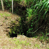
Entrance of Nishihara's Underground Shelter


View Map It! Okinawa in a larger map
The Nishihara Village Office Underground Shelter

     GPS
     LatitudeLongitude
     N 26 13.753E 127 45.048


The Nishihara Village Office Underground Shelter

Shelters like the one above serve as a reminder of the past. It was before the Great Okinawan War had come to fruition, that the local people had dug out this shelter off a hillside in Nishihara Village some time after June 1944. This shelter served as an air raid shelter, but also to keep safe important documents for the Nishihara Village Office. A sign (translated in English) sits next to the shelter states that there was a safe inside and in it “contain[ed] important documents such as family and land registers, public funds, office seals, account books, and wartime credits.” Village office workers would retrieve documents from the safe daily and return them before close of business.(1)

The safe was said to weigh about 1 ton.(1) Where that safe is today is not certain by the author. But could quite possibly be preserved in a museum or at the town office. The search continues.

The shelter entrance has gone through some cosmetic changes due to damages that occurred decades after the war and is barred from entry. A building contractor around 1980, was working near this area where damage was inadvertently done to the shelter.(1) Man-made shelters like the one in Nishihara are not uncommon to see on Okinawa. This one pictured here is on the Motobu Peninsula. Its history is not really clear at the moment.

Directions. The shelter is in Nishihara Town. Take Highway 329 south into Nishihara and then take Highway 38 (right before the big San-A Shopping Center). You will pass as Lawson convenience store (left-hand side). You will then pass a Family Mart convenience store (also left-hand side). The next traffic light make a left. About 300 meters you will see the underground shelter on the right.

Source of Information. 1. Sign (translated in English)  

Friday, August 9, 2013

"The Matsuda Caves & the Mēgā Gama Ruins"

The Matsuda Caves & the Mēgā Gama Ruins


View Map It! Okinawa in a larger map
The Matsuda Caves & the Mēgā Gama Ruins

     GPS
     LatitudeLongitude
     N 26 29.648E 127 59.591


The Matsuda Caves & the Mēgā Gama Ruins

This article is being reposted with up-to-date information. The Matsuda Caves are now open for Guided Tours (Reservations only). Please read the entire article before going. A 'How-to Guide' on how to make reservations is linked below.

For many years, the villagers from the quiet town of Matsuda, Ginoza (long ago called Kocha) have known about one of its most precious natural wonders. Up to now, it has been one of the best kept secrets on Okinawa for a very long time. Everyday, hundreds and hundreds of transients drive along Highway 329 passing this very special and sacred place, unbeknownst to them that a very large cavern sits just 200 meters away from the main road. One shouldn't be surprised that even villagers from the adjacent districts of Nago City and Kin Town, (and from some areas of Ginoza Village outside of Matsuda) are aware of these mysterious undergrounds that have stayed hidden close to home for decades – possibly centuries. Welcome to the Matsuda Caves and the Mēgā Gama Ruins of Ginoza Village.

History. Local villagers have long regarded the Matsuda caves for its precious source of water. Even today, water streams through the intricate networks of tunnels that lie beneath the Matsuda underground. Researchers have found inside artifacts, such as pottery and shells, that date back to the Gusuku Era of the Ryukyu Kingdom. And like most caves during the Great Okinawan War, the Matsuda caves were a sanctuary for many during this very dreadful period. The caves were not only a safe haven for local villagers. Okinawans from other areas, to include the shimajiri region (southern part of the main Okinawan island), sought refuge here. A woman, now a Kin Town resident from the Namizato District, recalls seeking refuge in these caves when she was a child during the 1945 battle. Speaking with the official planners from the Ginoza Office, it is believed no one died in these caves during that time. However, there is no doubt that the elders of Matsuda have had series of long and dark memories surrounding the war and these caves – but there is one cave legend they are proud talk about.(1)

The Serpent & The Buddhist Monk. The main cave (picture above) is part of the Mēgā Gama Ruins. , according to the villagers, is of an Okinawan dialect that means before or in front. Ga means stream. Loosely translated, it means the river in front. In this case it is the river in front of Matsuda Village. Long ago, villagers feared going near this cave because of a very large serpent they believed that lived inside. Desperate, the villagers had asked a Buddhist monk from Shuri to help rid them of this menacing snake once and for all. Shortly after, the snake had mysteriously...vanished. The villagers have longed believed it was the monk's prayers and and his chants that 'exorcised' this slithering 'demon' from their midst. The monk would later go on to marry a local woman and spend the rest of his life in Matsuda village. His grave was put near the cave as a memorial to his contribution to the people of that town. His actual remains have since been relocated, but remains of his original tomb still sit near the cave. His remains are now located inside the worshiping house that sits up top.(2)(3)(4)

The Kushi Utaki. You may notice that behind the main worshiping area is a concrete utaki and behind that is a large hill. That entire hill is referred to as the Kushi Utaki. Villagers paid homage to this sacred hill for protecting Matsuda Village from strong winds during typhoons. The word 'Kushi' is also of the Okinawan language meaning 'behind'. In this case, it is referring to a sacred area behind Matsuda Village.(5)

The Cave Network. It is believed that throughout Matsuda Village there are other caves that have no cave openings. This has become a problem in the event new building are to be erected. A thorough land inspection has to be conducted before any new buildings are to be put up. It is said that during the war, there were 11 cave entrances where Okinawan hid for safety. Many of them have since collapsed.

Author's Notes.
(1)Gusuku Era can be considered as the 12 century but currently cannot cite an official reference that clearly defines the time period in question.
(2) No dates could be found when the 'Buddhist Monk' legend took place, but given that it involved a 'Buddhist' monk may shed some light on the time period when this legend occurred. The monk was also said to have traveled to the Kin Kannon-do Temple prior to coming to Matsuda Village, but was originally from Shuri.
(3) It wasn't clear if the bride was given to the monk as a sign of gratitude by the villagers. Some even say her residence was somewhere near or above the cave. This cannot be substantiated as of yet.
(4) Officials have said the remains of the Buddhist monk are now part main worshiping area.
(5) Sign near the Kushi Utaki in Japanese. Note that an Utaki which means sacred grove is also used to describe a small house-like structure where prayers are performed. But an Utaki could be a waterfall, large rock, and sacred grounds. Usually the house-like structure is just a focal point where prayers are offered, much like a crucifix might a focal point for prayer within a church for Christians.

Epilogue. For better or worse, the little town of Matsuda is about to change forever. When we first stumbled upon the cave over a year ago, it was agreed that it was something that could not be divulged to the public out of concern for public safety and that it would overwhelmingly alter the natural environment of the Matsuda town. Though the cave entrance sits 200 meters away from the main highway, there were no signs on the main road indicating its location, which lead us to believe that was done intentionally, and for understandable reasons. However, with the decision to make the Matsuda caves a public attraction, the decision was then made by the Ginoza Office to officially release the story; A Japanese magazine publication, called the Okinawa Graph, released its December issue on December 1st 2012 featuring the Matsuda caves and its location. Road signs are now being posted. Because of the safety restrictions that have been set in place and a previous released public announcement made, the planners said it was okay for us to release its location and to talk about the cave's history. To see 'before' pictures of the main cave, click on the photo album.

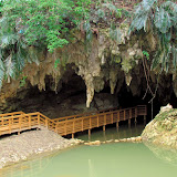
Guided Tours (Reservations Only). The Matsuda caves are now fenced up and safe for viewing from a distance. However,entering the cave is on a reservation basis only with the Ginoza Tourism Office. There are two main areas that will have guided tours. The boardwalk you see in the picture above goes in about 70 meters inside the cave. This is part of the Matsuda Village History Walking Tour (this is the only cave you enter for this tour). The other tunnel is about 240 meters long. The entire network, however, is believed to be about 800 meters in length, but many areas are too dangerous for passage due narrow channels and high water levels. 

>>>CLICK HERE ON HOW TO MAKE YOUR RESERVATION

Concerns and Recommended Areas for ParkingIMPORTANT! PLEASE READ. Keep in mind that this is a real village, and not a 'gated' attraction like 'Okinawa World'. Therefore, to help the people of Matsuda, it is highly recommended that you park away from anything that appears to be neighborhood road so as not to disrupt their daily life. Many still farm in this area. There is designated parking behind the 'Taiken Kouryu Center', (Green Thumbtack on the map) which will be the information hub and admission office for the caves. 

Furthermore, it will take some time for the people of Matsuda to get use to the number visitors it is about to have. The Matsuda people are a very proud and wonderful people, yet they are quiet about how they live their lives. Be respectful in mannerisms. A very quiet tone, a humble presence, a nice smile, and a 'konicihi wa' will go a long way.

Views on Caves. There is a stark difference on how non-Okinawans and Okinawans in general view caves. It is important to understand this. It is a difference between night and day. Please read Map It! Okinawa's Cave Disclosure Policy for background information.

Source of Information. Explanation signs on site (Japanese Only). Interview with Ginoza Tourism Office.

Directions. The turn-off to the Matsuda caves is about 500 meters south of the Highway 329 and Highway 234 T-Intersection in Ginoza Village. However, Highway 234 intersects twice with Highway 329. It intersects first in Kanna (south) and then again in Matsuda (north). Look for this large wood map board as seen in this picture for the turn-off. You will also see small white signs that say 'Taiken Kouryu Center' as seen in the same picture right hand-side.

Saturday, July 27, 2013

The Fere Rock

The Fērē Rock (Fere), Onna Village


View Map It! Okinawa in a larger map
The Fērē (Fere) Rock

     GPS
     LatitudeLongitude
     N 26 25.800E 127 46.344


The Fere Rock (Fērē), Onna Village

Along one of Onna Village's historical trails you will find a very large rock off to the side. If not for a sign, it would be inconspicuous to the regular traveler since large rocks are not uncommon to see on Okinawa. The rock you see above is called the Fērē Rock (フェーレー岩), which loosely translates to as 'The Bandit Rock'. The word Fērē (sometimes written as just Fere) is of the Okinawan language meaning an outlaw. You may not realize it either while you are there, but you are also on Mt Takō, or Takō-yama (多幸山).(1)

How it got its name. Long ago thieves would hide around this large rock waiting to rob ill-fated travelers. One method was to wait on top of the Fere Rock with a pole and a hook and snag belongings from above as travelers passed by. But heroes have also surfaced from such stories as well. In one case, a karate master by the name of Matsumora thwarted off the robbers with a sickle. Another story has it that a woman from Itoman by the name of Chiru successfully keep the robbers at bay.(1)

Author's note. It is not exactly certain by the author which karate master, Matsumora, the resource was referring to since only his last name was given. Additionally, the time frame surrounding the story of the bandits is also not certain since no dates were provided. It is the author's belief that it was several centuries ago, possibly in the 17th or 18th Century. This is pending further research. The Fere Rock sits along an extensive historical trail that covers the Yamada Castle Ruins and other notable historical areas soon to be mapped.

Source of Information. 1. Onna Village History and Culture Publication dated March 2000, published by the Onna Village Office.

Directions. Take Highway 58 and then get on Highway 6 as if you are going to Maeda Point. Your first LandMark is the tourist sign for Cape Maeda (designated by the LandMark pin in the map). The next LandMark is almost immediately after the Cape Maeda sign. It is designated by a small blue sign with the Katakana writing that as seen in this picture or looks like this when written 'フェーレー'岩' . This is where you turn off. Follow this road south for 1km. It may seem somewhat windy but eventually you will see the rock on the left-hand side with a historical sign written in Japanese.

Sunday, July 21, 2013

The Gohezu Cave

The Gohezu Cave


View Map It! Okinawa in a larger map
The Gohezu Cave

     GPS
     LatitudeLongitude
     N 26 43.403E 127 46.898


The Gohezu Cave, Ie Jima

In 1975, explorers made a fascinating discovery on Ie Island in an area called Gohezu Yama (ゴヘズ山). It is here, inside a cave, that human remains were found dating back to the Paleolithic Era (between 2.5 million to 10,000 B.C). Specifically, these remains were thought to originate some time around 20,000 B.C. (1).

Deer Remains. It may be hard today to imagine deer ever existing on Okinawa, particularly on a small island such as Ie Jima. But in addition to the human remains, primitive tools made from deer bones were also excavated(1), suggesting that a species of deer either once thrived there or were later brought to the island. Today, you can find deer on the Kerema Islands of Okinawa, such as Aka Jima, where they are now protected under law(2). The question that obviously comes to mind is 'how did they get there?', and why were some islands inhabited while others were not. The mystery continues.

Interesting Semantics of the Kanji '山' (Yama). Most people have come to understand the Kanji and the word 'Yama', as a word meaning 'a mountain'. However, it is not clear why they refer this place as Gohezu-Yama (ゴヘズ山). When you arrive, clearly you will see no mountain that most people have come to conceptualize. The area is somewhat elevated if seen from a distance however. From its highest point, it sits above sea level at 82 meters(1). This confusion with the Kanji, '山', has come up before where local people's concept of the term 'Yama' varies. To some Okinawans it may be a piece of land that is elevated above the surrounding terrain, and not necessarily like a real 'tall' mountain like Mount Fuji in Japan. There may be a scientific reason that has dubbed this area as a mountain. Research brought us to a Japanese hiker's website in which the author set out to locate 'ultra-low mountains' (100 meters or less) that are identified in Japan's Yamana Encyclopedia (Japan's Mountain Encyclopedia). On the hiker's website, the Gohezu-Yama Mountain is listed as #26 of ultra-low mountains he has since located. (See website). Note. The Yaman Encyclopedia has yet to be reviewed for its contents on 'ultra-low mountains'.

Author's Notes.
1. The Gohezu Cave is barred from entry. Please do not attempt to enter.
2. The time period describing the Paleolithic Era may vary slightly depending on sources. It is sometimes referred to as the 'Old Stone Age', describing a period where the first humans made primitive tools out of stone. For more about the Paleolithic Time Period please visit http://archaeology.about.com.

Getting to Ie Jima. The Gohezu Cave is on Ie Jima Island. Please referred to Map It! Okinawa's Travel Prep to Ie Jima Island.

Directions to the Cave. The Gohezu cave is in close proximity to the Ie Airport Facility, which is identified in the LandMark Icon in the map above. There will be a turn-off on the opposite side of the main road that sits along the airport facility. It will be a dirt road as seen in this picture. Follow that straight till you see the cave explanation sign

Other Places of Interest Nearby. Niya-Thiya Cave, Ahashagama Cave, Statue of Asato Gura, Yuri Matsuri (Late April to 1st Week of May).

Source of Information.
1. History of the Gohezu Cave, Japanese sign on location, provided by the Ie Jima Education Office.
2. Deer on Aka Jima, Japan National Tourism Organization website.

Saturday, July 6, 2013

"Sefa Utaki"

A family posing for pictures at Sēfa Utaki


View Map It! Okinawa in a larger map
Sēfa Utaki

     GPS
     LatitudeLongitude
     N 26 10.331E 127 49.599


Sefa Utaki

Today, Sefa Utaki (or Sēfa) is widely considered one of the most sacred sites in all of the Ryukyu Archipelago. It ranks up there with the islands, Kudaka and Hamahiga – soil where legends claim the first gods walked upon. Its triangular-like entrance captivates hundreds and hundreds of visitors daily to this special place. But its unique shape isn't what makes the sacred grove special. It's whats on the other side that gives Sefa Utaki its true intrinsic value, and once there...it's not hard to understand why many Okinawans believe that the gods themselves had a say in its design; there you will find a viewpoint, like a window through the forest, and dead center...a lowly island known as Kudaka-Jima, Okinawa's claimed 'Garden of Eden'. If not for Kudaka, Sefa Utaki would not have the reputation it does today.

It is said, here and around Sefa Utaki, that the first Okinawan people settled on the main island. As legend would have it, Amamikiyo – one of the first Okinawa gods, created the area around Sefa Utaki for her people after leaving Kudaka. In subsequent years, the King and the Supreme High Priestess (kikoe ogimi) would come here to pay homage to their earlier ancestors as they faced towards Kudaka Island (1)(2)(3).

Yuinchi and Ufuguui. The relationship between Shuri and Sefa Utaki is not one by mere coincidence. You'll find similar areas at Sefa Utaki that mimic the names of special places at Shuri Castle. One is the Yuinchi, meaning “a place full of abundant harvest and catches of fish”(4). At Shuri Castle, this was the cooking quarters for the royal family and at Sefa Utaki, a place where fortunes were told(4). The other is Ufuguui, a place where ritual ceremonies were held at Shuri Castle and its meaning holds similar to that at Sefa Utaki(5). (Author speculation. Perhaps the similarity in names was to give legitimacy to the authority at Shuri Castle being that Sefa Utaki already had a strong appeal with the early Okinawan people. It would make sense for any ruler to blend its relationship with a site widely believed to be sacred).

The Two Stalactite Stones. Next to the great triangular-like entrance, you will find an area called the 'kifujinsama oyasumidokoro' where certain rituals were held during the turn of the New Year. Up on top you will see two stalactite stones with pots underneath. Water dripping from these stones is liken to be holy water and was once used to provide the fortune for the King and the high priestess(6).

The Agari Umaii & UNESCO Sponsorship. Sefa Utaki is one of many areas that are considered part of the Agari Umaai Pilgrimage (to be mapped in its entirety). The pilgrimage was used in the Old Kingdom to offer homage to sacred areas that have strong ties to the earlier ancestors, particularly to the goddess Amamikiyo. On May 15, 1972 Sefa Utaki was listed as a National Historical Site and on December 2, 2000, it received UNESCO sponsorship under the United Nations' World Heritage Program (7).

Hours. 9-1800 (Final Admission 1730)
Closed. December 29 – January 3
Admission Fee. 200 High School & above, 100 Elementary/Junior High, 150 Group (20 or more High School or above)
Phone Number. 098-949-1899
Website. For update information visit Okinawa Convention & Visitors Bureau website
Amenities. Public restrooms available. Because of its historical layout and unique nature, it is not wheel chair accessible, nor recommended for baby strollers. Please plan accordingly.
Parking. Free.

Directions. Sefa Utaki sits above Cape Chinen off of Highway 331. Though you will see signs directing you to Sefa Utaki it may not be so evident where you turn off on Highway 331. Look for the post office which sits across from the sign pointing you to Cape Chinen. This is the turn-off that takes you up to the parking lot and visiting center.

Source of Information. 1. Okinawa Convention & Visitors Bureau 2. Okinawa Prefectural Board of Education 3. Okinawa – A People and Their Gods, James Robinson, 1969, pg 42. 4. Reference to Yuinchi (sign on site in English) 5. Reference to Ufuguui (sign on site in English) 6. Reference to Kifujinsama oyasumidokoro (sign on site in English) 7. Reference to Agari Umaii & World Heritage Program (sign on site in English).

Related Articles. Azama: Gateway to Kudaka, In the Beginning...there was Kudaka-jima, Gateway to the Otherside? Hamahiga Island.

Other Places of Interest Nearby. Cape Chinen.