Search Map It! Okinawa

Sunday, April 12, 2015

"Traveling to Ie Jima"

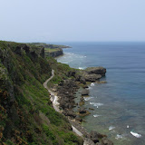
Ie Jima as seen from Sesoko Island (Mt. Tachu in the background)


View Map It! Okinawa in a larger map
Ie Jima Highlights

     GPS 
     LatitudeLongitude
     N 26 38.442E 127 52.803
        *GPS to Motobu Port


Traveling to Ie Jima (伊江島)

Maybe one of the most noticeable islands seen from the Okinawa main island is Ie Jima (伊江島) which sits off the coast of the Motobu Peninsula just north of Sesoko Island. Its hallmark feature is a large rock hill that appears to sit dead center on this good size isle. In the modern era, this little mountain is referred to as Mt. Gusuku. However, to many Okinawans of yesteryear, and even today, she is called Mt. Tachu (タチュ). Ie Jima, like others islands of Okinawa witnessed its moments of wartime dread. But today, she is one of the more touristy islands one can travel to during your time here on Okinawa Prefecture. You can spend one day or just a few days depending on what you are looking for. This article is dedicated on getting to Ie Jima and some of the amenities that are provided to make your stay enjoyable. Future articles will cover in more detail on specific areas, with the stories and history behind each location. The Google map above identifies most areas that have historical significance. Your adventure begins at Motobo Port.

Travel Information to Ie Jima.
To get to Ie Jima, you have to use a ferry which is about a 30 minute ride from Motobu Port. Ie Jima also has a tiny airport that is not frequently used, however, small commuter planes travel there from time to time. If you fly, there will be more logistical considerations that must be taken into account once you arrive such as your on-island transportation, and all this will have to be coordinated by you the traveler. There are no accommodations at the airport. The following information is from leaving Motobu Port only.

Motobu Port Directions. To get to Motobu Port take Highway 58 going north towards Nago City and then turn onto Highway 449 going towards the Motobu Peninsula. The port will be just before the Sesoko Bridge. Scroll downward on the map above. There will be a balloon icon designating Motobu Port. GPS coordinates for Motobu Port are N26 38.442, E127 52.803.

Motobu Port Phone Number. 098 047 3940 (although not fluent in English, staff members are accustom to English speaking travelers).

Website/Ferry Schedule.  http://iekanko.jp/modules/pico/index.php?content_id=15 (Japanese only) or click here for Google Translated Version in English.

Website/Individual Ticket/Vehicle Prices.  http://iekanko.jp/modules/pico/index.php?content_id=15 (Japanese only) or click here for Google Translated Version in English.

On-Island Transportation. You have several options when traveling to Ie Island. The most convenient options are to go as yourself, bring a bicycle, or bring some kind of vehicle transportation with you. If you want to see most of the island in one day it is recommended that you have some kind of vehicle transportation with you. They do have bike rentals as well as vehicle rentals at Ie Port (inventory may be limited).
Bike Rentals. Generally, 1000 Yen rental fee for the entire day. The bike rental facility is at Ie Port. Mitsuba Rental Bicycle 090 9781-3063.
Vehicle Rental. Tama Rental, 098 049 5208.
Bringing Your Own Bicycle. You can bring your own bicycle on the ferry, but an added fee will be added when you pay for your ticket at Motobu Port. See website above for prices.

Personal Recommendations. If you just want to get to the Island and immediately explore, then bringing your own personal transportation is recommended but you will need to make vehicle reservations in advance to ensure that there is space available.
How to Make Reservations. Reservations in advance are required in order to bring your vehicle to and back from Ie Island. Make reservations at the Motobu Port Office, phone number (098) 047 3940. See website above for fee information. You will have to provide your name, make of vehicle and vehicle length in meters to the Motobu Port Office. Generally, the larger the car the more you have to pay.
Vehicle check-in. When you check in at the ticket office in person, they will give you a ticket stub and instruct you which lane you have to line up your car (the lane numbers will be visible. They are near the ferry loading ramp). Please check in at the ticket office about 30 to 40 minutes before the ferry departs.
Vehicle Loading. Only the driver is required to be in the vehicle during loading. All other passengers can walk on the ferry. When ready, a port personnel with a whistle will direct vehicles one by one. Once he directs you, you will have to position your vehicle so as to back it in. Once you have your car in position he will take your ticket stub. Port personnel will direct you all the way in. You are not required to stay in the vehicle during the ferry ride. Just ensure your car is turned off, doors locked, and parking breaks engaged. Just ensure you return back to your car 10 minutes before the ferry arrives at Ie Port. The process is the same on your return trip. Do not lose the other half of your round trip ticket stub. You will need it in order to return to the main island. Caution. Once the ferry ramp drops down there is tremendous amount of loading and off-loading activity at an amazing speed. Please watch your children at all times in this area.

English Friendly. If you are concerned about the English/Japanese language barrier, you will find that Ie Jima is one of your more English friendly tourist areas to travel to. Travel Tip: At Motobu Port they have tourist handouts in English as well as in other languages. The travel staff are accustom to English speaking people. You can pick up more English pamphlets at Ie Port, at the Information Office. 

Convenience Stores. Ie Jima has two main convenience stores (Family Mart and Cocos) that are designated by the Green Balloon Icons in the map. They are in the vicinity of the main town area next to the port. You will also see many 'Obaa-san' stores on the island.

Gas Stations. There are a few gas stations in the vicinity of the main town area near Ie Port. Travel Tip: recommend you fill up gas prior to departing to Ie Island.

Cash/ATM/Credit. The main medium for payment is done in Yen. Few areas may accept credit card. The Japanese Post Office does offer an ATM service that uses the Plus System which is compatible with some American Banking/Credit Union institutions. ATM hours are based on Post Office hours. Travel Tip: Bring plenty of YEN! The post office is located near the Coco Convenience Store (marked by the Green Balloon Icon).

Places for Overnight Stay. There are a variety of minshuku's (private host homes/lodging) that you can stay at overnight. The English Tourism Handout at the Motobu Port will have a list of minshuku's available.
YYY Club Resort (English Friendly). If you looking for great hotel accommodations then you may want to look into the YYY Club Resort. Website in English at http://www.ie-resort.com/english/ . Location: southeast of Ie Island. Street Signs in English will be available directing you to the YYY.
Overnight Camping. You can also camp at the Ie Village Youth Excursion Village (Generally, 300 Yen and 200 Yen per adult and child, respectively, per night for camping). On the same premises you will see public showers near the public cooking and beach area. Location of the Youth Excursion Village: Southeast of Ie Island (marked by a Pink Balloon Icon).

Shower Facilities. If you just want to use the shower then you have to enter the Ie Village Youth Excursion Village (Entrance fee only is 100 Yen Adult, 50 Yen Child/The staff may wave you on through if you let them know you just want to use the shower). The shower facility will be near the public cooking area and convenience stores. The cost to use the shower per person is 200 Yen. You have to pay the staff at the convenience store (closest to the shower room). Shower Hours are 0900-1800.

US Military Compound. There is a US Marine Compound on Ie Jima if Service Members require emergency assistance.

What to Bring. What you bring is dependent on the type of transportation you bring with you and how long you plan on staying on Ie Island. At a minimum, you may consider bringing proper attire for shade and sun protection, a neck towel, mosquito repellent, water and snacks for nourishment, hiking gloves for protection. You will definitely want to bring a camera.

Places to See. The following links are major highlights of Ie Jima to see. (All places are marked in the above map). Please click links above for other places to visit. Mt Tachu (Mt. Gusuku) (photo), Niyathiya Cave (Senin Gama), Wajee View Point (photo), Ahasha Cave (photo).

Sunday, April 5, 2015

"The Purple Iris Fields of Kijoka"

Standing Watch! A purple iris stands tall


View Map It! Okinawa in a larger map
The Purple Iris Fields of Kijoka

     GPS
     LatitudeLongitude
     N 26 42.402E 128 08.944


The Purple Iris Fields of Kijoka


Aside from the Kijoka Falls, the town of Kijoka also hosts a very beautiful green field full of purple irises. The general blooming time for these flowers here in Okinawa is between the late month of March through early to mid-April. Just like the Cherry Blossoms, timing is critical if you want to see these flowers in their best performance. The roughly 1 square km field of lush green iris stems and leaves highlight these purple wonders under the morning sun.

The exact scientific classification of these simple flowers, however, has proven to be somewhat more complex. Conflicting scientific terms have surfaced. They are part of the Iridaceae Family, but the exact specie type is left to question. Research sources, such as The Society for Japanese Irises, The Iris Encyclopedia, and The American Iris Society were reviewed, but an exact classification could not yet be determined with 100% accuracy (This post will be updated upon new findings).

One thing is for certain however, is that the Okinawans refer to this particular iris as 'Okurareruka' (written in Katakana as オクラレルカ). There is a species called 'Iris ochroleuca' with the second half of the name mimicking the pronunciation 'Okurareruka' in Japanese. However, conflicting images have surfaced depicting the flower as all white instead of purple. It is quite possible that these purple irises of Kijoka were initially given the classification of 'Iris ochroleuca' and later found to be of a different kind, while the name, 'Okurareruka', had taken root among the Okinawans.

Kijoka is found in Ogimi Village and they have provided a website link displaying the blooming phases of the Kijoka Iris Fields. Please visit link http://www.vill.ogimi.okinawa.jp (Japanese).

Blooming Season. Late March to early to mid-April. Best time to view is 7-10 days after first bloom. 

Related Articles. For other related images of the Kijoka Purple Iris Field, see Mike's Ryukyu Gallery at: http://blog.mikesryukyugallery.com/2012/03/2012-okinawa-iris-flowers-are-starting.html.

Directions. The directions is the same as if you were going to the Kijoka Falls. If you are going north on Highway 58, look for the 'Bashofu Weaving Workshop' sign to know where to turn off (start of the blue route in the map above). After the turn make the first right. Follow this road and continue straight. Instead of turning right at the LandMark Building that takes you to the Kijoka Falls, continue straight. Once you pass this LandMark, you will want to look to your left and look for the lush green fields. It's not difficult to find. Navigate your way through and park in some of the open areas provided. Avoid parking in areas that might disrupt traffic.

Other places of interest nearby. The Kijoka Falls.

Thursday, March 5, 2015

The Akainko Shrine

The Akainko Shrine


View Map It! Okinawa in a larger map
Akainko Shrine

      GPS
     LatitudeLongitude
     N 26 23.142E 127 44.432


The Legend of Akainko, the Father of the Sanshin

The story behind the Akainko Shrine is both a sad and happy one. The story dates back to the 15th and 16th century in an area now known as Sobe of Yomitan Village. It deals with hardship of a village life, a tale of love and death, and the triumph of one man’s legacy that would ultimately change Okinawa forever. The following tale is derived from the Yomitan Village Folklore and Legends publication.
The villagers were clinging to hope, but the drought showed no signs of ending any time soon. Fresh water had become scarce, and the townspeople where in much need of a miracle. It so happened that in the village there was a beautiful young woman by the name of Chira who had a pet dog. The two were always together and the dog was known for his brilliant red hair. One day, the dog disappeared, and when he returned, Chira had noticed something odd; the dog was soaked with water! “How could this be?”, she wondered, for there hasn’t been any rain for such a long time. The dog tugged on her clothes pleading with her. He obviously wanted to show her something; and so she followed him. He led her to a nearby cave and inside, she discovered the reason why the dog was wet. There was a spring inside! Chira ran back and told the villagers, and upon hearing the great news they extolled both Chira and her pet dog.

However, happiness was short-lived for the young woman. Chira had found herself in a vicious love triangle, and the situation was about to escalate; for she had made it known who she wanted, and this did not sit well with the defeated lover. He would eventually murder the man Chira loved, but it would not stop there. This was just the beginning of her troubles.(ii)

Devastated and heartbroken, Chira was now facing another reality: she was pregnant with her now deceased lover’s child. What was she going to do? She wasn’t married; and how was she going to explain this to her parents? Time went on, and it became obvious that she was bearing a child in her womb. Villagers began to question the ordeal and rumors circulated. It turned out, the man who killed Chira’s true love was the one spreading these rumors. To lay one more knife in Chira’s heart, he planted the idea that Chira had done the unthinkable. The father of her baby wasn’t a man. It was her dog.

If her dignity wasn’t destroyed then, it was now hanging by a thread. Humiliated and emotionally isolated, Chira had no choice but to leave the village. She fled to Ikei Island to live out the rest of her days.(i) There, she gave birth to a son and found some hope of a peaceful life, but that too was short lived. A few years later, her parents had found out where she was staying and decided to go see her. But after learning the news of their arrival, she became stricken with guilt for she had caused them so much pain. Ashamed and unable to face them again, Chira had taken her own life.

She left behind her parents, broken-hearted, and a son with an uncertain future.

Years later…

He was sitting around when it began to rain. Drops, one-by-one, fell to the earth making a nice thump-like sound. So pleased with the rhythm, the young man wanted to mimic what he had heard. He then took a branch from a Kuba Tree and took three strands from a horse’s tail and put them together to make a banjo-like instrument.(iii) The young man liked what he had heard and took his new invention and played it wherever he went.

One day, a servant of the king had heard the young man’s music. He was so pleased that he asked him if he would go to Shuri to play for his majesty. The young man agreed and together they set off to see the king. And so the young man played and played to his heart’s content. The king wasn’t just amazed. He was enthralled by its beauty and power; so much that he immediately directed the young man to travel throughout the island to spread his music. And so off he went spreading his love in musical form.

His adventures would eventually take him to China and on his journey back, he brought with him various types of grains and apparel he had found in his travels. The villagers of Yomitan took the grains, cultivated them, and spread them throughout village yielding many, many crops. It was from this day forward that Yomitan would become known as the 'King of Vegetables' throughout the kingdom.
Epilogue. Every year Yomitan Village celebrates the Akainko Festival typically held around 20 September of the Lunar Calendar to honor the young man’s legacy and the new staples he introduced centuries before.

Sanshin and Sanshi-no-hi (三線の日).The banjo-like instrument he created became known as the Sanshin, named for the three strings used to make the beautiful sound; and henceforth the young man became known as the ‘Father of the Sanshin’. Sanshin, in Japanese literally means ‘three strings’. Every year on March 4th, a special musical ceremony (mainly comprised of sanshin players) is performed in front of the Akainko Shrine to honor his musical contribution to Okinawa and to the world. This is no ordinary date. March 4th has become known as the ‘Day of the Sanshin’ or in Japanese, Sanshi-no-hi (三線の日). The reason March 4th was chosen is because numerically the date can be written as 3/4. The special date is based on a Japanese pun, where 'san', means 3, and 'shi', means 4 – the two syllables found in the word sanshin. It is not uncommon to see students of the sanshin praying at the shrine. It is believed it will help them master the art.

The Shrine and the Meaning of his Name. The location of the shrine is believed to be where the young man ascended into heaven.(2) His true name given at the time of his birth remains to be a mystery however. It appears that any knowledge of that went to his mother’s grave all those years ago on Ikei Island. So he decided to take on another name. In the Okinawan language he called himself Akanukuu (アカヌクー). In Japanese this translate to Akainko (赤犬子).(iv) If one where to analyze its kanji form, the meaning becomes clear. Put together it means 'Child of the Red Dog'.

Author’s Notes.
i. The above account was derived from Yomitan’s Folklore and Legends Publication, dated 2005. An older source mentions that Chira fled to Katsuren and lived inside a cave near the ocean. It made no mention of Ikei Island. The source was from a 1990 version of Yomitan’s History Chronicles #11, beginning on pg 220.
ii. Other sources describe a more chilling version of the love triangle that occurred between Chira and the two men involved. This is pending further research and investigation as this version was not mentioned in either of the above sources.
iii. The Kuba Tree is the Okinawan name for the Chinese Fan Palm, (Livistona chinensis). For images, visit Floridata.com.
iv. The first kanji (赤) means red (Aka); the second kanji (犬) means dog (Inu); and last kanji (子) means child (Ko). When the kanji’s are put together the ‘u’ is subtracted from inu.

Reference.
1. The Akainko Story, The Yomitan Folklore and Legends Publication, dated 2005, pg 39
2. Akainko's ascension, Okinawa Prefectural Board of Education. Website.

Directions/Parking. The Akainko Shrine is about 250 meters in front of the US Army Base Torii Station main gate. It is the turn-off immediate west of the Family Mart. Take Highway 58 into Yomitan and then take Highway 6 going west towards Torii Station. Torii Station will be on your left, the Family Mart to your right. Parking is very confined. Please do not block any gates belonging to any residential areas.

Sunday, February 15, 2015

Zatsungawa River (ザツンガワ / 座津武川)

The Zatsungawa River (ザツンガワ / 座津武川)


View Map It! Okinawa in a larger map
Zatsungawa

      GPS
     LatitudeLongitude
     N 26 49.434E 128 14.784
      *GPS to starting point


The Zatsungawa River, ザツンガワ / 座津武川

The Zatsungawa River of Uka, Kunigami Village is one of many beautiful rivers in the northern part of Okinawa. For the outdoor enthusiast, this offers an escape into the wild and a good taste of nature. See Trekking Data below. There are some moderate to high risk areas so please read the recommended guidelines below.

Trekking Data & Information
River Name. Zatsungawa (ザツンガワ / 座津武川)
River Location. Uka, Kunigami Village (宇嘉, 国頭村)
Trek Starting Point. GPS N26 49.434 E128 14.784
Recommended Emergency Rally Point (For Emergency Vehicles). GPS N26 49.468 E128 14.632
1st Stopping Point. GPS N26 49.386 E128 14.906 (image, video)
2nd Stopping Point. GPS N26 49.384 E128 14.955 (image, video)
3rd Stopping Point. GPS N26 49.249 E128 15.037 (image, video)
Turn-Around Point. GPS N26 49.246 E128 15.130 (image, video)
Trek Time from Starting Point to Turn-Around Point. Approx 3 hrs
Total Time. 7 hrs
Video Overview.  Map It! Okinawa Video Short, Zatsungawa River.

Tip. Start your trek near the water station. Look for a metallic ladder taking you down to the river. Climb down and cross to the other side. You will see a trail and it will take you to a launch point on your trek.

Note. At the time of this river trek, the turn-around-point could not be surpassed due to the semi steep outer-terrain and the depth of water. Under warmer conditions this may be feasible. It is not recommended to submerge into water above the waist during the colder months. Please read below. The post will be updated after future attempts have been completed.

Recommended Guidelines (MUST READ!)
1. VERY IMPORTANT! This particular river trek is recommended only for those who have fairly good physical agility, coordination skills, and upper body strength. Negotiating steep inclines may be required. Recommended only for young adults and above. Though most of the trek is manageable, it does have some moderate to high risk areas.
2. VERY IMPORTANT! Plan on getting wet up to your knees. It is sometimes safer to walk in the river, rather than hopping and balancing yourself on the rocks just to keep dry. On a normal good weather day, the river current at most areas is not enough to push you off balance. Though this rule may seem trivial, it is a very important thing to remember. The biggest risk to this trek is falling and slipping on the rocks.
3. VERY IMPORTANT! In the colder months you do not want to get wet above your waist. You will run the risk of hypothermia if you continue further. Your upper body will not provide you enough heat for you to keep warm. Ideally, try to keep the water below the knees.
4. VERY IMPORTANT! It is recommended that you do not trek during the rain or after a recent rain shower. The ideal time is on an average good weather day (no rain or drizzle). During good weather the rocks above the river will be dry. This is important for grip. There are some high risk areas that will require good surface grip (feet, hands, and body) to get from point A to point B. This rule is unique to this river. Surface grip will be required to negotiate difficult terrain.
5. DO NOT WEAR TENNIS SHOES!!! Tennis shoes offer no traction and will slip on these rocks. Wear something that has hard soles and has great traction on these kinds of surfaces. If you do not have hard soles you will 'feel' every step you take. And since you will be getting wet, thick heavy boots will only get heavier when soaked. You should wear something that is lighter, has good traction, but still gives you flexibility of movement.
6. GUIDE STICK. Having a guide stick is recommended. Sometimes it will be safer to skirt the terrain just to avoid danger areas. If at some point it seems impossible to continue, look for red or yellow tape markers around the trees. Trekkers have left guide marks to assist with negotiating terrain (though on this particular river, it has not always been helpful). You will need a guide stick to probe these areas for snakes and to knock down spider webs. When you are negotiating boulders however, you will have to set your guide stick aside to free your hands for climbing. This is very important. When it comes to negotiating boulders and rocky terrain, your hands will be your best assets. This is for safety.
7. Never go alone. Have a buddy. For this particular river trek, the 'ideal' number is to have at least three (3) hiking buddies, but optimally try to have more than 3 due to the level of difficulty. If one gets hurt, then you have the option of leaving at least one with the injured while the other(s) go retrieve help. Cell phone reception is very difficult, if not non-existent in these areas. If you are a US Service Member, your nearest US Military Facility will be the Okuma Recreational Facility. It is recommended that everyone should have the number to this location should an emergency arise.
8. Tell someone (or few others), where you will be river trekking to and leave them at a minimum: the GPS coordinate of the starting point, the name of the river, and this website URL (see Trek Data Information above).
9. Wear a light long-sleeve top (depending on the weather) for protection against the elements and bugs. Whether you trek on the river or skirt the landscape, you will hit spider web after spider web (summer or winter).
10. Wear a hat or beanie to keep warm and to protect yourself against the elements and bugs. You may run into many spider webs along the way (Do a 'spider check' with your buddy every now and then). A beanie does offer some bit of head protection in the event of a fall.
11. VERY IMPORTANT! Bring some light hiking gloves for grip and protection. You may be required to grab roots, tree limbs, trees, rocks, dirt, etc. in order to negotiate terrain.
12. DO NOT WEAR SHORTS! Find something that you don't mind getting wet in and that offers protection against the elements. There 'will' be a few times you will be on your knees or on your rear end as you negotiate some of the terrain. Also you need to protect your legs from critters and abrasions. You may want to bring some shorts if you want to take a dip in the water. There are some areas that are over 7 feet deep. Swimming not recommend in the colder months.
13. VERY IMPORTANT! Apply the '3-Points of Contact Rule' when going over difficult terrain.
14. VERY IMPORTANT! Maintain a low center of gravity when going over difficult terrain.
15. If something looks unsafe, then avoid. Find another way to negotiate the terrain or SIMPLY, DON'T DO IT. Don't try to be brave. You do not have to travel far to enjoy the natural scenery.
16. Give yourself plenty of time AND TAKE YOUR TIME. NO NEED TO RUSH. But remember you have to add time to get back (before dark!). Recommend you leave early morning time frame. The rule of thumb is travel far enough so that have the same amount of time to get back. However, add an extra hour as a buffer on your return trip. (For example, if you travel 3 hours, ensure you have 4 hours of sunlight left to get back). Note. From experience, it is more dangerous on your return trip. There are two reasons; on your return trip your are more fatigued and therefore less alert; and second, gravity and descending elevation. It is usually a lot easier to climb up then it is to climb down.
17. Bring a light backpack for food, water, toilet paper, flash light, survival kit, first aid kit, light rain coat, warming layers, etc. and water proof them as needed.
18. USE THE BATHROOM BEFORE YOU GO! Making natural deposits of certain kind in the wild may not be fun for some.
19. You will get dirty. Bring a towel, extra socks, extra pair of shoes, shirt, pants, and warming layers (Can leave in the car).
20. Tuck in your shoe laces to prevent tripping.
21. Protect & secure items such as your wallet and cell phone from moisture and from getting soaked.
22. Don't try to be brave. Respect your limits and respect nature.
23. You do not have to go all the way to any of the stopping points or to the Turn-Around Point. You don't have to go far to enjoy some of the beauty along the river. Never feel pressured to continue on if you are fatigued or if it becomes too hazardous.

Directions/Parking. Take Highway 58 into Kunigami Village (to the town of Uka, 宇嘉). You will have to navigate by Landmarks annotated in the map. The turn-off point is just a few hundred meters south of the Uka Tunnel (click here for Japanese writing above the tunnel). Additionally, the Uka Tunnel is a newer tunnel. The older tunnel is fenced off to the side. It is the old Zatsun Tunnel. If you wish to park near the water station, please do not block the entrance gate as maintenance crews utilize this station.

Other Rivers in Okinawa. Takazato River, Fukugawa II, Taa Water. 

Sunday, December 28, 2014

The Yabu Temple, Ryounin

The Yabu Temple, Nago City


View Map It! Okinawa in a larger map

The Yabu Temple

     GPS
     LatitudeLongitude
     N 26 36.342E 127 57.127


The Yabu Temple, Ryounin - Nago City

The Yabu Temple (屋部寺) is a small Buddhist temple believed to originated some time in the 17th century. The temple resides in the town of Yabu of Nago City bordering the coastline along Highway 449 on the Motubu Peninsula. Formally, the temple is named Ryōun'in (凌雲院). The original temple was destroyed during the Okinawan War.(1)(2)(i) It was later rebuilt in 1956.(1)(2)(ii)

Though the temple is quite small, it was officially recognized by the Old Ryukyu government along with three of its local legends.(2)(3) The temple, and its legends, were recorded in an official document known as the Kyuu-you (or Kyuyo).(3)(iii) It is an historical account of the Ryukyu islands that was completed in 1745. James Robinson author of the book, Okinawa: A People and their Gods, published in 1969, also writes of one legend that have similarities to those in the official record. It's not certain if his account was derived from local villagers or from official documents belonging to the Ryukyu government. The following is a breakdown of those legends.

Legends derived from the Kyuyo
Legend One.(3) In the year 1692, drought had plagued the village of Yabu. Around the same time, sporadic fires too had wreaked havoc on the village. In an act of desperation, a Buddhist monk by the name of Ryun Washo was asked to bring prosperity to Yabu. The monk granted their request and prayed for seven days on a large stone at the base of the hill. On the seventh day rain had finally come saving the village from despair. The once problematic fires too ceased their torment on the townspeople. In his honor and to show their gratitude the villagers erected the small temple. The rock that Ryun Washo had meditated on still sits behind the temple untouched and unmarked. It sits inconspicuously in its natural environment. A documented photograph can be found on page 51 of the Yabu Historical Chronicles.(2) An photograph taken in December 2014 is shown here.

Legend Two.(3) Behind temple lived a very large snake up in the hills. It was said that this snake could blow fire from its mouth. The people frantically requested help from a Chuzan kingdom lord. The lord agreed and dispatched a man by the name of Kinjo-san from the Tenkai Temple [Note. It wasn't clear by the translation if Kinjo-san was a monk and it is not certain by the author where the Tenkai Temple is located]. Kinjo-san prayed fervently and the snake was defeated. Later, Kinjo-san had placed a large statue of Buddha inside the temple to mark the occasion. [Note. The statue is believed by the author to be the one in the middle seen in this picture].

Legend Three.(3) One day a Buddhist monk from Shuri had visited the temple. He had said that the large hill behind the temple showed great promise [perhaps indicating its spiritual value, author assertion]. However, he said that there was a split within the hills that resembled a snake's mouth. He declared that this was a bad omen under the concept of Feng Shui (Fu Sui in Japanese).(iv)(v) However, to offset this premonition the monk then placed seven statues of Buddha inside the temple to thwart off any misfortune.[Note: those statues can be seen here inside the temple].

After his work was completed, the monk decided to return to Shuri. A man from Yabu was sent with him to assist with his belongings. When they arrived back to Shuri, the monk had made a prophetic comment to the Yabu villager. He said, “tomorrow will be my death, so today please eat from the ufurunme [a type of hospitality dish?] on my behalf before you return to Yabu".(vi) As foretold, the monk passed away the very next day.

Legend from James Robinson's Research.(1) James Robinson, in his 1969 book, writes “there was a spirit named 'Akamata' which had the power to transform himself into a handsome young man”. However, Robinson does not add much in his book about the spirit's sinister deeds other than trying to lure a farmer's daughter. Interesting however, he does explain that an Enkakuji Temple monk by the name of Ryun Washo (same person from Legend One above) came from Shuri and defeated the spirit 'Akamata' by use of incantations. The Yabu Temple was then built in honor of Buddha. [Note. It is important to note that the word 'akamata' is a type of snake found in the Okinawan islands. A picture can be seen here, photographed by Shawn Miller. It's not uncommon to find snakes in Okinawan legends. See Related Links below for other snake legends of Okinawa.]

Local Ceremonies. On October 15th of the old calendar (kyureki/lunar calendar) some of Yabu's elderly and prominent townspeople preside over prayer ceremonies within the district. Ceremonies are held at 10 different places in sequential order. It is to give thanks and to pray for the the town's prosperity. The Yabu Temple is third in the order of ceremonies.(2) The ceremonies are typically lead by a kaminchu, a term meaning spiritual leader in the Okinawa language.

The Yabu Temple during New Years (Jan 1 - 3)
Local Villagers, as well as some from the nearby area, come to the Yabu Temple to celebrate New Years Day. A small ceremony starts around 2345 (1145pm) on December 31st. For those who wish to attend the Yabu Temple during New Years, below is the general sequence of events to help you through the process.

General Sequence of Events. Please note, the Yabu Temple is not a Shinto Shrine. However, there are similarities to attending both temples and shrines during New Years. The Yabu Temple is small so the process is typically is more simplified. 
1. Entering the Premise. There is a small gate entrance. This is not a torii gate. However, the gate does alert visitors they are entering a sacred area.
2. Purification Fountain. There are no purification fountains at the Yabu Temple. Typically, these kinds of fountains are found at major Shinto Shrines.
3. Omikuji (optional). People who attend the temple have the option of receiving their fortune for the New Year. This fortune is called an omikuji and can be purchased for about 100 Yen. [Note. Because of the low expected volume of foreign visitors to the temple, the omikuji here at the Yabu Temple is typically written in Japanese]. You can either take the fortune with you or tie it to a tree branch or place provided. Depending on whether your fortune is great or not, it is believed that by leaving it at the shrine or temple grounds, your fortune will either multiply in prosperity or bad luck will be diverted.(5)
4. Approaching the Temple. Typically there will be a line to approach the temple. As you approach the temple you will notice a saisen, a box where you deposit monetary offerings, anywhere from 5¥ to 100¥.
5. Prayer. Normally, you pray after you make your monetary offering. Most people bow and clap twice and say a small prayer in silence. Some may just fold there hands.
6. Ringing of the Temple Bell (optional). After you have said your prayers, individuals, couples, or family members are welcome to ring the temple bell. For proper etiquette, this is just done once as an entity.

Reference.
1. Book, Okinawa: A People and their Gods, 1969, James Robinson, Tuttle Publishing Company, pg 59, Link
2. Book, Yabu Historical Chronicles, 2002 October 27 (Japanese), published by the Town of Yabu, pg 52
3. Information Handout, Ryounin - The Yabu Temple, Published by the Town of Yabu, Image Link
4. Website, Compilation of Official Histories and Establishment of the Legal System, Okinawa Prefectural Board of Education, Link
5. Website, Shinto Shrines, Japan Guide, Link

Author's Notes.
i. The references stated that the original temple was destroyed during the Okinawan War but it did not specify details as to who or what caused its destruction.
ii. In James Robison's research he states that the temple was rebuilt in 1957. However, the Yabu Historical Chronicles, a more recent publication, states it was rebuilt in 1956.
iii. The Kyuyo is a compilation of historical events that took place in the Old Kingdom. It was completed in 1745. It also contains legends found throughout the Old Kingdom.(4)
iv. In essence, Feng Shui deals with the balance of nature. More can be read about it here at About.com
v. It's not certain where this split or "snakes mouth" is in relation to the temple. There is a split (now a road) that goes between two hills next to the Yabu Temple. See picture here
vi. The term ufurunme could not be found in any official resource. But interviews with Okinawan people have lead us to believe it is an Okinawan word meaning some kind of hospitality food. The latter suffix -me can mean food in the Okinawan language. Additionally, during some Okinawa funerals, family members of the deceased eat from a specially prepared meal called usande (ウサンデー) . It is not certain if the two terms have identical meaning in this context. It was theorized during this research that ufurunme could possibly be dialect from an aristocratic society, such as that found at Shuri during the Old Kingdom. As stated, there are no official references as of yet to support any of this.

Parking/Amenities. Parking. You will have to park somewhere off to the side of the road near the temple grounds. There is a parking field across the from the temple but it is own by the nursery school and gated. It may be open for the New Years. Amenities. There is a walk ramp leading up to the temple for baby strollers and those using a wheel chair.

Directions. Take Highway 58 into Nago City. Then take Highway 449 (coastline) going towards Motubu. Please study the map carefully. You will pass the Yabu Post Office (on the right) before you reach the turn-off (on the right), about 400 meters later. The turn-off is not easily recognizable. Warning. You are more likely to pass the turn-off the first time around. Be careful of making sudden stops as you see the turn-off. It will sneak up on you. See picture of turn-off here. In the interest of safety, if you pass it just turn around later. Avoid making sudden stops. There typically is a high volume of traffic on the main route. From the turn-off, follow the Blue Vehicle route designated in the map above. LandMarks (yellow diamond icons) have been placed to help you reach the temple.

Related Articles (Snake Legends of Okinawa). The Matsuda Cave & Mega Gama Ruins, Legend of Yara Muruchi.